Itinerary
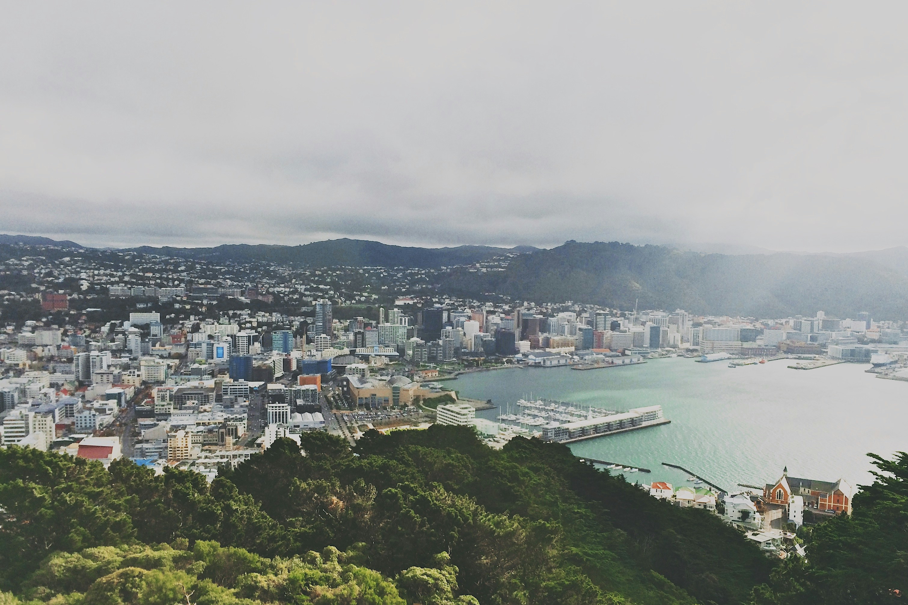
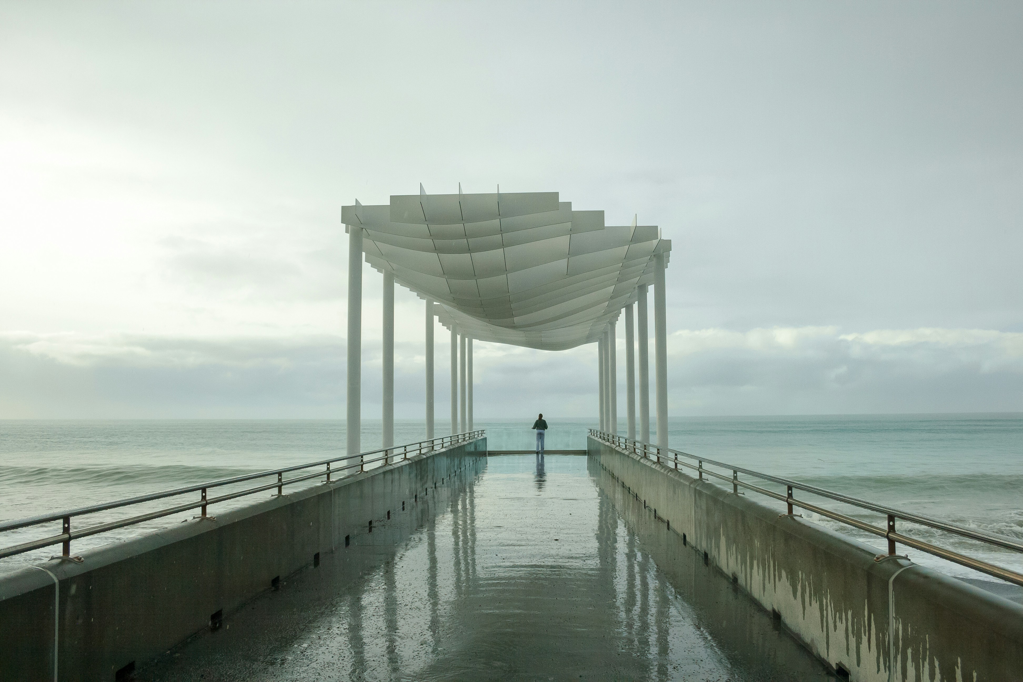
Wellington, New Zealand
New Zealand’s capital is, arguably, the country’s most cosmopolitan metropolis. It’s world-class Te Papa Tongarewa-Museum of New Zealand is a don’t-miss attraction, and the burgeoning film industry led, of course, by the Lord of the Rings extravaganzas has injected new life into the local arts scene. Attractive and compact enough to be explored easily on foot, Wellington is a booming destination. Modern high-rise buildings gaze over Port Nicholson, surely one of the finest natural anchorages in the world. Known to local Māori as The Great Harbor of Tara, its two massive arms form the jaws of the fish of Maui from Māori legend. Sometimes referred to as the windy city, Wellington has been the seat of New Zealand’s government since 1865.
Napier, New Zealand
The earthquake that struck Napier at 10:46 am on February 3, 1931, was—at 7.8 on the Richter scale—the largest quake ever recorded in New Zealand. The coastline was wrenched upward several feet. Almost all the town’s brick buildings collapsed; many people were killed on the footpaths as they rushed outside. The quake triggered fires throughout town, and with water mains shattered, little could be done to stop the blazes that devoured the remaining wooden structures. Only a few buildings survived (the Public Service Building with its neoclassical pillars is one), and the death toll was well over 100.The surviving townspeople set up tents and cookhouses in Nelson Park, and then tackled the city’s reconstruction at a remarkable pace. In the rush to rebuild, Napier went mad for art deco, the bold, geometric style that had burst on the global design scene in 1925. Now a walk through the art deco district, concentrated between Emerson, Herschell, Dalton, and Browning streets, is a stylistic immersion. The decorative elements are often above the ground floors, so keep your eyes up.
Rotorua, New Zealand
Today, journey through Esk Valley and Te Pōhue, stopping at the charming town of Taupō. Later, travel to Rotorua and enjoy a Signature Experience.
Signature Experience – Te Pā Tū
Enjoy a feast of Māori delicacies and performance of haka, song and storytelling at Te Pā Tū (Māori Village). Over a magical evening, you will be welcomed with a haka pōwhiri (cultural welcome) and then be treated to further captivating performances while enjoying seasonal canapés, chef selected aperitifs and a seasonal three-course dinner.
Rotorua, New Zealand
This morning, discover the beauty of Rotorua as you enjoy your chosen sightseeing activity. The evening is yours at leisure to explore further.
Freedom of Choice Sightseeing – Rotorua Icons
Embark on a Rotorua adventure. Experience the lively Agrodome Farm Show, before heading to the incredible natural geothermal wonder that is renowned for its healing properties, the mineral-rich Te Puia Thermal Reserve.
Freedom of Choice Sightseeing – Hobbiton Movie Set Tour
A must for any fan of ‘The Lord of the Rings’, this tour explores locations where some of the famous movie scenes were filmed. You’ll feel as though you’re a part of the massive blockbuster trilogy.
Freedom of Choice Sightseeing – Eco-Thermal Tour
Drive through a unique mix of forest and farmland to visit New Zealand’s largest boiling mud pool and a series of colourful hot springs at the calming Waiotapu.
Freedom of Choice – Wai Ariki Hot Springs and Spa
Immerse yourself in the rejuvenating geothermal waters of Wai Ariki Hot Springs and Spa on a Restorative Journey. The 7-step multisensory process combines Māori culture and traditional healing practices, with the therapeutic elements of geothermal heat, water, mud, and steam.
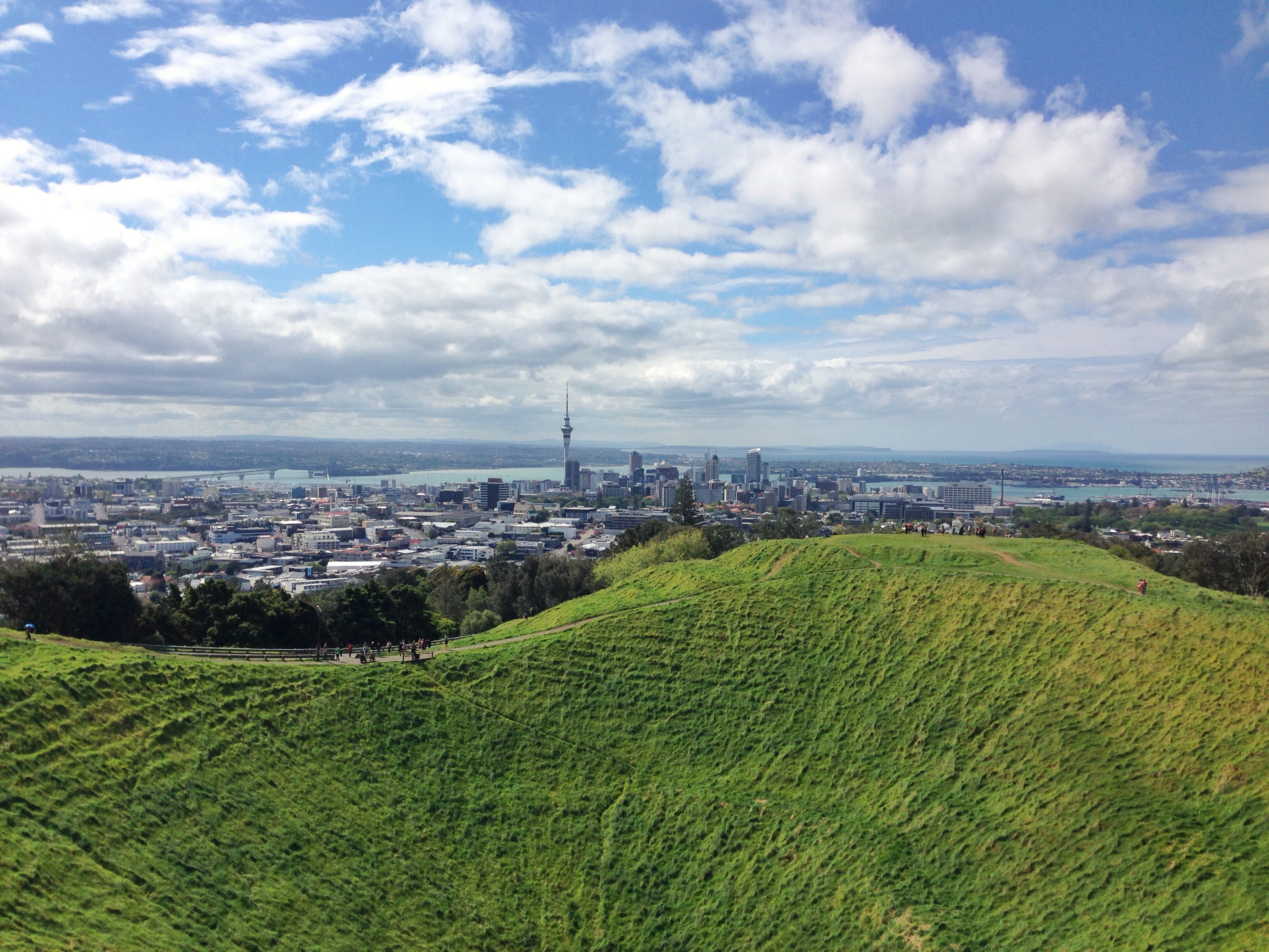
Auckland, New Zealand
Auckland is called the City of Sails, and visitors flying in will see why. On the East Coast is the Waitemata Harbour—a Māori word meaning sparkling waters—which is bordered by the Hauraki Gulf, an aquatic playground peppered with small islands where many Aucklanders can be found “mucking around in boats.”Not surprisingly, Auckland has some 70,000 boats. About one in four households in Auckland has a seacraft of some kind, and there are 102 beaches within an hour’s drive; during the week many are quite empty. Even the airport is by the water; it borders the Manukau Harbour, which also takes its name from the Māori language and means solitary bird.According to Māori tradition, the Auckland isthmus was originally peopled by a race of giants and fairy folk. When Europeans arrived in the early 19th century, however, the Ngāti-Whātua tribe was firmly in control of the region. The British began negotiations with the Ngāti-Whātua in 1840 to purchase the isthmus and establish the colony’s first capital. In September of that year the British flag was hoisted to mark the township’s foundation, and Auckland remained the capital until 1865, when the seat of government was moved to Wellington. Aucklanders expected to suffer from the shift; it hurt their pride but not their pockets. As the terminal for the South Sea shipping routes, Auckland was already an established commercial center. Since then the urban sprawl has made this city of approximately 1.3 million people one of the world’s largest geographically.A couple of days in the city will reveal just how developed and sophisticated Auckland is—the Mercer City Survey 2012 saw it ranked as the third-highest city for quality of life—though those seeking a New York in the South Pacific will be disappointed. Auckland is more get-up and go-outside than get-dressed-up and go-out. That said, most shops are open daily, central bars and a few nightclubs buzz well into the wee hours, especially Thursday through Saturday, and a mix of Māori, Pacific people, Asians, and Europeans contributes to the cultural milieu. Auckland has the world’s largest single population of Pacific Islanders living outside their home countries, though many of them live outside the central parts of the city and in Manukau to the south. The Samoan language is the second most spoken in New Zealand. Most Pacific people came to New Zealand seeking a better life. When the plentiful, low-skilled work that attracted them dried up, the dream soured, and the population has suffered with poor health and education. Luckily, policies are now addressing that, and change is slowly coming. The Pacifica Festival in March is the region’s biggest cultural event, attracting thousands to Western Springs. The annual Pacific Island Secondary Schools’ Competition, also in March, sees young Pacific Islander and Asian students compete in traditional dance, drumming, and singing. This event is open to the public.At the geographical center of Auckland city is the 1,082-foot Sky Tower, a convenient landmark for those exploring on foot and some say a visible sign of the city’s naked aspiration. It has earned nicknames like the Needle and the Big Penis—a counterpoint to a poem by acclaimed New Zealand poet James K. Baxter, which refers to Rangitoto Island as a clitoris in the harbor.The Waitemata Harbour has become better known since New Zealand staged its first defense of the America’s Cup in 2000 and the successful Louis Vuitton Pacific Series in early 2009. The first regatta saw major redevelopment of the waterfront. The area, where many of the city’s most popular bars, cafés, and restaurants are located, is now known as Viaduct Basin or, more commonly, the Viaduct. A recent expansion has created another area, Wynyard Quarter, which is slowly adding restaurants.These days, Auckland is still considered too bold and brash for its own good by many Kiwis who live “south of the Bombay Hills,” the geographical divide between Auckland and the rest of New Zealand (barring Northland). “Jafa,” an acronym for “just another f—ing Aucklander,” has entered the local lexicon; there’s even a book out called Way of the Jafa: A Guide to Surviving Auckland and Aucklanders. A common complaint is that Auckland absorbs the wealth from the hard work of the rest of the country. Most Aucklanders, on the other hand, still try to shrug and see it as the parochial envy of those who live in small towns. But these internal identity squabbles aren’t your problem. You can enjoy a well-made coffee in almost any café, or take a walk on a beach—knowing that within 30 minutes’ driving time you could be cruising the spectacular harbor, playing a round at a public golf course, or even walking in subtropical forest while listening to the song of a native tûî bird.
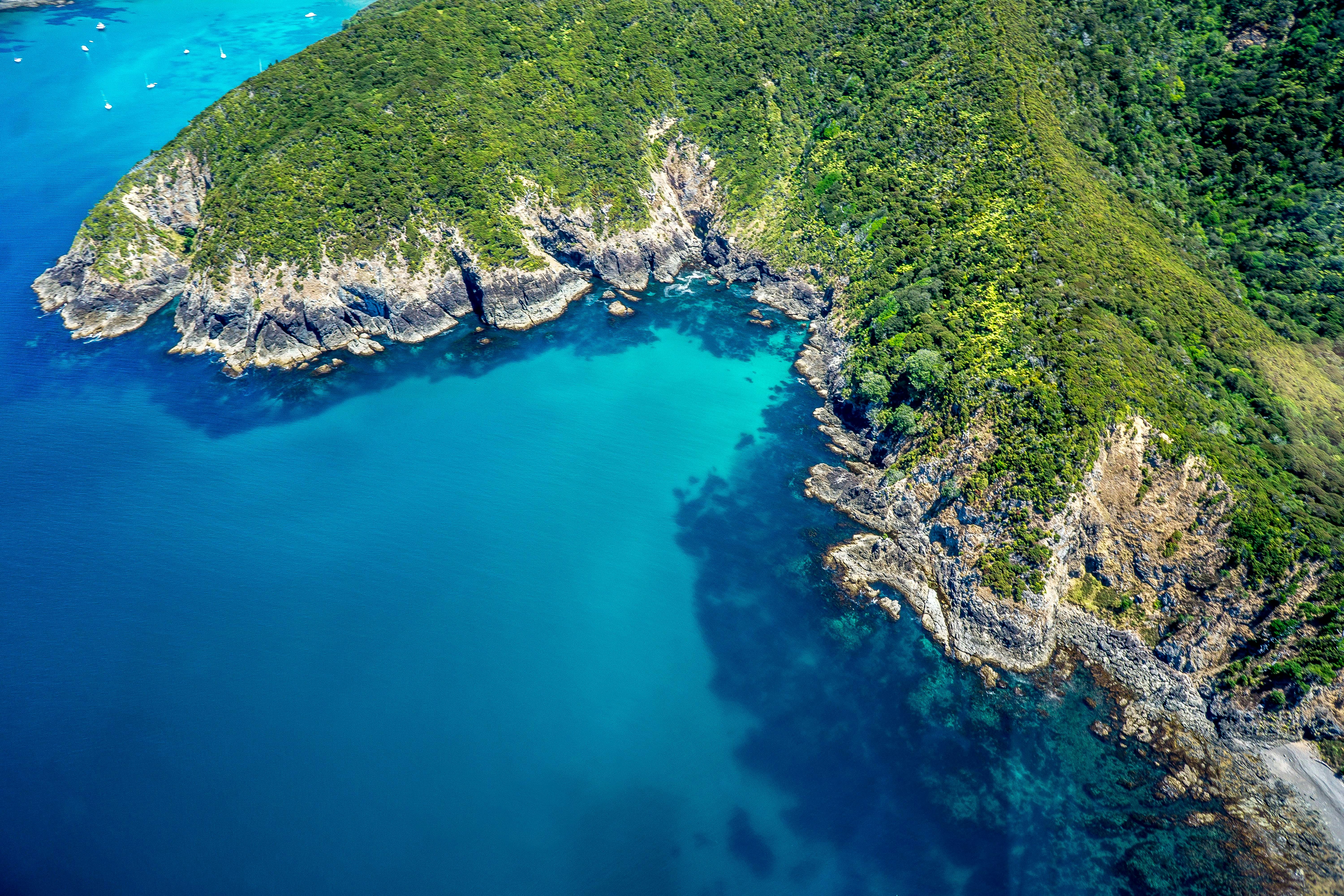
Bay of Islands, New Zealand
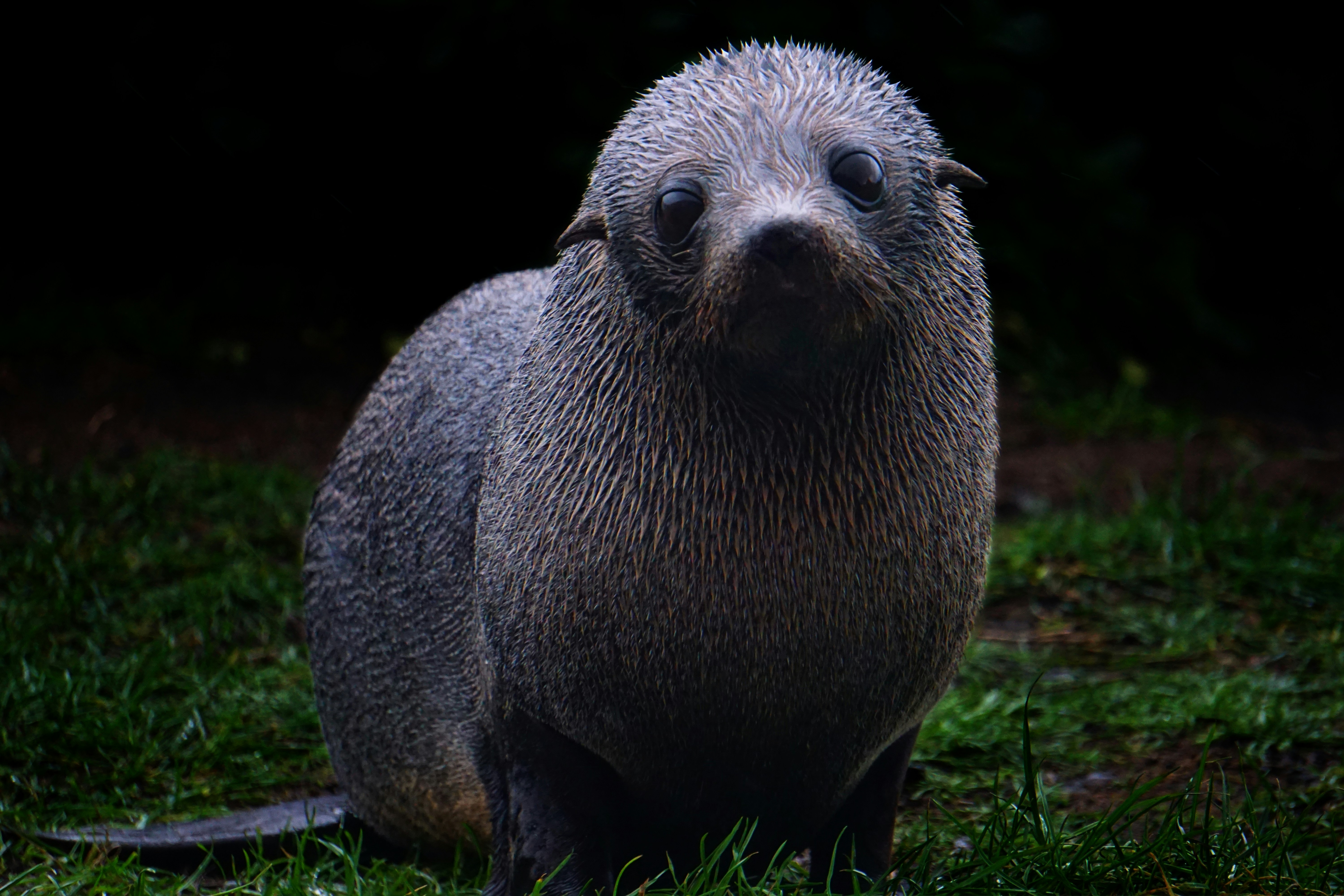
The Tasman Sea on the west and the Pacific Ocean on the east meet at thetop of North Island at Cape Reinga. No matter what route you take, you’ll passfarms and forests, marvellous beaches, and great open spaces. The East Coast,up to the Bay of Islands, is Northland’s most densely populated, often withrefugees from bigger cities—looking for a more relaxed life—clustered aroundbreathtaking beaches. The first decision on the drive north comes at the footof the Brynderwyn Hills. Turning left will take you up the West Coast throughareas once covered with forests and now used for either agricultural orhorticulture. Driving over “the Brynderwyns,” as they are known,takes you to Whangarei, the only city in Northland. If you’re in the mood for adiversion, you can slip to the beautiful coastline and take in Waipu Cove, anarea settled by Scots, and Laings Beach, where million-dollar homes sit next tosmall Kiwi beach houses.An hour’s drive farther north is the Bay of Islands, known all over theworld for its beauty. There you will find lush forests, splendid beaches, andshimmering harbors. The Treaty of Waitangi was signed here in 1840 betweenMāoriand the British Crown, establishing the basis for the modern New Zealandstate. Every year on February 6, the extremely beautiful Waitangi Treaty Ground(the name means weeping waters) is the sight of a celebration of the treaty andprotests by Māori unhappy with it. Continuing north on the East Coast, theagricultural backbone of the region is even more evident and a series ofwinding loop roads off the main highway will take you to beaches that are bothbeautiful and isolated where you can swim, dive, picnic, or just laze. .The West Coast is even less populated, and the coastline is rugged andwindswept. In the Waipoua Forest, you will find some of New Zealand’s oldestand largest kauri trees; the winding road will also take you past mangroveswamps. Crowning the region is the spiritually significant Cape Reinga, theheadland at the top of the vast stretch of 90 Mile Beach, where it’s believedMāori souls depart after death. Today Māori make up roughly a quarter of thearea’s population (compared with the national average of about 15%). The legendaryMāori navigator Kupe was said to have landed on the shores of Hokianga Harbour,where the first arrivals made their home. Many different wi (tribes) livedthroughout Northland, including Ngapuhi (the largest), Te Roroa, Ngati Wai,Ngati Kuri, Te Aupouri, Ngaitakoto, Ngati Kahu, and Te Rarawa. Many Māoriherecan trace their ancestry to the earliest inhabitants
Bay of Islands, New Zealand
The Tasman Sea on the west and the Pacific Ocean on the east meet at thetop of North Island at Cape Reinga. No matter what route you take, you’ll passfarms and forests, marvellous beaches, and great open spaces. The East Coast,up to the Bay of Islands, is Northland’s most densely populated, often withrefugees from bigger cities—looking for a more relaxed life—clustered aroundbreathtaking beaches. The first decision on the drive north comes at the footof the Brynderwyn Hills. Turning left will take you up the West Coast throughareas once covered with forests and now used for either agricultural orhorticulture. Driving over “the Brynderwyns,” as they are known,takes you to Whangarei, the only city in Northland. If you’re in the mood for adiversion, you can slip to the beautiful coastline and take in Waipu Cove, anarea settled by Scots, and Laings Beach, where million-dollar homes sit next tosmall Kiwi beach houses.An hour’s drive farther north is the Bay of Islands, known all over theworld for its beauty. There you will find lush forests, splendid beaches, andshimmering harbors. The Treaty of Waitangi was signed here in 1840 betweenMāoriand the British Crown, establishing the basis for the modern New Zealandstate. Every year on February 6, the extremely beautiful Waitangi Treaty Ground(the name means weeping waters) is the sight of a celebration of the treaty andprotests by Māori unhappy with it. Continuing north on the East Coast, theagricultural backbone of the region is even more evident and a series ofwinding loop roads off the main highway will take you to beaches that are bothbeautiful and isolated where you can swim, dive, picnic, or just laze. .The West Coast is even less populated, and the coastline is rugged andwindswept. In the Waipoua Forest, you will find some of New Zealand’s oldestand largest kauri trees; the winding road will also take you past mangroveswamps. Crowning the region is the spiritually significant Cape Reinga, theheadland at the top of the vast stretch of 90 Mile Beach, where it’s believedMāori souls depart after death. Today Māori make up roughly a quarter of thearea’s population (compared with the national average of about 15%). The legendaryMāori navigator Kupe was said to have landed on the shores of Hokianga Harbour,where the first arrivals made their home. Many different wi (tribes) livedthroughout Northland, including Ngapuhi (the largest), Te Roroa, Ngati Wai,Ngati Kuri, Te Aupouri, Ngaitakoto, Ngati Kahu, and Te Rarawa. Many Māoriherecan trace their ancestry to the earliest inhabitants
Wellington, New Zealand
New Zealand’s capital is, arguably, the country’s most cosmopolitan metropolis. It’s world-class Te Papa Tongarewa-Museum of New Zealand is a don’t-miss attraction, and the burgeoning film industry led, of course, by the Lord of the Rings extravaganzas has injected new life into the local arts scene. Attractive and compact enough to be explored easily on foot, Wellington is a booming destination. Modern high-rise buildings gaze over Port Nicholson, surely one of the finest natural anchorages in the world. Known to local Māori as The Great Harbor of Tara, its two massive arms form the jaws of the fish of Maui from Māori legend. Sometimes referred to as the windy city, Wellington has been the seat of New Zealand’s government since 1865.
Napier, New Zealand
The earthquake that struck Napier at 10:46 am on February 3, 1931, was—at 7.8 on the Richter scale—the largest quake ever recorded in New Zealand. The coastline was wrenched upward several feet. Almost all the town’s brick buildings collapsed; many people were killed on the footpaths as they rushed outside. The quake triggered fires throughout town, and with water mains shattered, little could be done to stop the blazes that devoured the remaining wooden structures. Only a few buildings survived (the Public Service Building with its neoclassical pillars is one), and the death toll was well over 100.The surviving townspeople set up tents and cookhouses in Nelson Park, and then tackled the city’s reconstruction at a remarkable pace. In the rush to rebuild, Napier went mad for art deco, the bold, geometric style that had burst on the global design scene in 1925. Now a walk through the art deco district, concentrated between Emerson, Herschell, Dalton, and Browning streets, is a stylistic immersion. The decorative elements are often above the ground floors, so keep your eyes up.
Rotorua, New Zealand
Today, journey through Esk Valley and Te Pōhue, stopping at the charming town of Taupō. Later, travel to Rotorua and enjoy a Signature Experience.
Signature Experience – Te Pā Tū
Enjoy a feast of Māori delicacies and performance of haka, song and storytelling at Te Pā Tū (Māori Village). Over a magical evening, you will be welcomed with a haka pōwhiri (cultural welcome) and then be treated to further captivating performances while enjoying seasonal canapés, chef selected aperitifs and a seasonal three-course dinner.
Rotorua, New Zealand
This morning, discover the beauty of Rotorua as you enjoy your chosen sightseeing activity. The evening is yours at leisure to explore further.
Freedom of Choice Sightseeing – Rotorua Icons
Embark on a Rotorua adventure. Experience the lively Agrodome Farm Show, before heading to the incredible natural geothermal wonder that is renowned for its healing properties, the mineral-rich Te Puia Thermal Reserve.
Freedom of Choice Sightseeing – Hobbiton Movie Set Tour
A must for any fan of ‘The Lord of the Rings’, this tour explores locations where some of the famous movie scenes were filmed. You’ll feel as though you’re a part of the massive blockbuster trilogy.
Freedom of Choice Sightseeing – Eco-Thermal Tour
Drive through a unique mix of forest and farmland to visit New Zealand’s largest boiling mud pool and a series of colourful hot springs at the calming Waiotapu.
Freedom of Choice – Wai Ariki Hot Springs and Spa
Immerse yourself in the rejuvenating geothermal waters of Wai Ariki Hot Springs and Spa on a Restorative Journey. The 7-step multisensory process combines Māori culture and traditional healing practices, with the therapeutic elements of geothermal heat, water, mud, and steam.
Auckland, New Zealand
Auckland is called the City of Sails, and visitors flying in will see why. On the East Coast is the Waitemata Harbour—a Māori word meaning sparkling waters—which is bordered by the Hauraki Gulf, an aquatic playground peppered with small islands where many Aucklanders can be found “mucking around in boats.”Not surprisingly, Auckland has some 70,000 boats. About one in four households in Auckland has a seacraft of some kind, and there are 102 beaches within an hour’s drive; during the week many are quite empty. Even the airport is by the water; it borders the Manukau Harbour, which also takes its name from the Māori language and means solitary bird.According to Māori tradition, the Auckland isthmus was originally peopled by a race of giants and fairy folk. When Europeans arrived in the early 19th century, however, the Ngāti-Whātua tribe was firmly in control of the region. The British began negotiations with the Ngāti-Whātua in 1840 to purchase the isthmus and establish the colony’s first capital. In September of that year the British flag was hoisted to mark the township’s foundation, and Auckland remained the capital until 1865, when the seat of government was moved to Wellington. Aucklanders expected to suffer from the shift; it hurt their pride but not their pockets. As the terminal for the South Sea shipping routes, Auckland was already an established commercial center. Since then the urban sprawl has made this city of approximately 1.3 million people one of the world’s largest geographically.A couple of days in the city will reveal just how developed and sophisticated Auckland is—the Mercer City Survey 2012 saw it ranked as the third-highest city for quality of life—though those seeking a New York in the South Pacific will be disappointed. Auckland is more get-up and go-outside than get-dressed-up and go-out. That said, most shops are open daily, central bars and a few nightclubs buzz well into the wee hours, especially Thursday through Saturday, and a mix of Māori, Pacific people, Asians, and Europeans contributes to the cultural milieu. Auckland has the world’s largest single population of Pacific Islanders living outside their home countries, though many of them live outside the central parts of the city and in Manukau to the south. The Samoan language is the second most spoken in New Zealand. Most Pacific people came to New Zealand seeking a better life. When the plentiful, low-skilled work that attracted them dried up, the dream soured, and the population has suffered with poor health and education. Luckily, policies are now addressing that, and change is slowly coming. The Pacifica Festival in March is the region’s biggest cultural event, attracting thousands to Western Springs. The annual Pacific Island Secondary Schools’ Competition, also in March, sees young Pacific Islander and Asian students compete in traditional dance, drumming, and singing. This event is open to the public.At the geographical center of Auckland city is the 1,082-foot Sky Tower, a convenient landmark for those exploring on foot and some say a visible sign of the city’s naked aspiration. It has earned nicknames like the Needle and the Big Penis—a counterpoint to a poem by acclaimed New Zealand poet James K. Baxter, which refers to Rangitoto Island as a clitoris in the harbor.The Waitemata Harbour has become better known since New Zealand staged its first defense of the America’s Cup in 2000 and the successful Louis Vuitton Pacific Series in early 2009. The first regatta saw major redevelopment of the waterfront. The area, where many of the city’s most popular bars, cafés, and restaurants are located, is now known as Viaduct Basin or, more commonly, the Viaduct. A recent expansion has created another area, Wynyard Quarter, which is slowly adding restaurants.These days, Auckland is still considered too bold and brash for its own good by many Kiwis who live “south of the Bombay Hills,” the geographical divide between Auckland and the rest of New Zealand (barring Northland). “Jafa,” an acronym for “just another f—ing Aucklander,” has entered the local lexicon; there’s even a book out called Way of the Jafa: A Guide to Surviving Auckland and Aucklanders. A common complaint is that Auckland absorbs the wealth from the hard work of the rest of the country. Most Aucklanders, on the other hand, still try to shrug and see it as the parochial envy of those who live in small towns. But these internal identity squabbles aren’t your problem. You can enjoy a well-made coffee in almost any café, or take a walk on a beach—knowing that within 30 minutes’ driving time you could be cruising the spectacular harbor, playing a round at a public golf course, or even walking in subtropical forest while listening to the song of a native tûî bird.
Bay of Islands, New Zealand
The Tasman Sea on the west and the Pacific Ocean on the east meet at thetop of North Island at Cape Reinga. No matter what route you take, you’ll passfarms and forests, marvellous beaches, and great open spaces. The East Coast,up to the Bay of Islands, is Northland’s most densely populated, often withrefugees from bigger cities—looking for a more relaxed life—clustered aroundbreathtaking beaches. The first decision on the drive north comes at the footof the Brynderwyn Hills. Turning left will take you up the West Coast throughareas once covered with forests and now used for either agricultural orhorticulture. Driving over “the Brynderwyns,” as they are known,takes you to Whangarei, the only city in Northland. If you’re in the mood for adiversion, you can slip to the beautiful coastline and take in Waipu Cove, anarea settled by Scots, and Laings Beach, where million-dollar homes sit next tosmall Kiwi beach houses.An hour’s drive farther north is the Bay of Islands, known all over theworld for its beauty. There you will find lush forests, splendid beaches, andshimmering harbors. The Treaty of Waitangi was signed here in 1840 betweenMāoriand the British Crown, establishing the basis for the modern New Zealandstate. Every year on February 6, the extremely beautiful Waitangi Treaty Ground(the name means weeping waters) is the sight of a celebration of the treaty andprotests by Māori unhappy with it. Continuing north on the East Coast, theagricultural backbone of the region is even more evident and a series ofwinding loop roads off the main highway will take you to beaches that are bothbeautiful and isolated where you can swim, dive, picnic, or just laze. .The West Coast is even less populated, and the coastline is rugged andwindswept. In the Waipoua Forest, you will find some of New Zealand’s oldestand largest kauri trees; the winding road will also take you past mangroveswamps. Crowning the region is the spiritually significant Cape Reinga, theheadland at the top of the vast stretch of 90 Mile Beach, where it’s believedMāori souls depart after death. Today Māori make up roughly a quarter of thearea’s population (compared with the national average of about 15%). The legendaryMāori navigator Kupe was said to have landed on the shores of Hokianga Harbour,where the first arrivals made their home. Many different wi (tribes) livedthroughout Northland, including Ngapuhi (the largest), Te Roroa, Ngati Wai,Ngati Kuri, Te Aupouri, Ngaitakoto, Ngati Kahu, and Te Rarawa. Many Māoriherecan trace their ancestry to the earliest inhabitants
Auckland, New Zealand
Auckland is called the City of Sails, and visitors flying in will see why. On the East Coast is the Waitemata Harbour—a Māori word meaning sparkling waters—which is bordered by the Hauraki Gulf, an aquatic playground peppered with small islands where many Aucklanders can be found “mucking around in boats.”Not surprisingly, Auckland has some 70,000 boats. About one in four households in Auckland has a seacraft of some kind, and there are 102 beaches within an hour’s drive; during the week many are quite empty. Even the airport is by the water; it borders the Manukau Harbour, which also takes its name from the Māori language and means solitary bird.According to Māori tradition, the Auckland isthmus was originally peopled by a race of giants and fairy folk. When Europeans arrived in the early 19th century, however, the Ngāti-Whātua tribe was firmly in control of the region. The British began negotiations with the Ngāti-Whātua in 1840 to purchase the isthmus and establish the colony’s first capital. In September of that year the British flag was hoisted to mark the township’s foundation, and Auckland remained the capital until 1865, when the seat of government was moved to Wellington. Aucklanders expected to suffer from the shift; it hurt their pride but not their pockets. As the terminal for the South Sea shipping routes, Auckland was already an established commercial center. Since then the urban sprawl has made this city of approximately 1.3 million people one of the world’s largest geographically.A couple of days in the city will reveal just how developed and sophisticated Auckland is—the Mercer City Survey 2012 saw it ranked as the third-highest city for quality of life—though those seeking a New York in the South Pacific will be disappointed. Auckland is more get-up and go-outside than get-dressed-up and go-out. That said, most shops are open daily, central bars and a few nightclubs buzz well into the wee hours, especially Thursday through Saturday, and a mix of Māori, Pacific people, Asians, and Europeans contributes to the cultural milieu. Auckland has the world’s largest single population of Pacific Islanders living outside their home countries, though many of them live outside the central parts of the city and in Manukau to the south. The Samoan language is the second most spoken in New Zealand. Most Pacific people came to New Zealand seeking a better life. When the plentiful, low-skilled work that attracted them dried up, the dream soured, and the population has suffered with poor health and education. Luckily, policies are now addressing that, and change is slowly coming. The Pacifica Festival in March is the region’s biggest cultural event, attracting thousands to Western Springs. The annual Pacific Island Secondary Schools’ Competition, also in March, sees young Pacific Islander and Asian students compete in traditional dance, drumming, and singing. This event is open to the public.At the geographical center of Auckland city is the 1,082-foot Sky Tower, a convenient landmark for those exploring on foot and some say a visible sign of the city’s naked aspiration. It has earned nicknames like the Needle and the Big Penis—a counterpoint to a poem by acclaimed New Zealand poet James K. Baxter, which refers to Rangitoto Island as a clitoris in the harbor.The Waitemata Harbour has become better known since New Zealand staged its first defense of the America’s Cup in 2000 and the successful Louis Vuitton Pacific Series in early 2009. The first regatta saw major redevelopment of the waterfront. The area, where many of the city’s most popular bars, cafés, and restaurants are located, is now known as Viaduct Basin or, more commonly, the Viaduct. A recent expansion has created another area, Wynyard Quarter, which is slowly adding restaurants.These days, Auckland is still considered too bold and brash for its own good by many Kiwis who live “south of the Bombay Hills,” the geographical divide between Auckland and the rest of New Zealand (barring Northland). “Jafa,” an acronym for “just another f—ing Aucklander,” has entered the local lexicon; there’s even a book out called Way of the Jafa: A Guide to Surviving Auckland and Aucklanders. A common complaint is that Auckland absorbs the wealth from the hard work of the rest of the country. Most Aucklanders, on the other hand, still try to shrug and see it as the parochial envy of those who live in small towns. But these internal identity squabbles aren’t your problem. You can enjoy a well-made coffee in almost any café, or take a walk on a beach—knowing that within 30 minutes’ driving time you could be cruising the spectacular harbor, playing a round at a public golf course, or even walking in subtropical forest while listening to the song of a native tûî bird.