
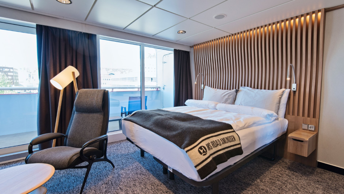
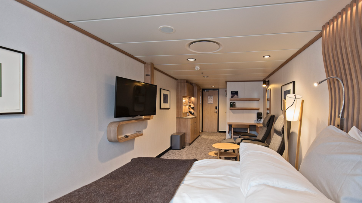
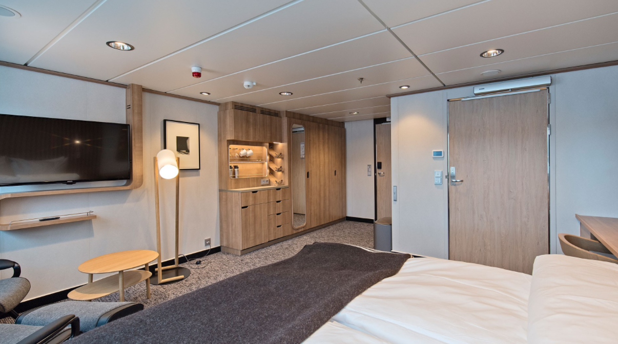
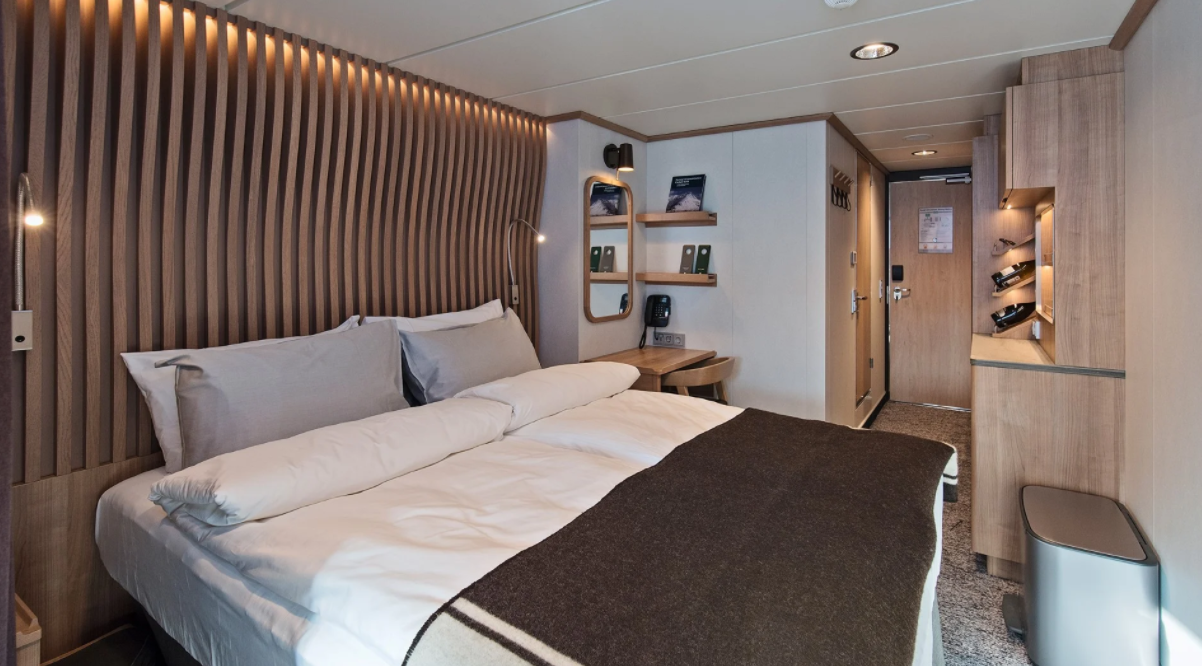
Featured Cabins
Itinerary
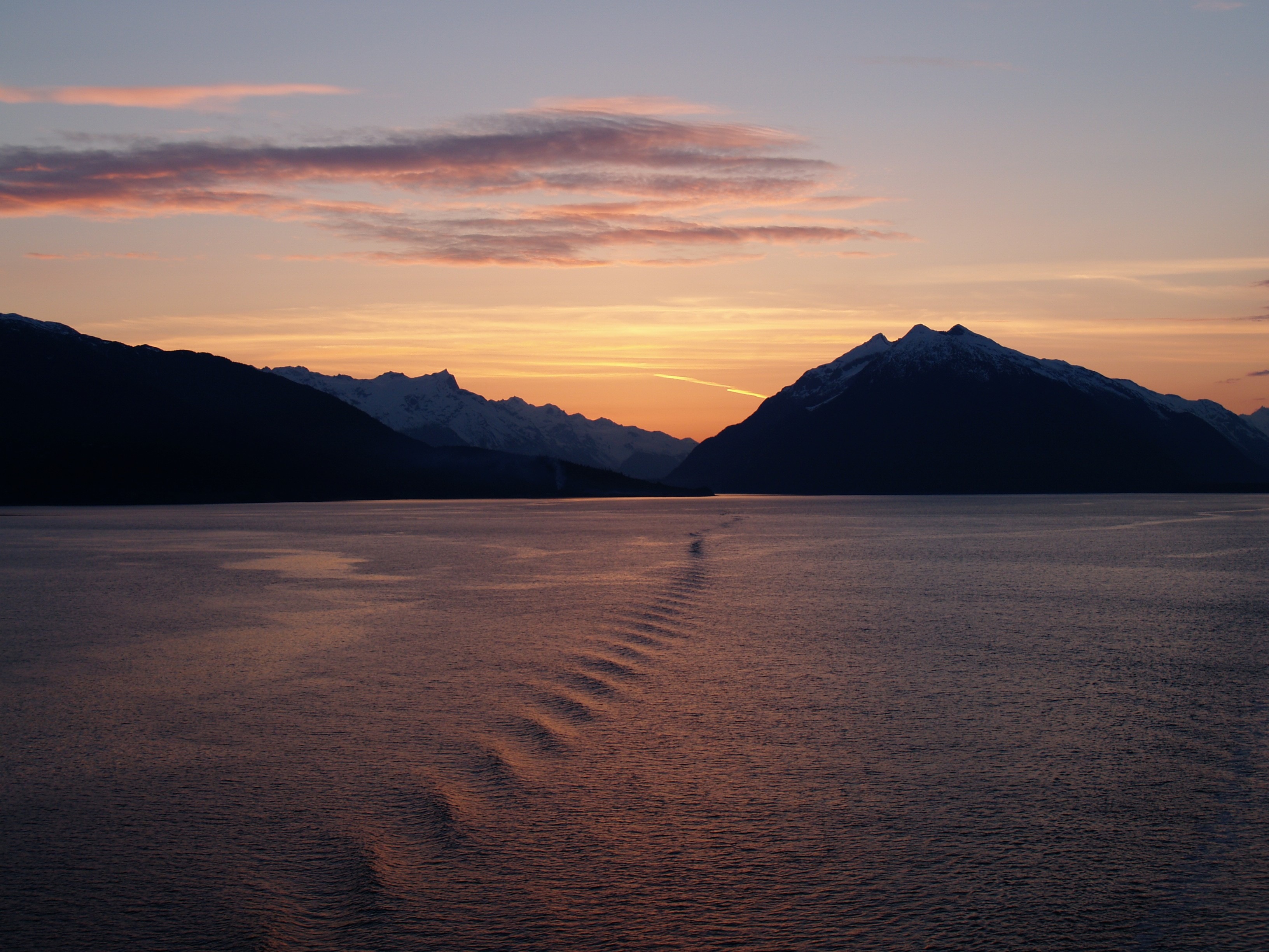
Nome, Alaska, United States
Nome is located on the edge of the Bering Sea, on the southwest side of the Seward Peninsula. Unlike other towns which are named for explorers, heroes or politicians, Nome was named as a result of a 50 year-old spelling error. In the 1850’s an officer on a British ship off the coast of Alaska noted on a manuscript map that a nearby prominent point was not identified. He wrote “? Name” next to the point. When the map was recopied, another draftsman thought that the “?” was a C and that the “a” in “Name” was an o, and thus a map-maker in the British Admiralty christened “Cape Nome.” The area has an amazing history dating back 10,000 years of Inupiaq Eskimo use for subsistence living. Modern history started in 1898 when “Three Lucky Swedes”, Jafet Lindberg, Erik Lindblom and John Brynteson, discovered gold in Anvil Creek…the rush was on! In 1899 the population of Nome swelled from a handful to 28,000. Today the population is just over 3,500. Much of Nome’s gold rush architecture remains.
At Sea
No additional details available for this day.
Herschel Island, Yukon, Canada
No additional details available for this day.
At Sea
No additional details available for this day.
Ulukhaktok, Northwest Territories, Canada
No additional details available for this day.
At Sea
No additional details available for this day.
Cambridge Bay, Nunavut, Canada
No additional details available for this day.
At Sea
No additional details available for this day.
Gjoa Haven, Nunavut, Canada
No additional details available for this day.
At Sea
No additional details available for this day.
Ulukhaktok, Northwest Territories, Canada
No additional details available for this day.
At Sea
No additional details available for this day.
Cambridge Bay, Nunavut, Canada
No additional details available for this day.
At Sea
No additional details available for this day.
Gjoa Haven, Nunavut, Canada
No additional details available for this day.
Fort Ross, Nunavut, Canada
No additional details available for this day.
Beechey Island, Nunavut, Canada
Beechey Island is a small island off the southwest coast of Devon Island, separated by a narrow waterway called the Barrow Strait. Captain William Edward Parry was the first European to visit the island in 1819. His lieutenant, Frederick William Beechey, named the island after his father, the artist William Beechey (1753–1839). Beechey Island played a significant role in the history of Arctic Exploration. During the winter of 1845-46, Sir John Franklin and his men camped on the island as part of their ill-fated quest to find the Northwest Passage. Mummified remains of three of Franklin’s crew were discovered, giving a better understanding of what happened before the disappearance of the expedition. In 1850 Edward Belcher used the island as a base while surveying the area. Later, in 1903, Norwegian explorer Roald Amundsen stopped at the island at the beginning of his successful voyage in search for the Northwest Passage. Subsequently, Beechey Island has been declared a “Territorial Historic Site” since 1975 by the Northwest Territories government
Croker Bay, Nunavut, Canada
No additional details available for this day.
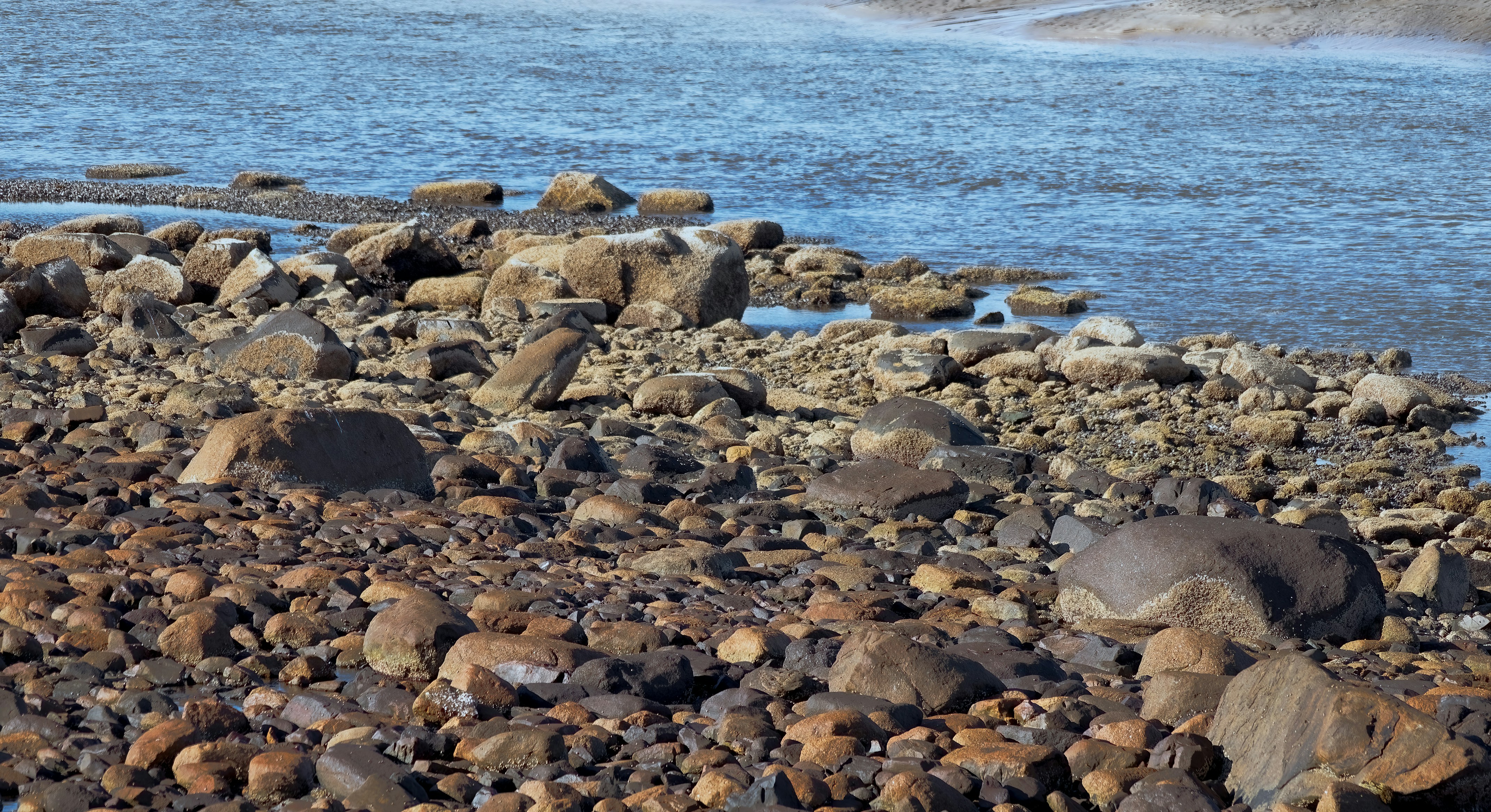
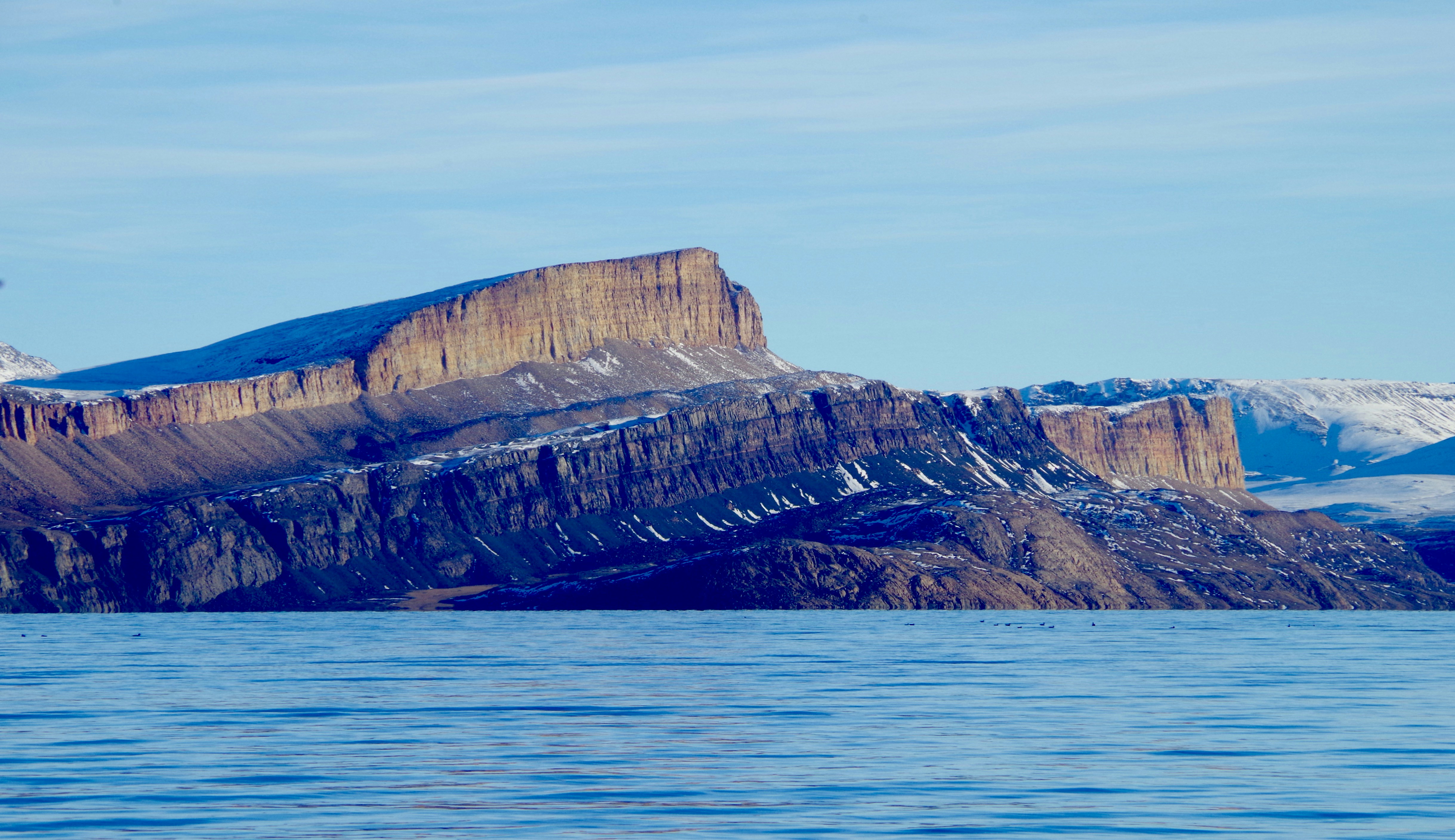
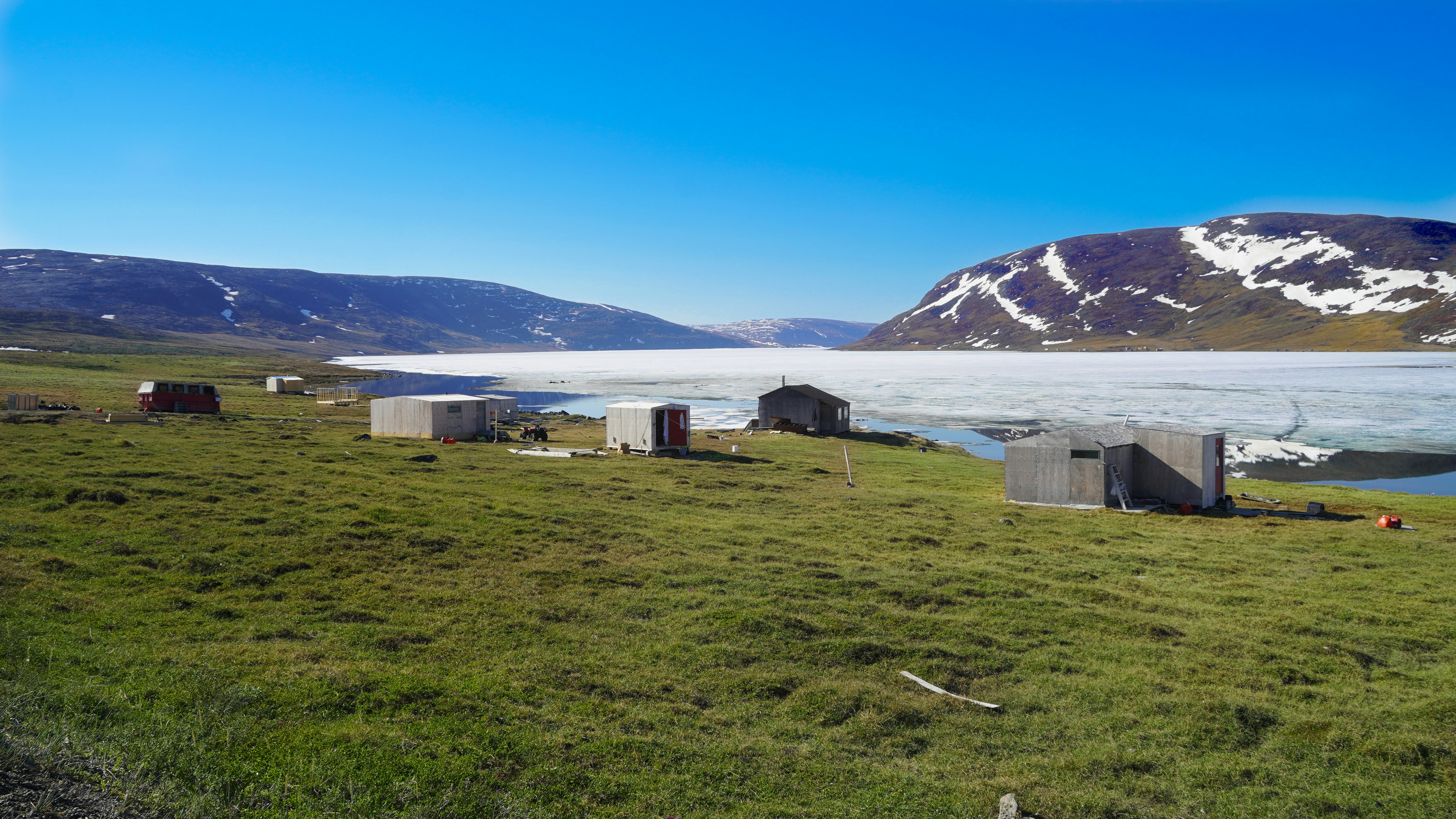
Dundas Harbour, Devon Island, Nunavut, Canada
Dundas Harbour is located in the southeast of Devon Island, Canada’s 6th largest island. It is a forlorn but starkly beautiful spot. The island was first sighted by Europeans in 1616 by the English explorers Robert Bylot and William Baffin. But it did not appear on maps until after explorer William Edward Parry’s exploration in the 1820’s. Parry named it after Devon, England. In the local Inuktitut language, the place is called Talluruti, which translates as “a woman’s chin with tattoos on it.” This refers to the deep crevasses and streaks on Devon Island, which from a distance resemble traditional facial tattoos. On land there are remains of a Thule settlement dating back to 1000 A.D., including tent rings, middens and a gravesite. There are also much more recent remains a Royal Canadian Mounted Police outpost. The first post was established in 1924 to monitor and control illegal activities, such as foreign whaling, in the eastern entrance to the Northwest Passage. But conditions were so isolated and severe that the post was abandoned in 1933. It was reopened in 1945, but again closed, this time permanently, in 1951. Today, Devon Island is the largest uninhabited island in the world.
Pond Inlet, Nunavut, Canada
Located in northern Baffin Island, Pond Inlet is a small, predo¬minantly Inuit community, with a population of roughly 1,500 inhabitants. In 1818, the British explorer John Ross named a bay in the vicinity after the English astronomer John Pond. Today Pond Inlet is considered one of Canada’s “jewels of the North” thanks to several picturesque glaciers and mountain ranges nearby. Many archaeological sites of ancient Dorset and Thule peoples can be found near Pond Inlet. The Inuit hunted caribou, ringed and harp seals, fish, polar bears, walrus, narwhals, geese, ptarmigans and Arctic hares, long before European and American whalers came here to harvest bowhead whales. Pond Inlet is also known as a major center of Inuit art, especially the printmaking and stone carving that are featured in the town’s art galleries.
At Sea
No additional details available for this day.
Fort Ross, Nunavut, Canada
No additional details available for this day.
Beechey Island, Nunavut, Canada
Beechey Island is a small island off the southwest coast of Devon Island, separated by a narrow waterway called the Barrow Strait. Captain William Edward Parry was the first European to visit the island in 1819. His lieutenant, Frederick William Beechey, named the island after his father, the artist William Beechey (1753–1839). Beechey Island played a significant role in the history of Arctic Exploration. During the winter of 1845-46, Sir John Franklin and his men camped on the island as part of their ill-fated quest to find the Northwest Passage. Mummified remains of three of Franklin’s crew were discovered, giving a better understanding of what happened before the disappearance of the expedition. In 1850 Edward Belcher used the island as a base while surveying the area. Later, in 1903, Norwegian explorer Roald Amundsen stopped at the island at the beginning of his successful voyage in search for the Northwest Passage. Subsequently, Beechey Island has been declared a “Territorial Historic Site” since 1975 by the Northwest Territories government
Croker Bay, Nunavut, Canada
No additional details available for this day.
Dundas Harbour, Devon Island, Nunavut, Canada
Dundas Harbour is located in the southeast of Devon Island, Canada’s 6th largest island. It is a forlorn but starkly beautiful spot. The island was first sighted by Europeans in 1616 by the English explorers Robert Bylot and William Baffin. But it did not appear on maps until after explorer William Edward Parry’s exploration in the 1820’s. Parry named it after Devon, England. In the local Inuktitut language, the place is called Talluruti, which translates as “a woman’s chin with tattoos on it.” This refers to the deep crevasses and streaks on Devon Island, which from a distance resemble traditional facial tattoos. On land there are remains of a Thule settlement dating back to 1000 A.D., including tent rings, middens and a gravesite. There are also much more recent remains a Royal Canadian Mounted Police outpost. The first post was established in 1924 to monitor and control illegal activities, such as foreign whaling, in the eastern entrance to the Northwest Passage. But conditions were so isolated and severe that the post was abandoned in 1933. It was reopened in 1945, but again closed, this time permanently, in 1951. Today, Devon Island is the largest uninhabited island in the world.
Pond Inlet, Nunavut, Canada
Located in northern Baffin Island, Pond Inlet is a small, predo¬minantly Inuit community, with a population of roughly 1,500 inhabitants. In 1818, the British explorer John Ross named a bay in the vicinity after the English astronomer John Pond. Today Pond Inlet is considered one of Canada’s “jewels of the North” thanks to several picturesque glaciers and mountain ranges nearby. Many archaeological sites of ancient Dorset and Thule peoples can be found near Pond Inlet. The Inuit hunted caribou, ringed and harp seals, fish, polar bears, walrus, narwhals, geese, ptarmigans and Arctic hares, long before European and American whalers came here to harvest bowhead whales. Pond Inlet is also known as a major center of Inuit art, especially the printmaking and stone carving that are featured in the town’s art galleries.
At Sea
No additional details available for this day.
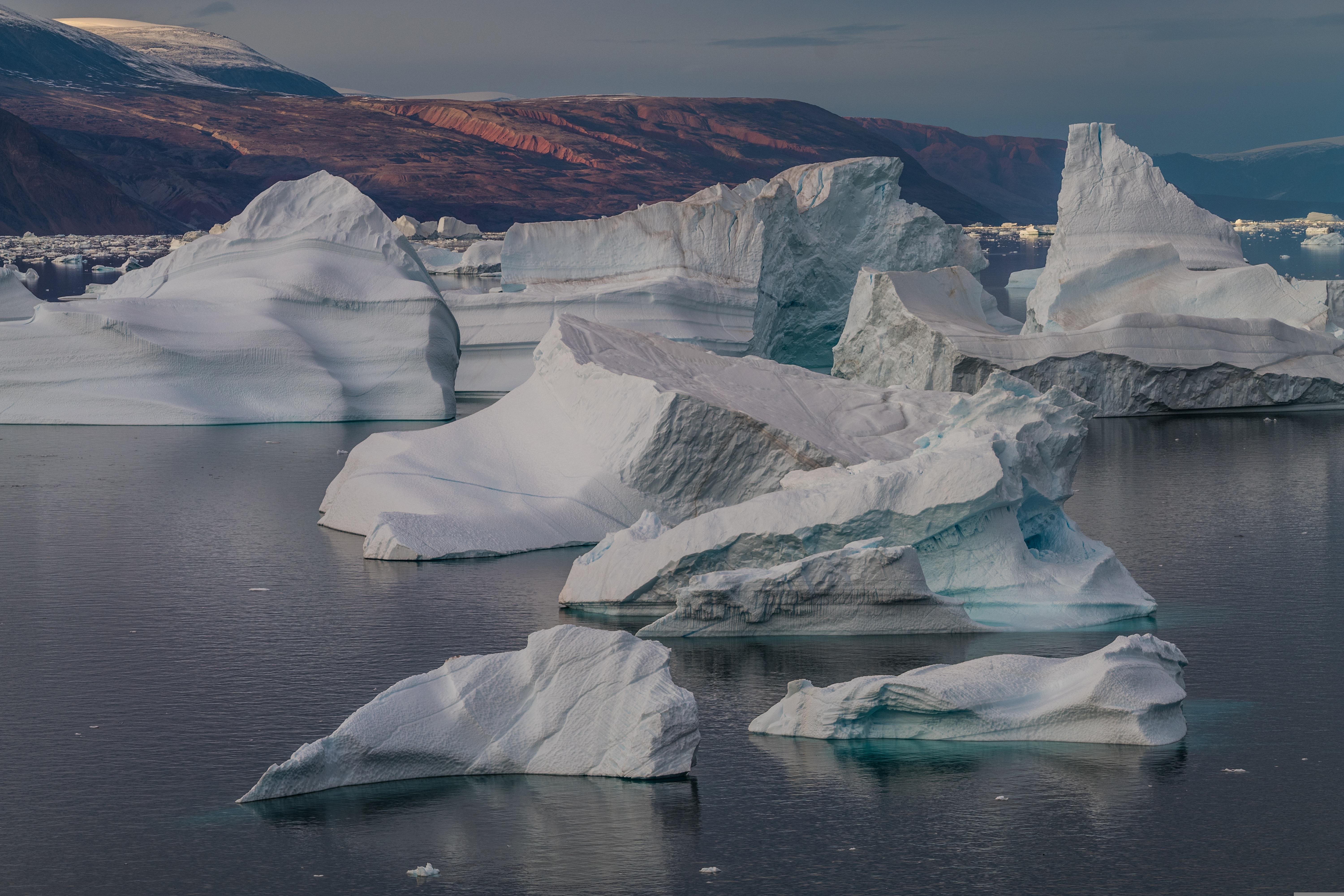
Ilulissat (Jakobshavn), Greenland
Known as the birthplace of icebergs, the Ilulissat Icefjord produces nearly 20 million tons of ice each day. In fact, the word Ilulissat means “icebergs” in the Kalaallisut language. The town of Ilulissat is known for its long periods of calm and settled weather, but the climate tends to be cold due to its proximity to the fjord. Approximately 4,500 people live in Ilulissat, the third-largest town in Greenland after Nuuk and Sisimiut. Some people here estimate that there are nearly as many sled dogs as human beings living in the town that also boasts a local history museum located in the former home of Greenlandic folk hero and famed polar explorer Knud Rasmussen.
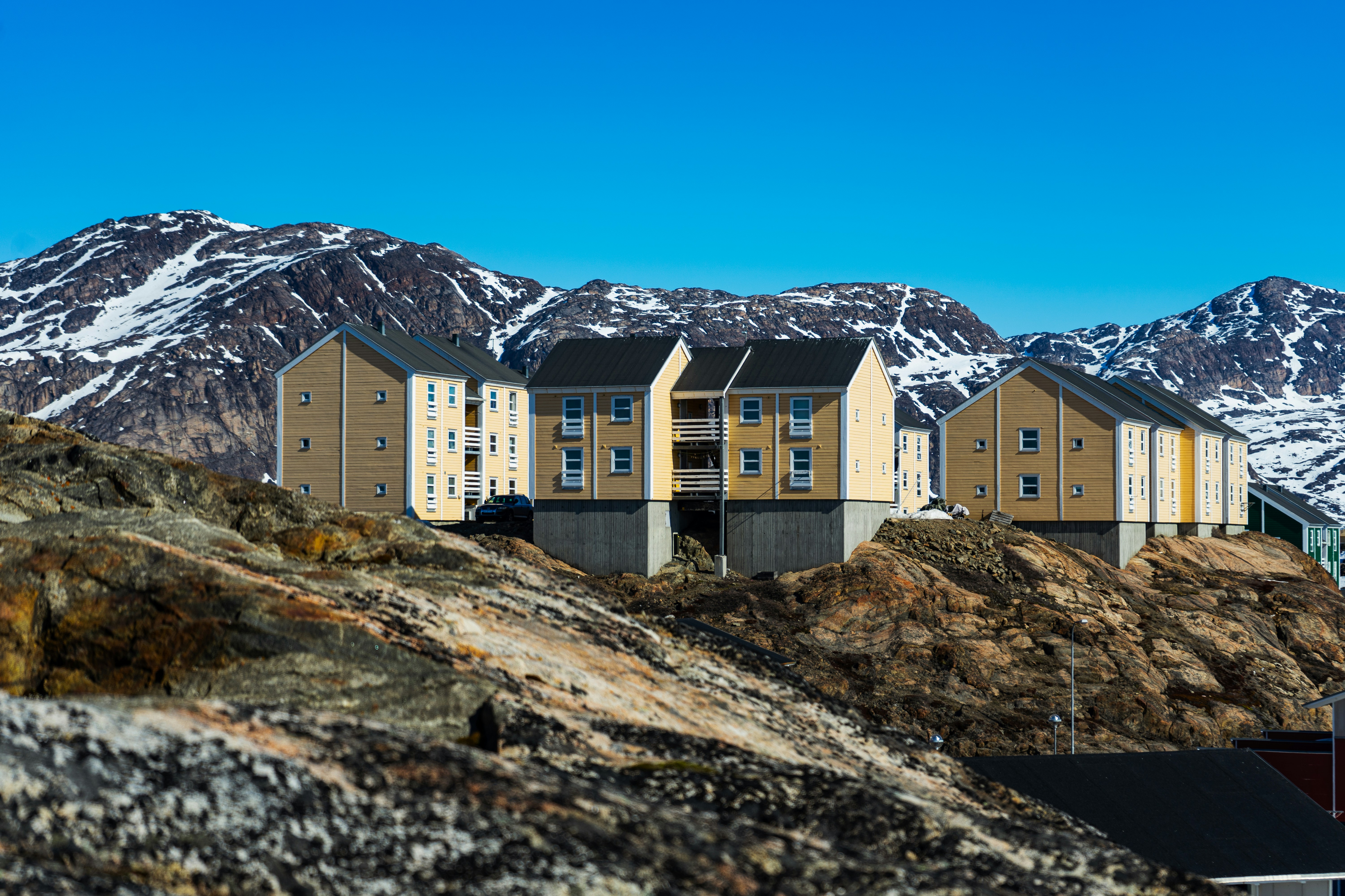
Sisimiut (Holsteinsborg), Greenland
Located just north of the Arctic Circle, Sisimiut is the northernmost town in Greenland where the port remains free of ice in the winter. Yet it is also the southernmost town where there is enough snow and ice to drive a dogsled in winter and spring. In Sisimiut, travelling by sled has been the primary means of winter transportation for centuries. In fact, the area has been inhabited for approximately 4,500 years. Modern Sisimiut is the largest business center in the north of Greenland, and is one of the fastest growing Greenlandic cities. Commercial fishing is the lead economy in the town‘s thriving industrial base.
Evighedsfjorden, Greenland
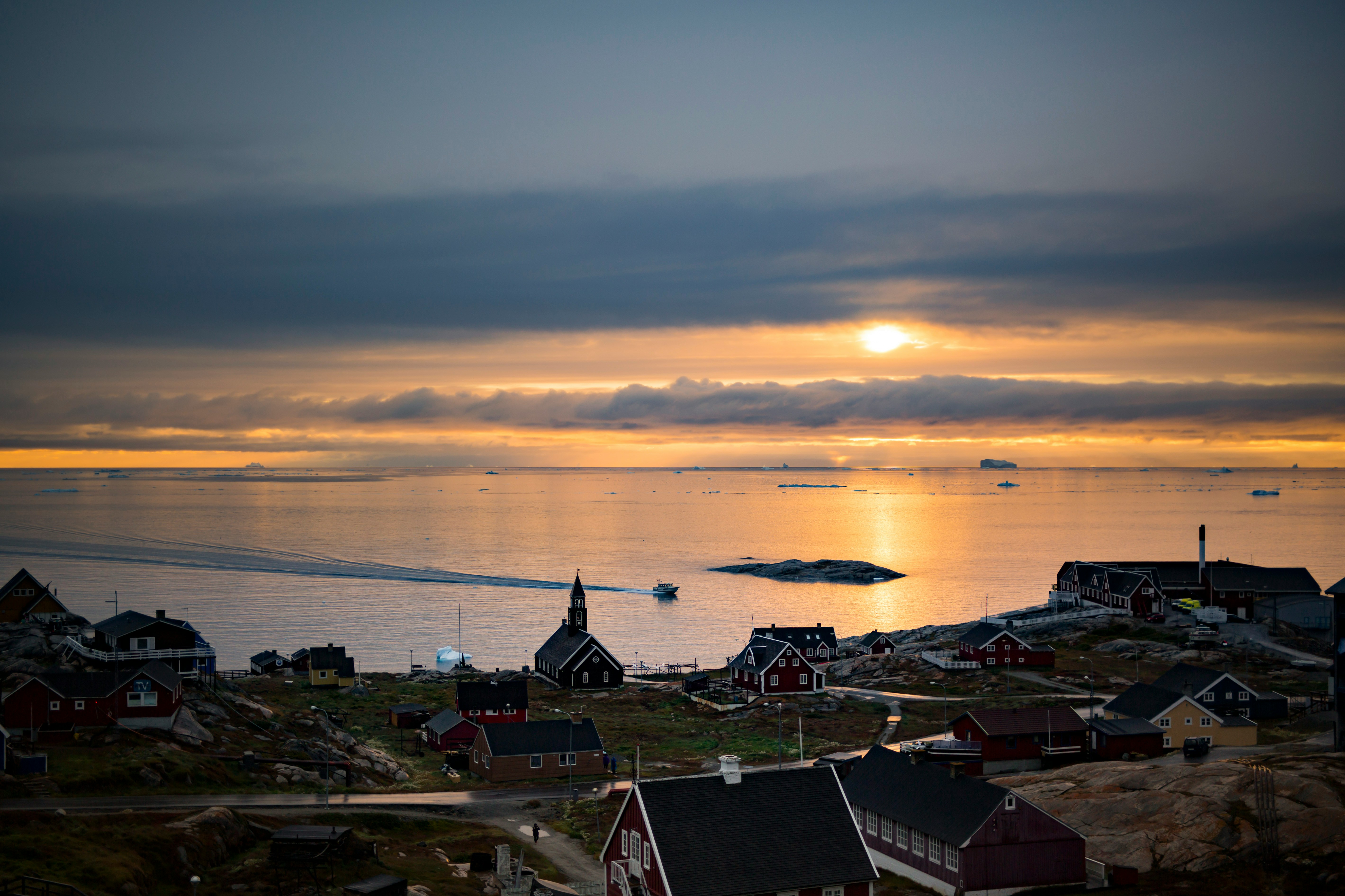
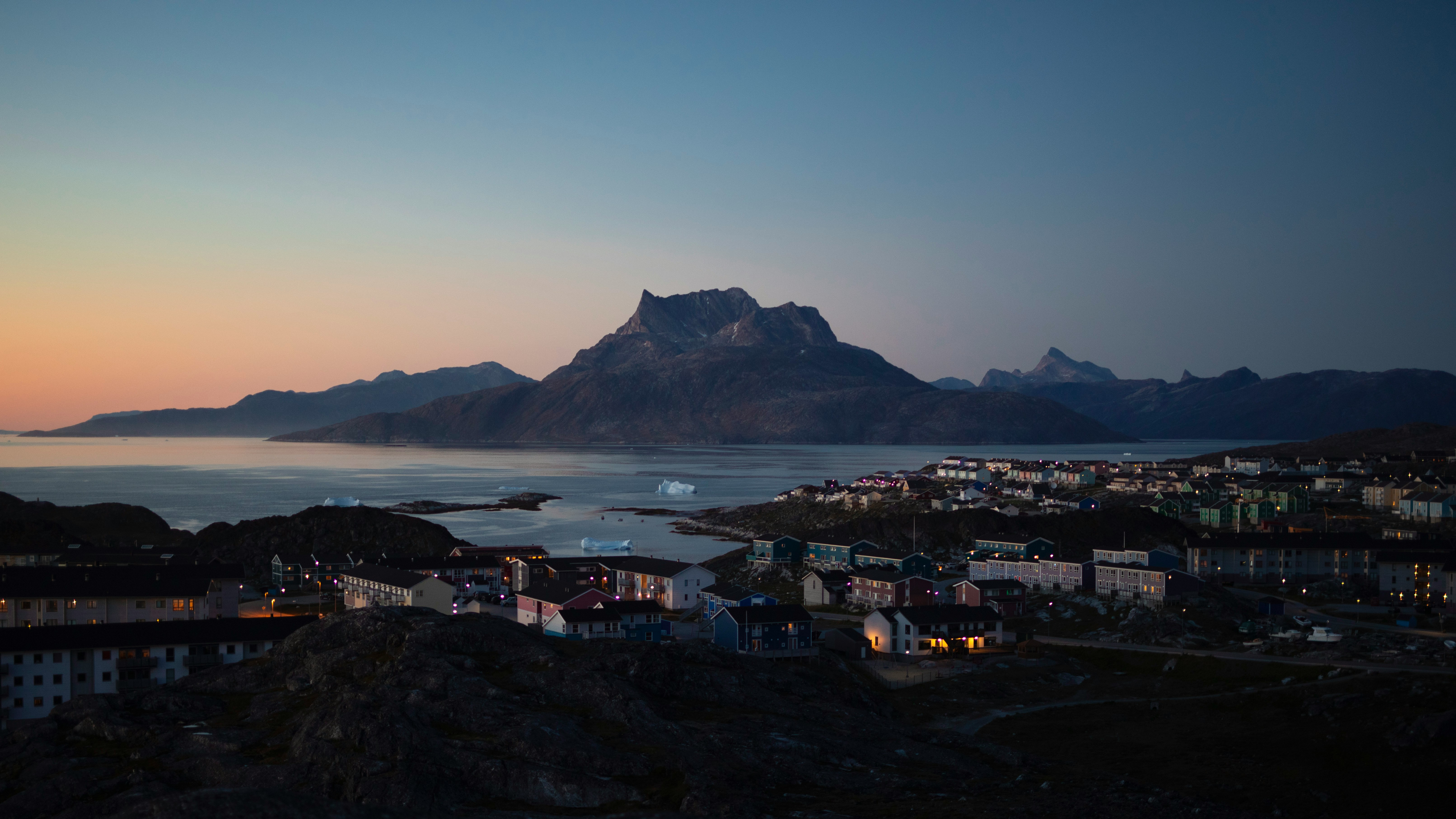
Nuuk (Godthaab), Greenland
Nuuk, meaning “the cape”, was Greenland’s first town (1728). Started as a fort and later mission and trading post some 240 kilometers south of the Arctic Circle, it is the current capital. Almost 30% of Greenland’s population lives in the town. Not only does Nuuk have great natural beauty in its vicinity, but there are Inuit ruins, Hans Egede’s home, the parliament, and the Church of our Saviour as well. The Greenlandic National Museum has an outstanding collection of Greenlandic traditional dresses, as well as the famous Qilakitsoq mummies. The Katuaq Cultural Center’s building was inspired by the undulating Northern Lights and can house 10% of Nuuk’s inhabitants.
Ilulissat (Jakobshavn), Greenland
Known as the birthplace of icebergs, the Ilulissat Icefjord produces nearly 20 million tons of ice each day. In fact, the word Ilulissat means “icebergs” in the Kalaallisut language. The town of Ilulissat is known for its long periods of calm and settled weather, but the climate tends to be cold due to its proximity to the fjord. Approximately 4,500 people live in Ilulissat, the third-largest town in Greenland after Nuuk and Sisimiut. Some people here estimate that there are nearly as many sled dogs as human beings living in the town that also boasts a local history museum located in the former home of Greenlandic folk hero and famed polar explorer Knud Rasmussen.
Sisimiut (Holsteinsborg), Greenland
Located just north of the Arctic Circle, Sisimiut is the northernmost town in Greenland where the port remains free of ice in the winter. Yet it is also the southernmost town where there is enough snow and ice to drive a dogsled in winter and spring. In Sisimiut, travelling by sled has been the primary means of winter transportation for centuries. In fact, the area has been inhabited for approximately 4,500 years. Modern Sisimiut is the largest business center in the north of Greenland, and is one of the fastest growing Greenlandic cities. Commercial fishing is the lead economy in the town‘s thriving industrial base.
Evighedsfjorden, Greenland
Nuuk (Godthaab), Greenland
Nuuk, meaning “the cape”, was Greenland’s first town (1728). Started as a fort and later mission and trading post some 240 kilometers south of the Arctic Circle, it is the current capital. Almost 30% of Greenland’s population lives in the town. Not only does Nuuk have great natural beauty in its vicinity, but there are Inuit ruins, Hans Egede’s home, the parliament, and the Church of our Saviour as well. The Greenlandic National Museum has an outstanding collection of Greenlandic traditional dresses, as well as the famous Qilakitsoq mummies. The Katuaq Cultural Center’s building was inspired by the undulating Northern Lights and can house 10% of Nuuk’s inhabitants.
Cabin Options
Expedition Suite | XL Suite – With balcony
Expedition Suite | Corner suite with balcony
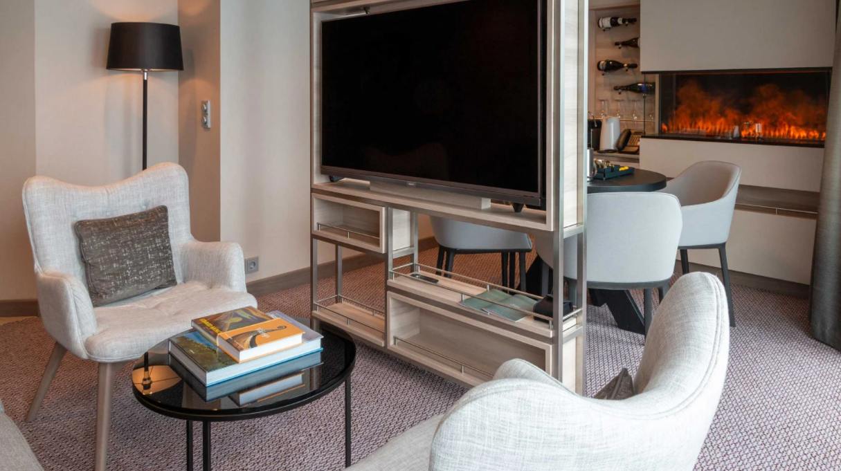
Expedition Suite | XL Suite
Expedition Suite | Large suite with balcony
Expedition Suite | Suite with balcony
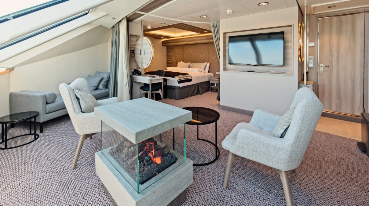
Expedition Suite | Corner suite
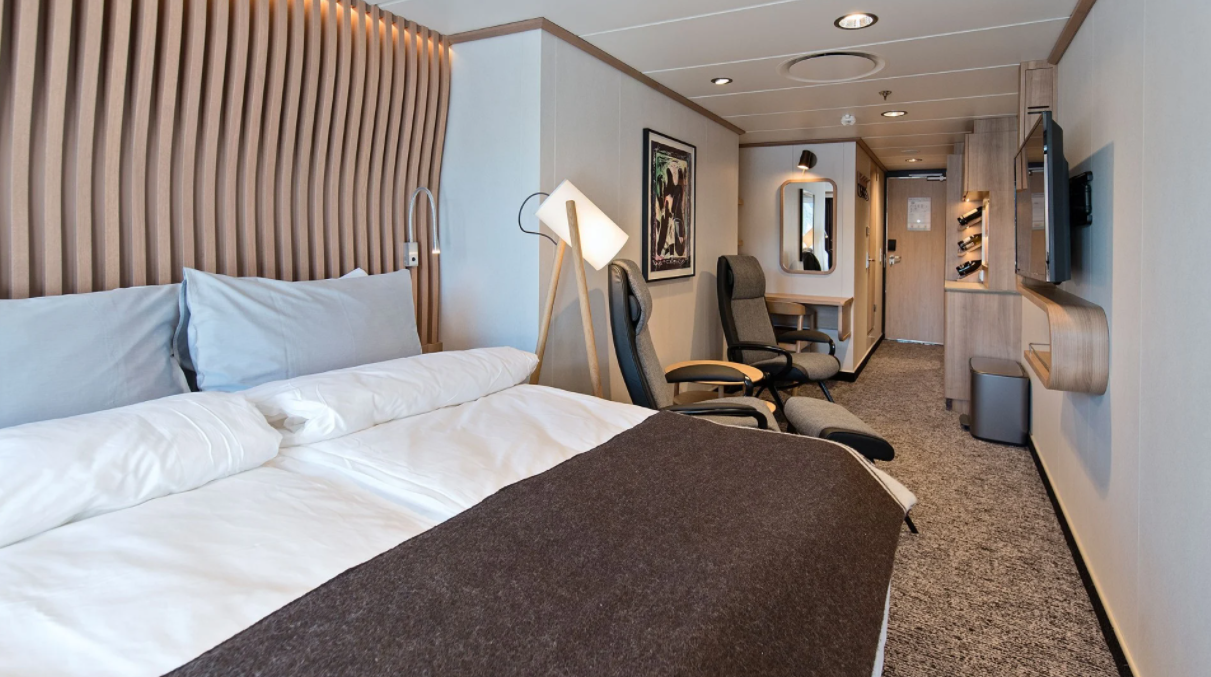
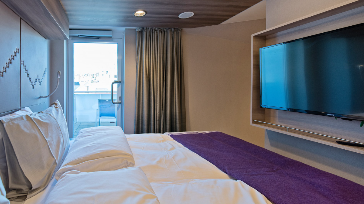
Arctic Superior | Outside cabin with balcony
Arctic Superior | Outside cabin with balcony
Arctic Superior | Wheelchair-accessible outside cabin with balcony
Arctic Superior | Outside cabin with balcony
Arctic Superior | Outside cabin – Lower/middle decks
Arctic Superior | Outside cabin – Lower/middle decks
Polar Outside | Outside cabin – Lower/middle decks
Ship Facilities
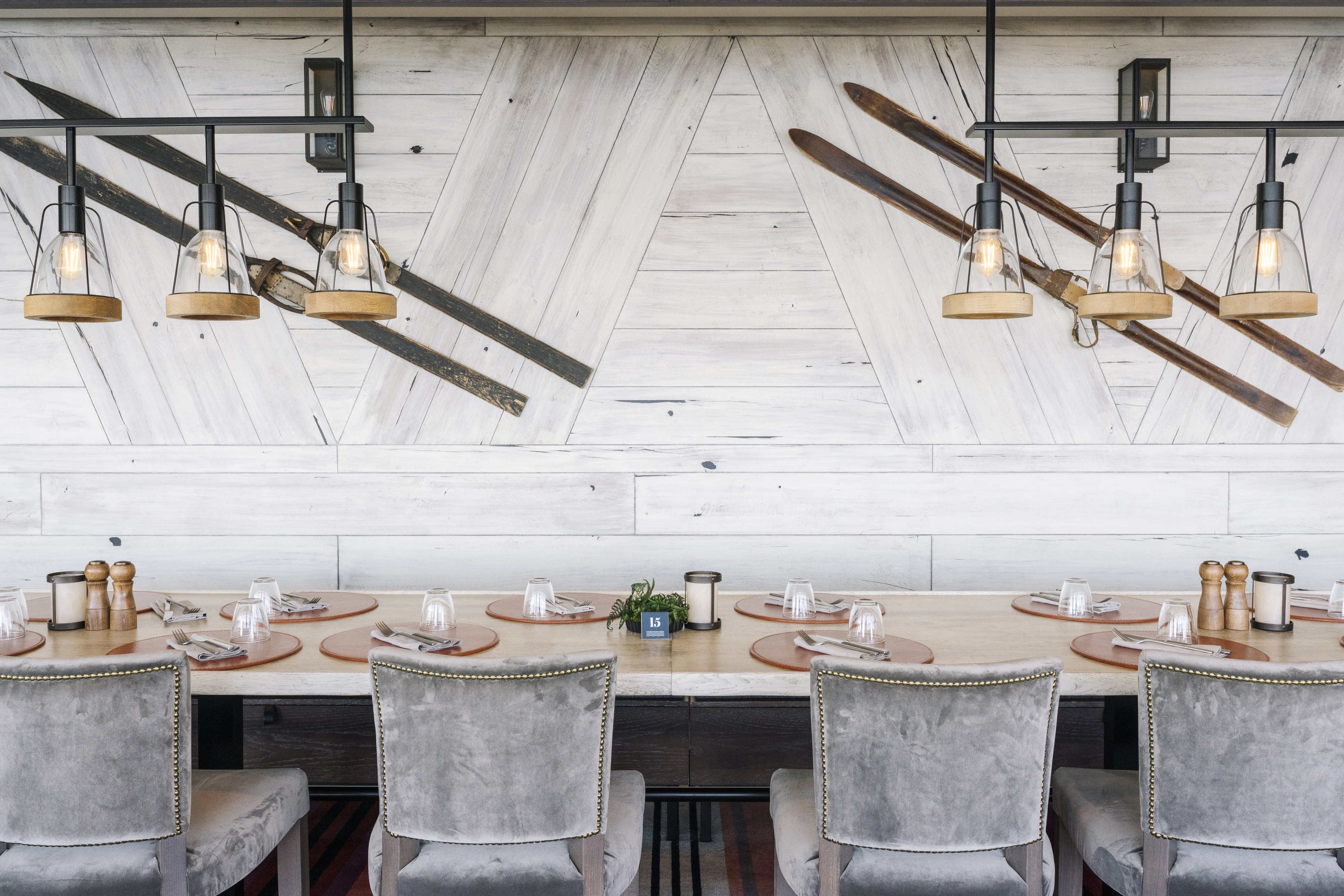
Fredheim
The ships’ informal and social meeting place – named after a 1900s hunting station on Svalbard.
Aune
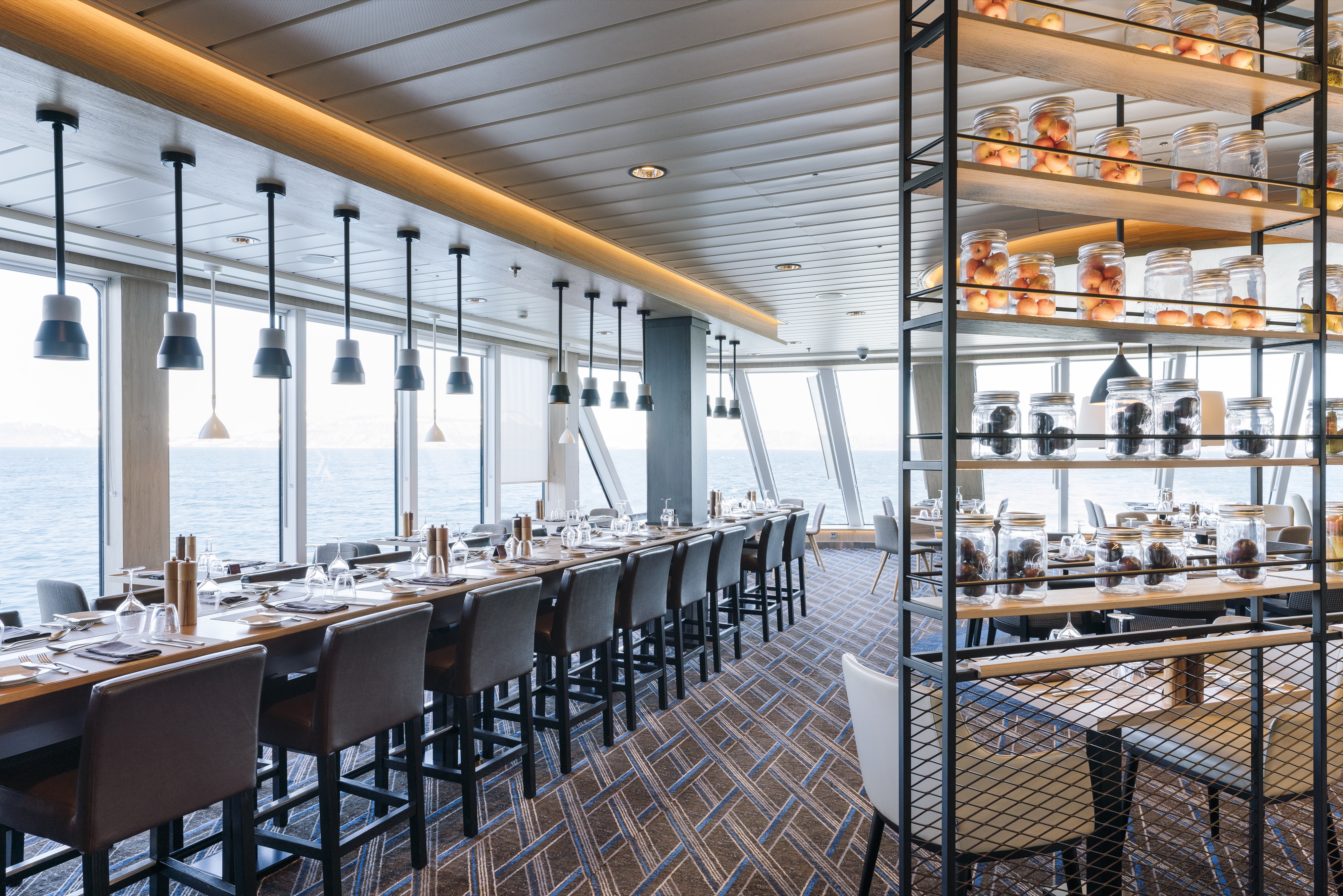
Lindstrøm
A speciality restaurant named after Adolf Lindstrøm, the favourite chef of the Norwegian polar heroes. Fine dining in Restaurant Lindstrøm is included for suite guests. Non-suite guests can enjoy breakfast, lunch and dinner in Lindstrøm for an additional cost.
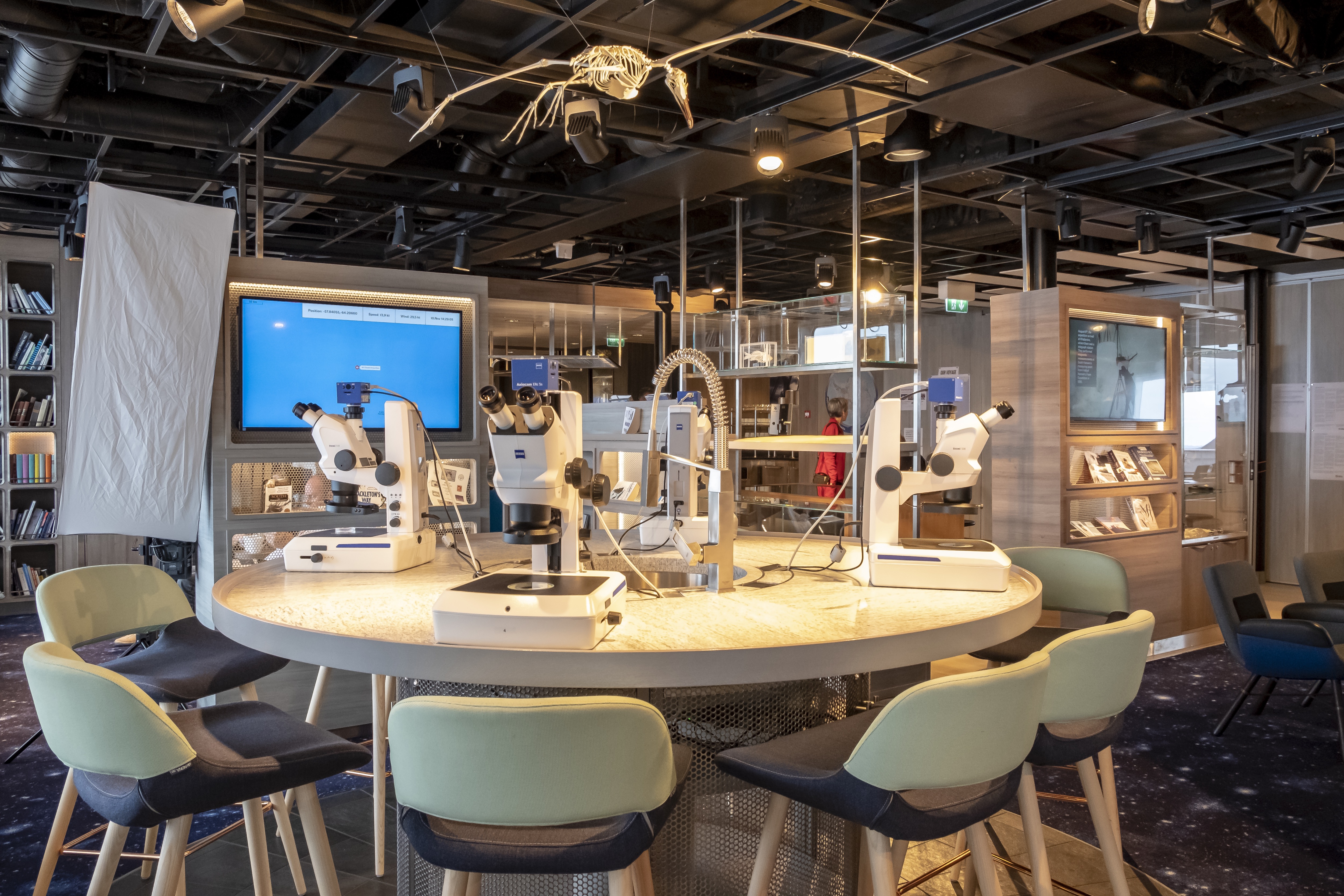
Science Center
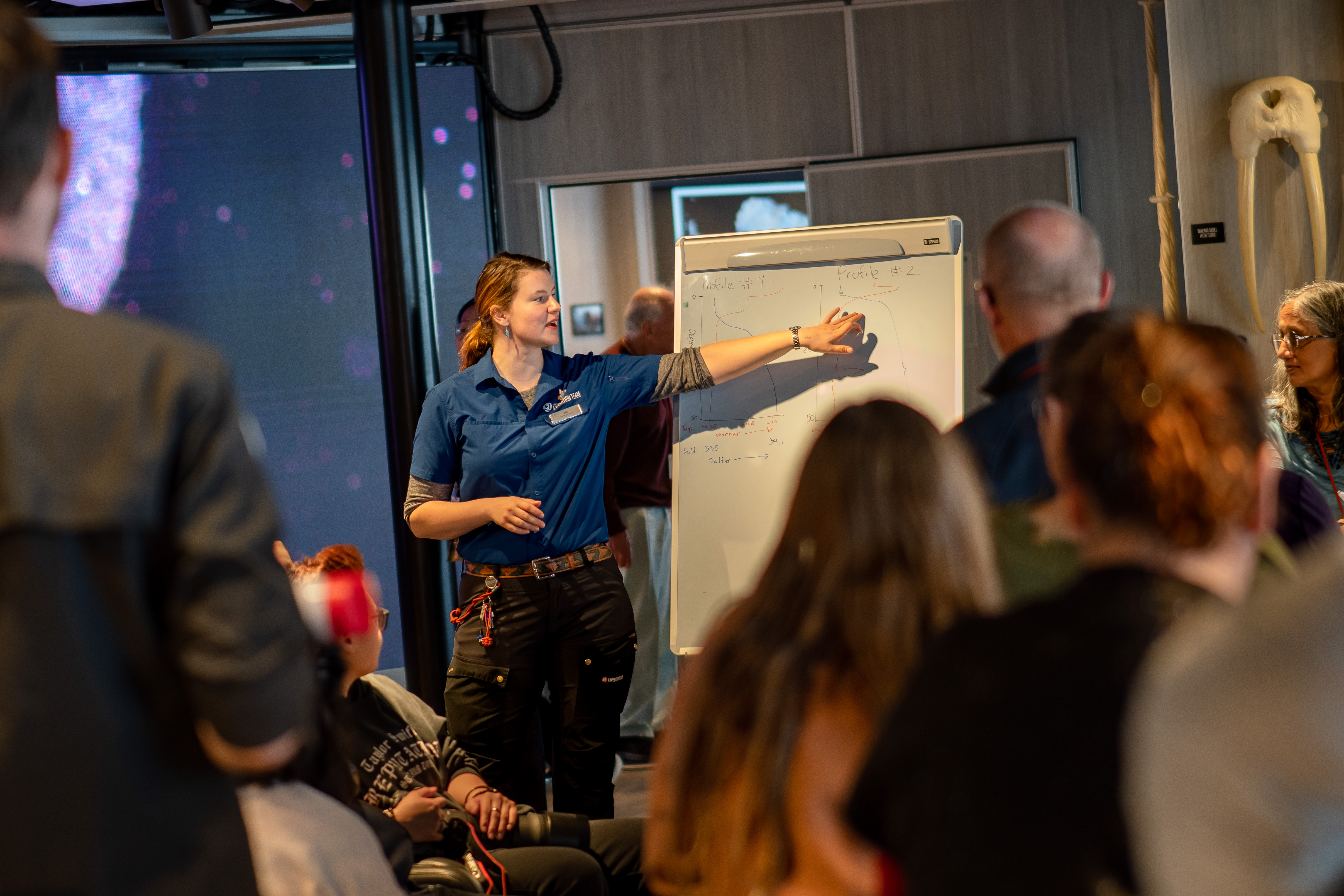
The Science & Education program brings together like-minded individuals
Covering over 3/4 of the planet’s surface, our oceans are vital in supporting human life on earth and are also home to over 90% of all known wildlife. Despite it influencing everything from our weather to transportation and yes, expedition cruises, very little is known about our blue planet.
This is where HX Expeditions and our fleet of small, state-of-the-art Expedition ships come in. We can reach, explore and collect vital scientific data on some of the planet’s most remote regions. From understanding whale migrations and phytoplankton communities to cloud observations and the Northern Lights, our onboard Science & Education Teams – with the help of you, our guests – captures, analyses, and reports invaluable data to organisations and research projects around the world.
Lectures
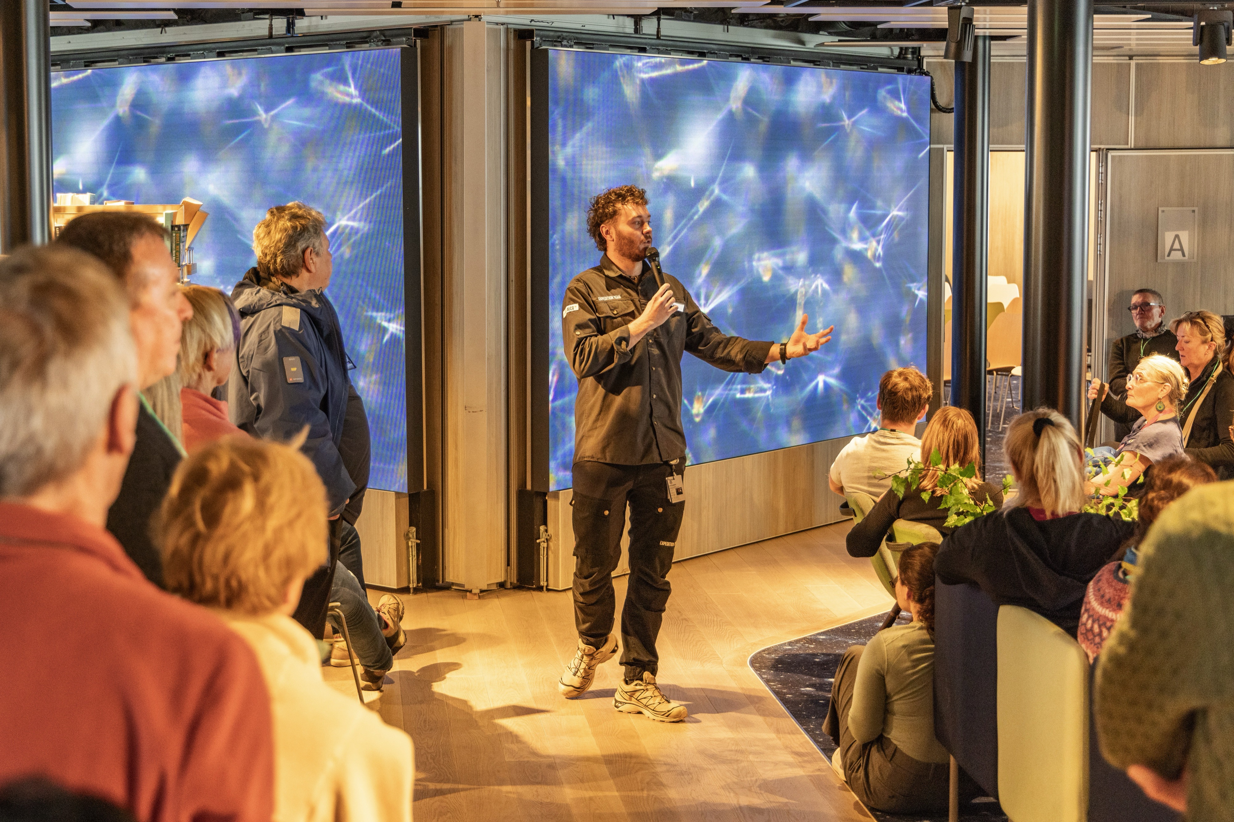
Expedition Team
The onboard Expedition Team is composed of the Expedition Leader, the Assistant Expedition Leader, the Expedition Coordinator plus several lecturers and experts. Your Expedition Leader will regularly update you on the progress of the trip as well as the different points of interest and wildlife sightings that may occur. Biographies of the Expedition Team can be found on board. In the ships science center, you will be able to find information regarding the trip and book optional excursions and activities
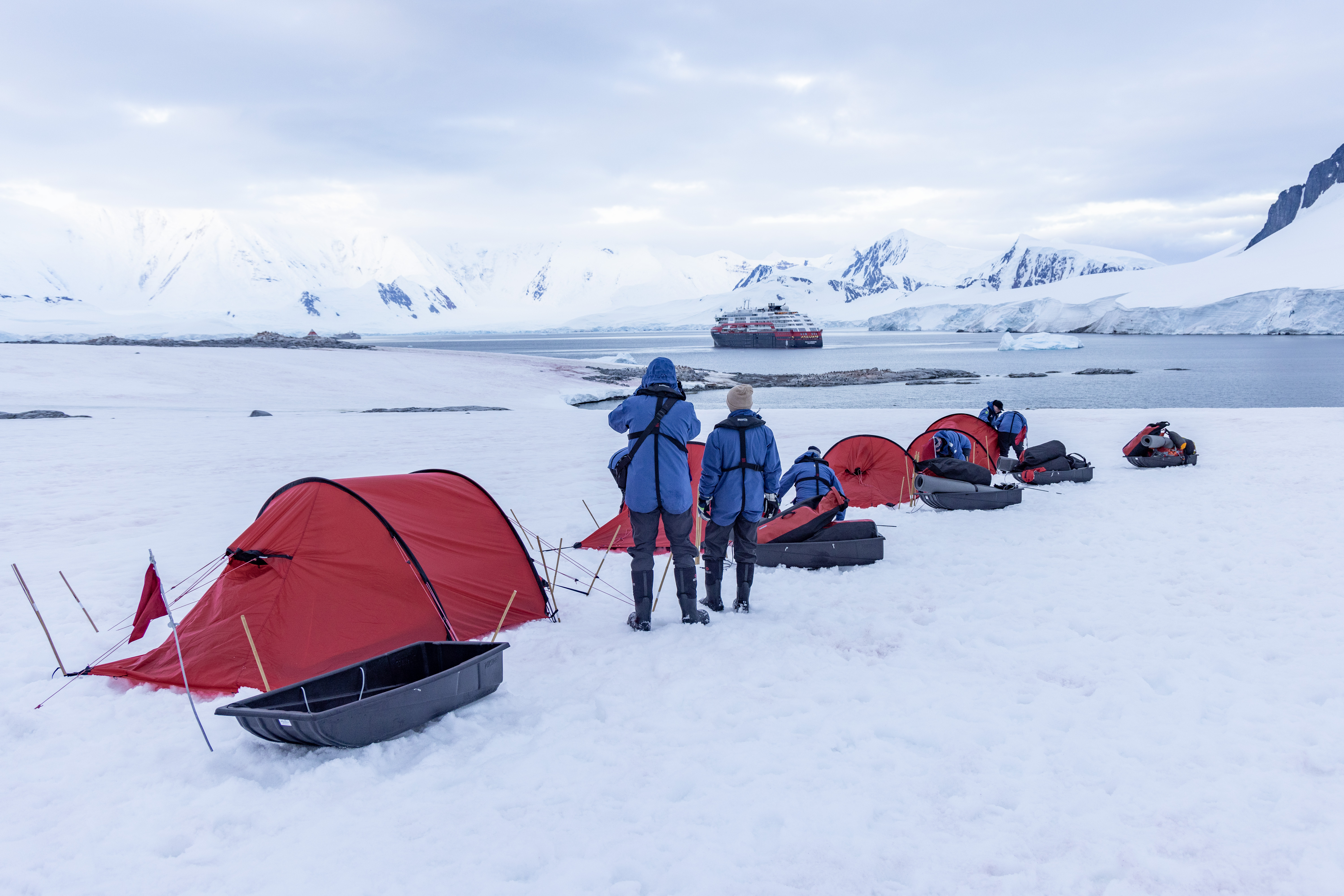
Excursions
Let the participants reveal the adventurer they carry within, and get to know the spectacular surroundings by taking part in the excursions we offer. You can also take a brief break and join in one of the activities that take place on deck. This will recharge your batteries for the next session.
Take a break and fill all of your senses – storytelling about food and its traditions is a large part of the gastronomic experience on our ships.
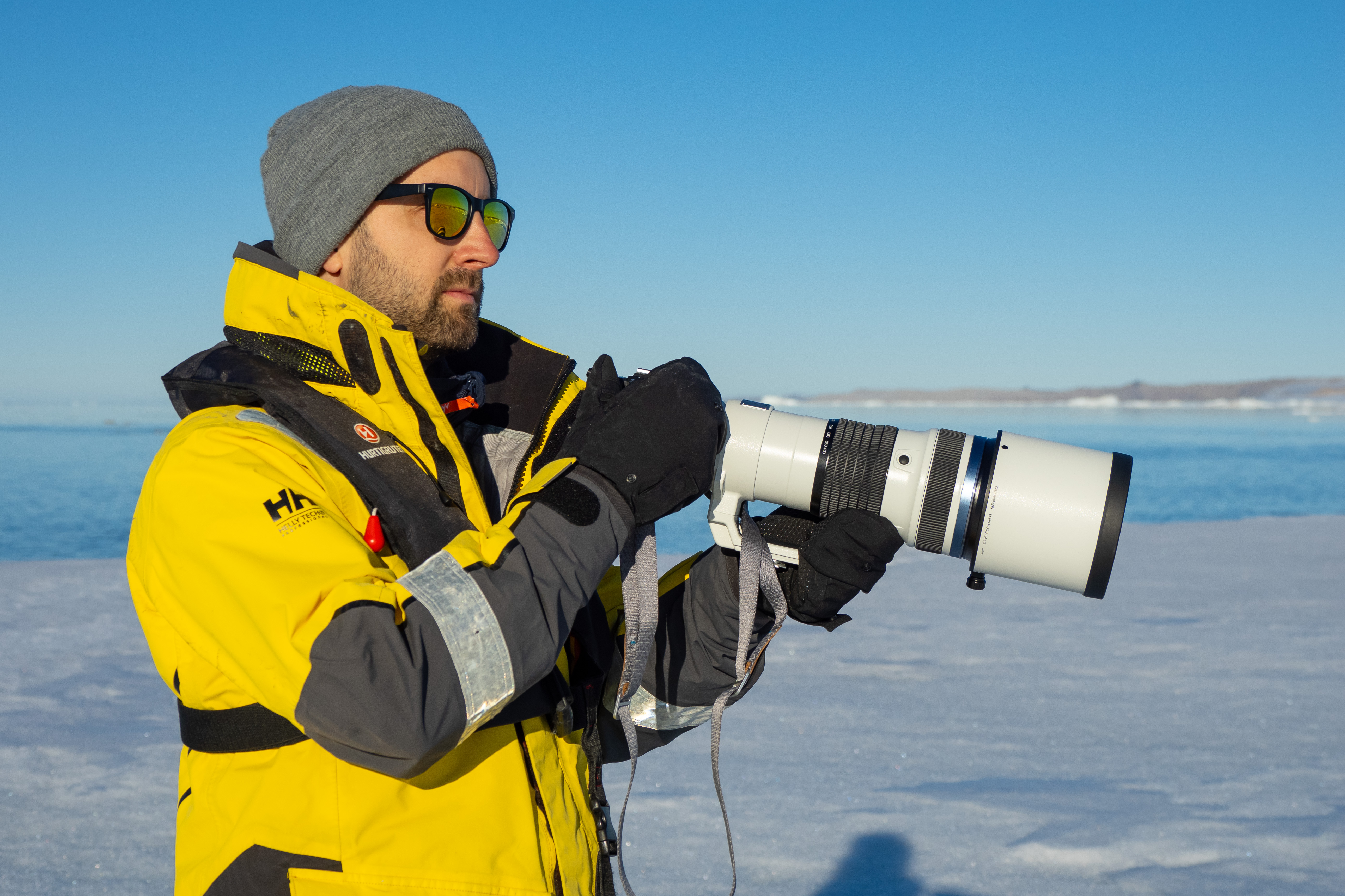
Resident photographers
Our on board photographer will be there to assist guests in the use of their photo equipment and to help improve their photo skills. To enhance the experience of the places we explore, we use photography actively with our guests. Slideshow shared onboard before the end of the voyage and made available for all guests in an Expedition Logbook – including a selection of photos as well as the Daily Programs, Expedition Team biographies, Maps from the voyage and more for sharing/download.
Explorer Lounge & Bar
Relax and rejuvenate in the elegant Explorer lounge & bar. Sink into a comfortable armchair and gaze out at the magnificent views through the floor-to-ceiling windows.
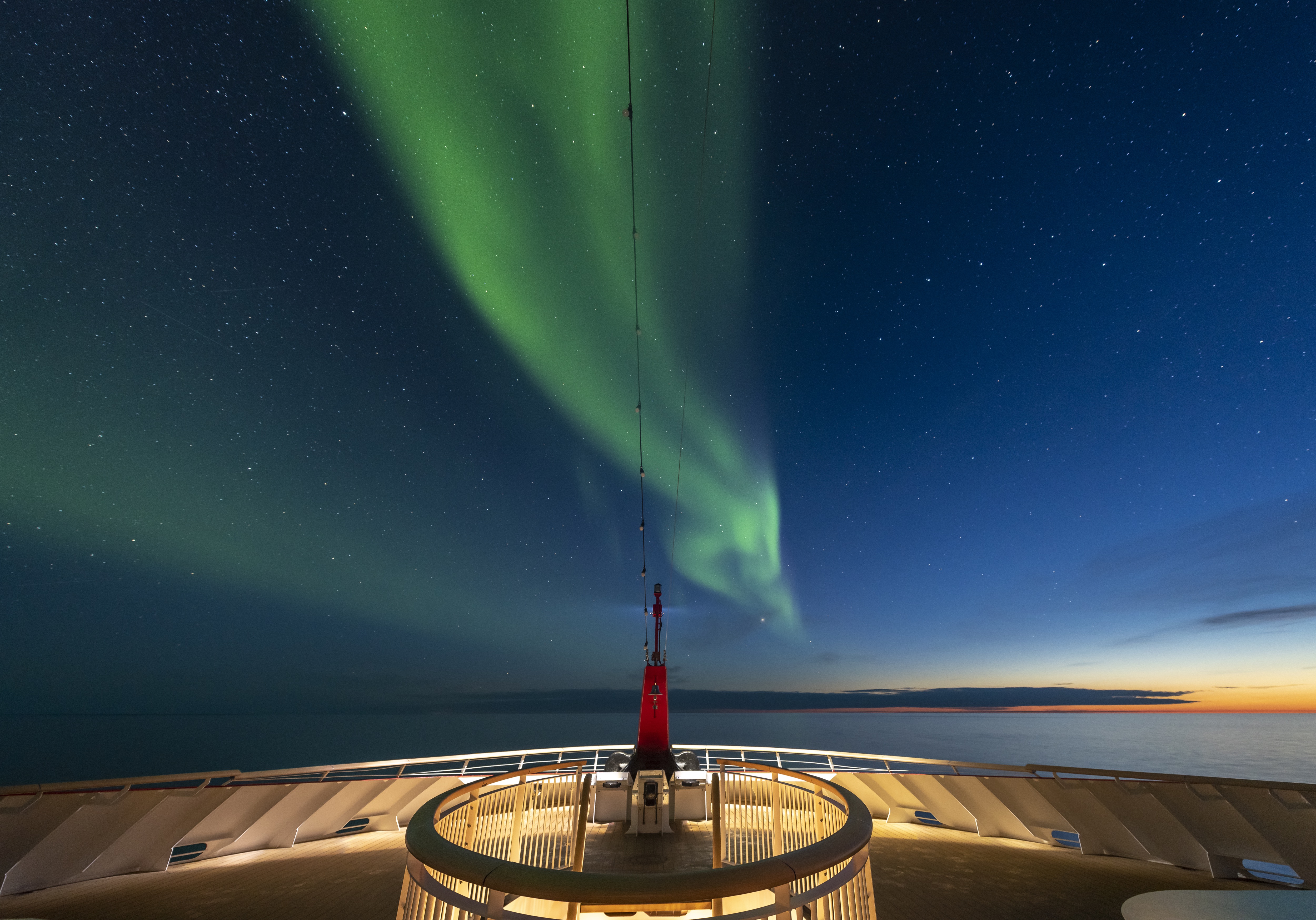
Observation Deck
The ship has spacious outdoor areas. They are perfect vantage points to sit back, relax and watch the world go by. The observation deck is located on deck 11, where you will also find the outdoor gym and running track.
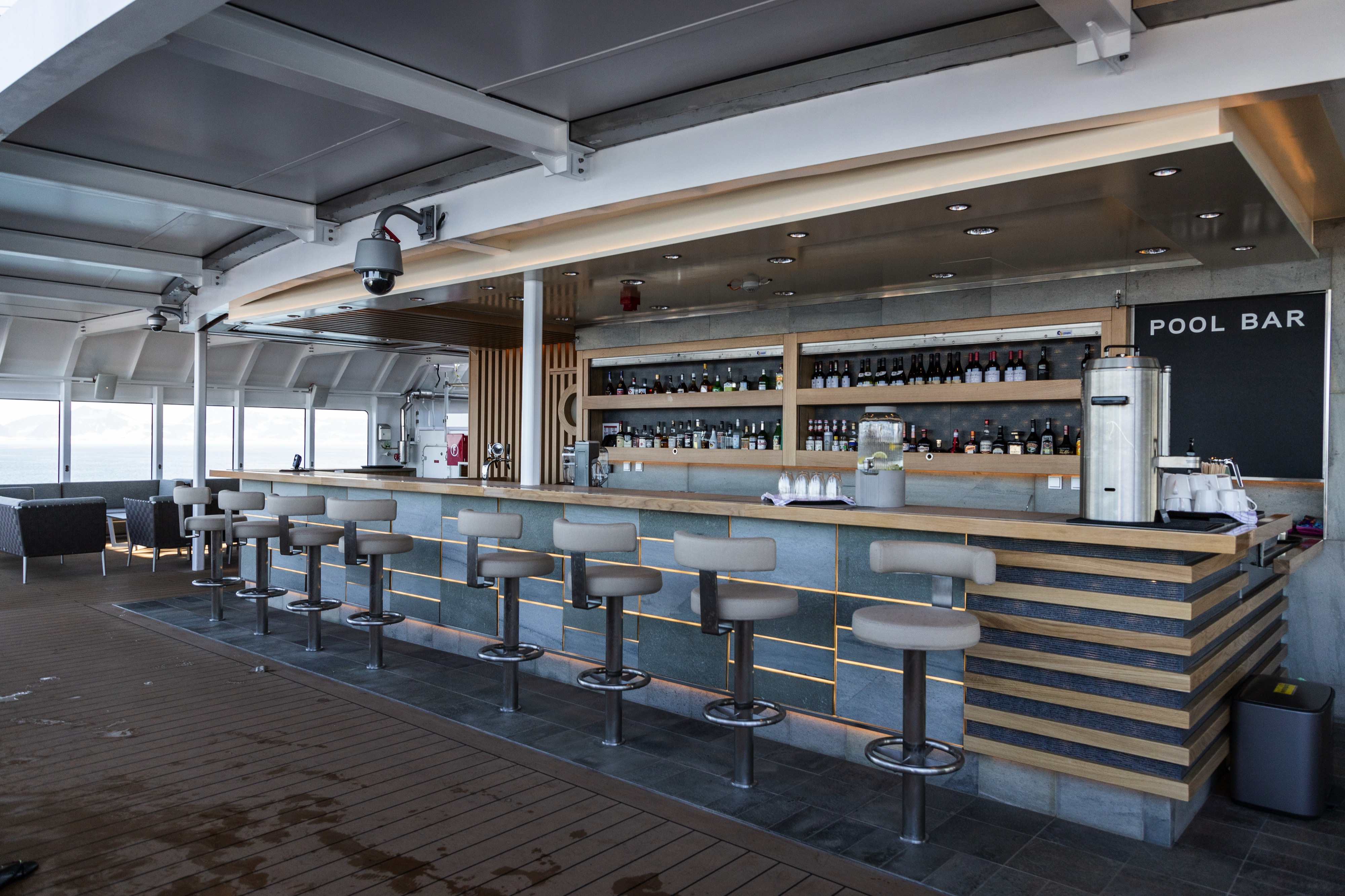
Pool Bar
Enjoy the refreshing pool with your favourite cocktail. What better way to get into holiday mode than by sipping on a cocktail while in the hot tub, creating a great atmosphere with great views.
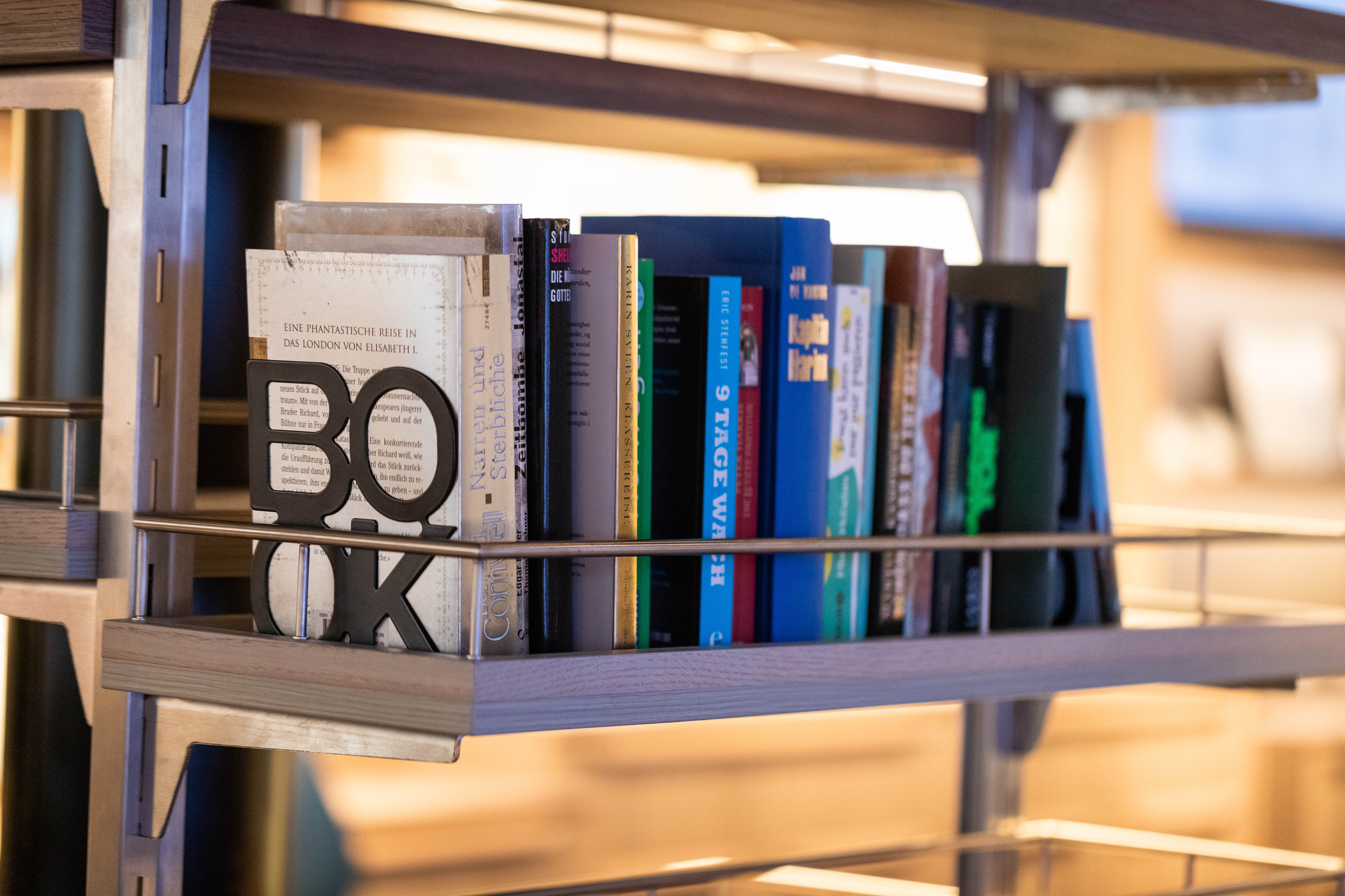
Library
The ship has a small selection of books on different topics that is available to guests while on board. The library is located on deck 6.
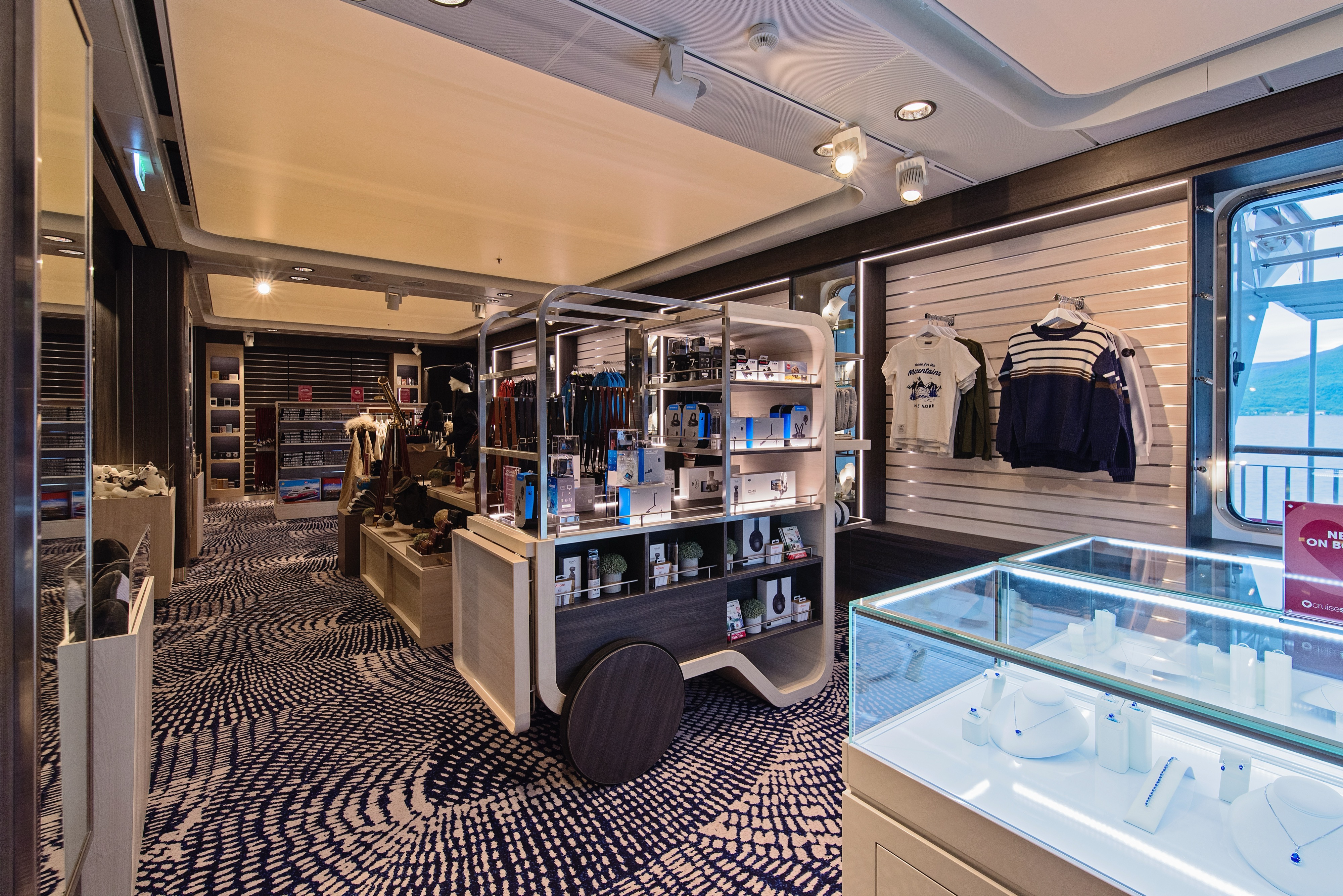
Shop
In our on-board shop you can buy clothing suitable for expedition cruises. Our Expedition Team will be happy to give you expert advice on how to dress properly according to the destinations. We offer a great range of both warm and practical clothing, and we focus on fabrics with natural fibres. We also offer souvenirs, handicrafts, and postcards, in addition to a small selection of soap, toothpaste, and other personal effects.
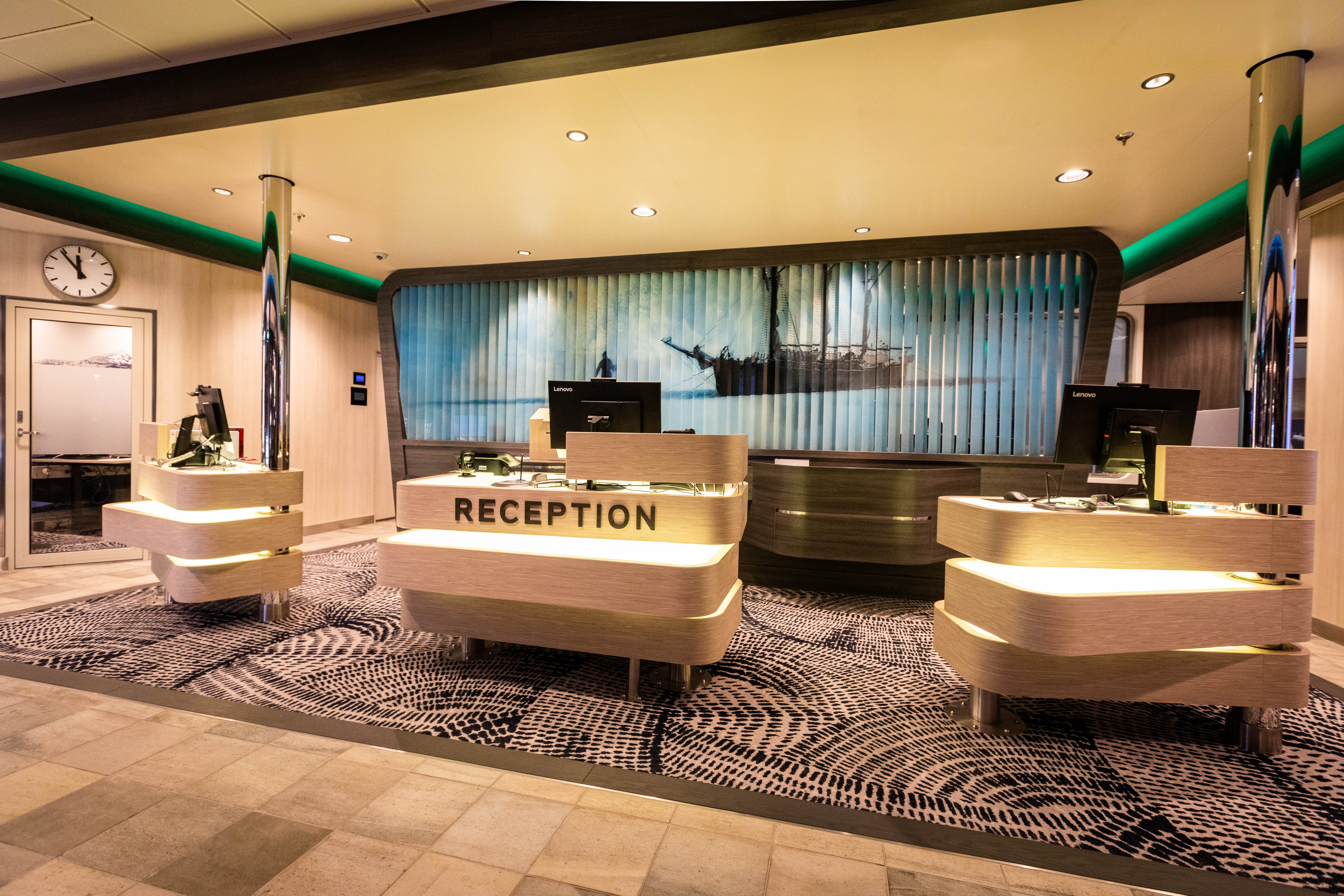
Reception
The reception is located on deck 6.
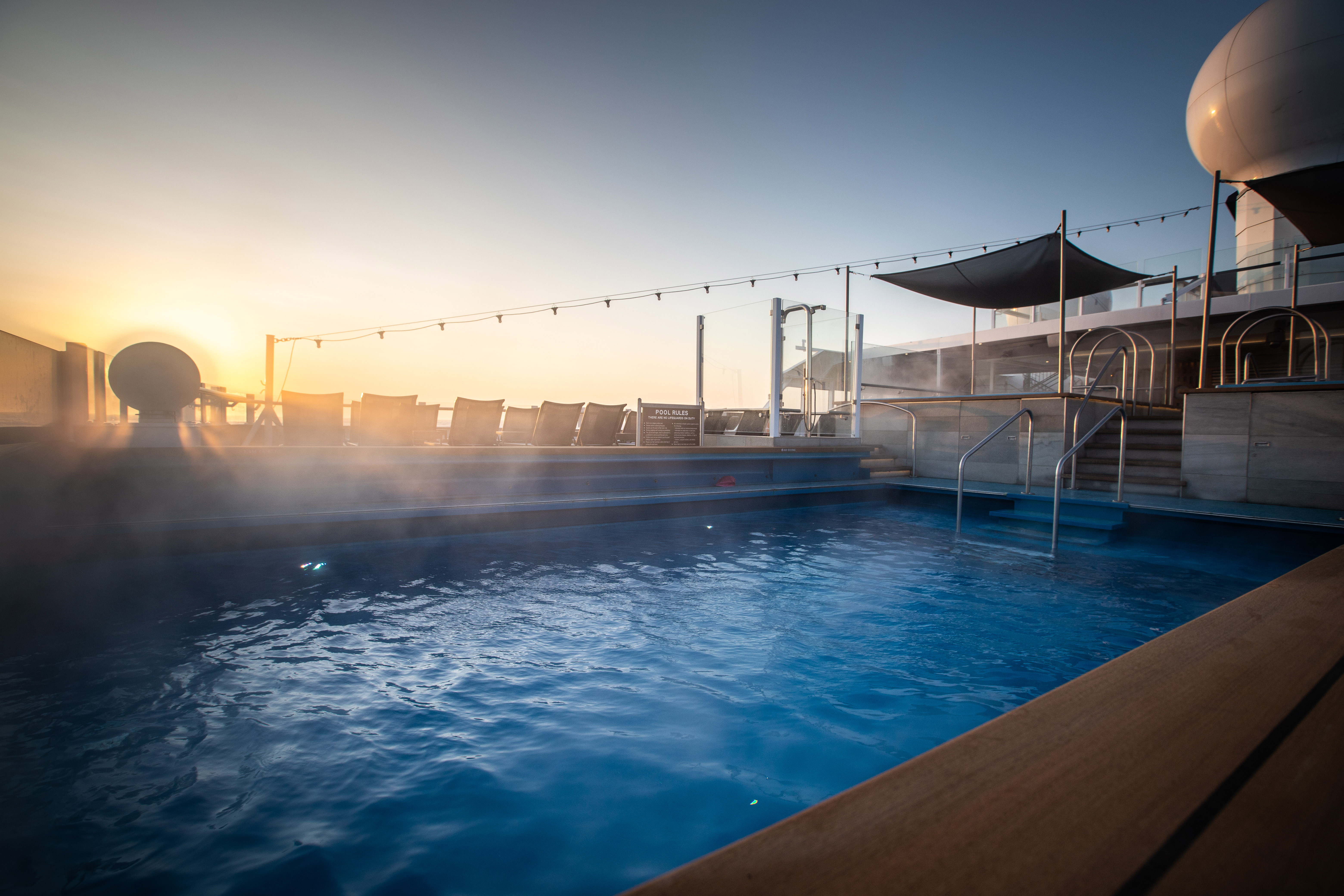
Hot Tub & Pool
After a day of exploring new destinations, guests can relax and rejuvenate in the aft infinity pool and hot tubs as one of the highlights.
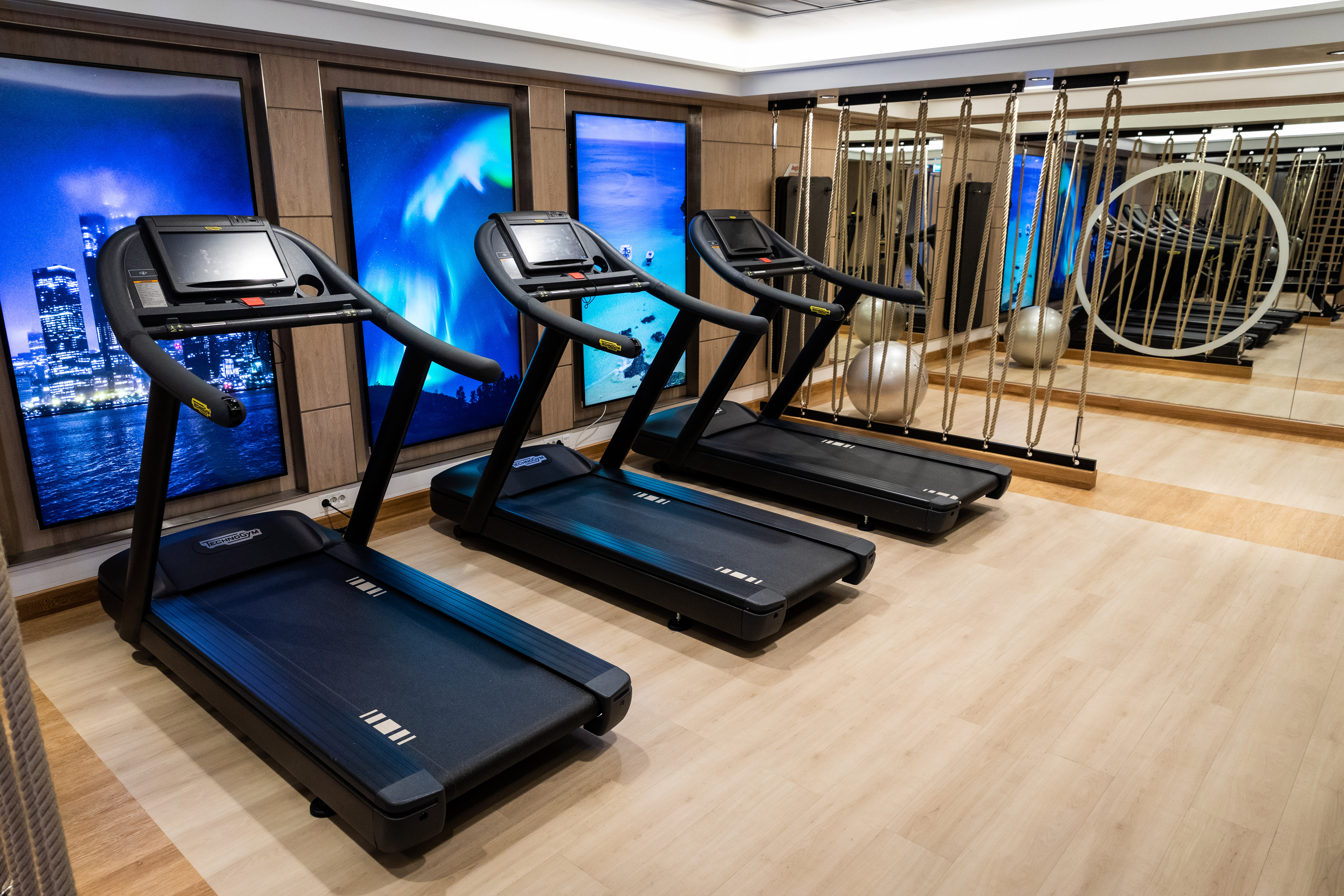
Gym
After a day of exploring new destinations, guests can relax and rejuvenate in the large gym and Wellness center.
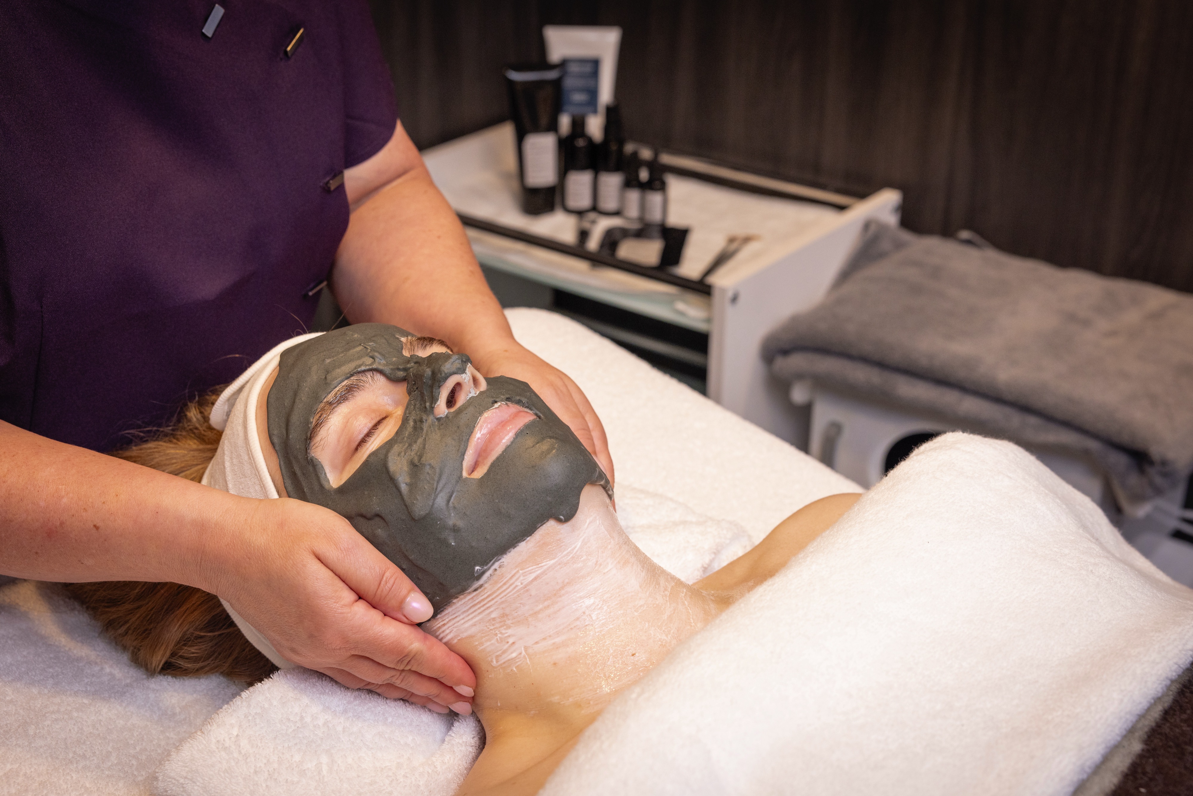
Wellness Center
The ship has a wellness center where the guests may buy treatments as body massage, face-, hand- and foot treatments.
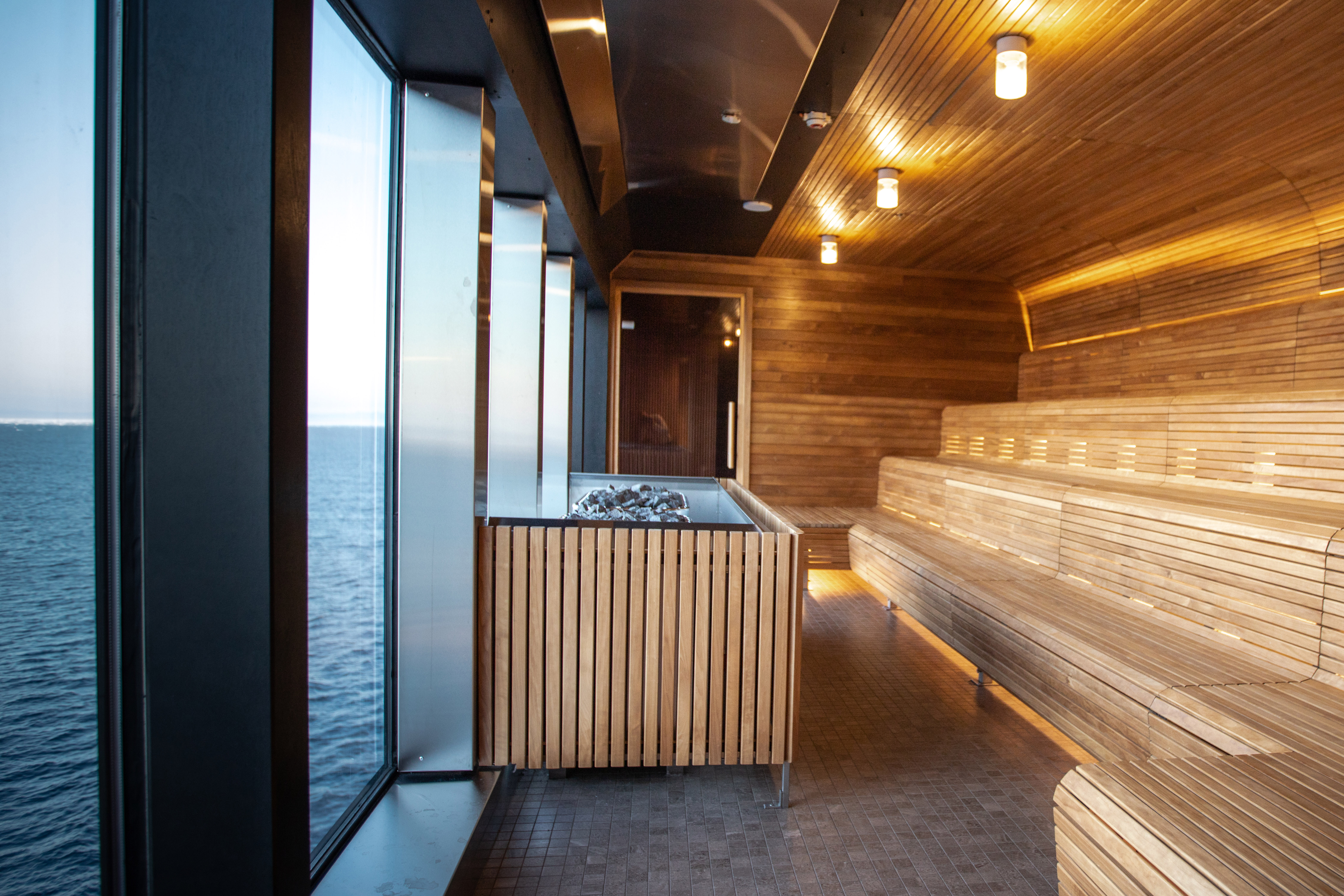
Sauna
The ship has a wellness center where the guests may buy treatments as body massage, face-, hand- and foot treatments.
Outdoor Running Track
The Outdoor Running Track Located on Deck 11.
Fredheim
The ships’ informal and social meeting place – named after a 1900s hunting station on Svalbard.
Aune
Lindstrøm
A speciality restaurant named after Adolf Lindstrøm, the favourite chef of the Norwegian polar heroes. Fine dining in Restaurant Lindstrøm is included for suite guests. Non-suite guests can enjoy breakfast, lunch and dinner in Lindstrøm for an additional cost.
Science Center
The Science & Education program brings together like-minded individuals
Covering over 3/4 of the planet’s surface, our oceans are vital in supporting human life on earth and are also home to over 90% of all known wildlife. Despite it influencing everything from our weather to transportation and yes, expedition cruises, very little is known about our blue planet.
This is where HX Expeditions and our fleet of small, state-of-the-art Expedition ships come in. We can reach, explore and collect vital scientific data on some of the planet’s most remote regions. From understanding whale migrations and phytoplankton communities to cloud observations and the Northern Lights, our onboard Science & Education Teams – with the help of you, our guests – captures, analyses, and reports invaluable data to organisations and research projects around the world.
Lectures
Expedition Team
The onboard Expedition Team is composed of the Expedition Leader, the Assistant Expedition Leader, the Expedition Coordinator plus several lecturers and experts. Your Expedition Leader will regularly update you on the progress of the trip as well as the different points of interest and wildlife sightings that may occur. Biographies of the Expedition Team can be found on board. In the ships science center, you will be able to find information regarding the trip and book optional excursions and activities
Excursions
Let the participants reveal the adventurer they carry within, and get to know the spectacular surroundings by taking part in the excursions we offer. You can also take a brief break and join in one of the activities that take place on deck. This will recharge your batteries for the next session.
Take a break and fill all of your senses – storytelling about food and its traditions is a large part of the gastronomic experience on our ships.
Resident photographers
Our on board photographer will be there to assist guests in the use of their photo equipment and to help improve their photo skills. To enhance the experience of the places we explore, we use photography actively with our guests. Slideshow shared onboard before the end of the voyage and made available for all guests in an Expedition Logbook – including a selection of photos as well as the Daily Programs, Expedition Team biographies, Maps from the voyage and more for sharing/download.
Explorer Lounge & Bar
Relax and rejuvenate in the elegant Explorer lounge & bar. Sink into a comfortable armchair and gaze out at the magnificent views through the floor-to-ceiling windows.
Observation Deck
The ship has spacious outdoor areas. They are perfect vantage points to sit back, relax and watch the world go by. The observation deck is located on deck 11, where you will also find the outdoor gym and running track.
Pool Bar
Enjoy the refreshing pool with your favourite cocktail. What better way to get into holiday mode than by sipping on a cocktail while in the hot tub, creating a great atmosphere with great views.
Library
The ship has a small selection of books on different topics that is available to guests while on board. The library is located on deck 6.
Shop
In our on-board shop you can buy clothing suitable for expedition cruises. Our Expedition Team will be happy to give you expert advice on how to dress properly according to the destinations. We offer a great range of both warm and practical clothing, and we focus on fabrics with natural fibres. We also offer souvenirs, handicrafts, and postcards, in addition to a small selection of soap, toothpaste, and other personal effects.
Reception
The reception is located on deck 6.
Hot Tub & Pool
After a day of exploring new destinations, guests can relax and rejuvenate in the aft infinity pool and hot tubs as one of the highlights.
Gym
After a day of exploring new destinations, guests can relax and rejuvenate in the large gym and Wellness center.
Wellness Center
The ship has a wellness center where the guests may buy treatments as body massage, face-, hand- and foot treatments.
Sauna
The ship has a wellness center where the guests may buy treatments as body massage, face-, hand- and foot treatments.
Outdoor Running Track
The Outdoor Running Track Located on Deck 11.
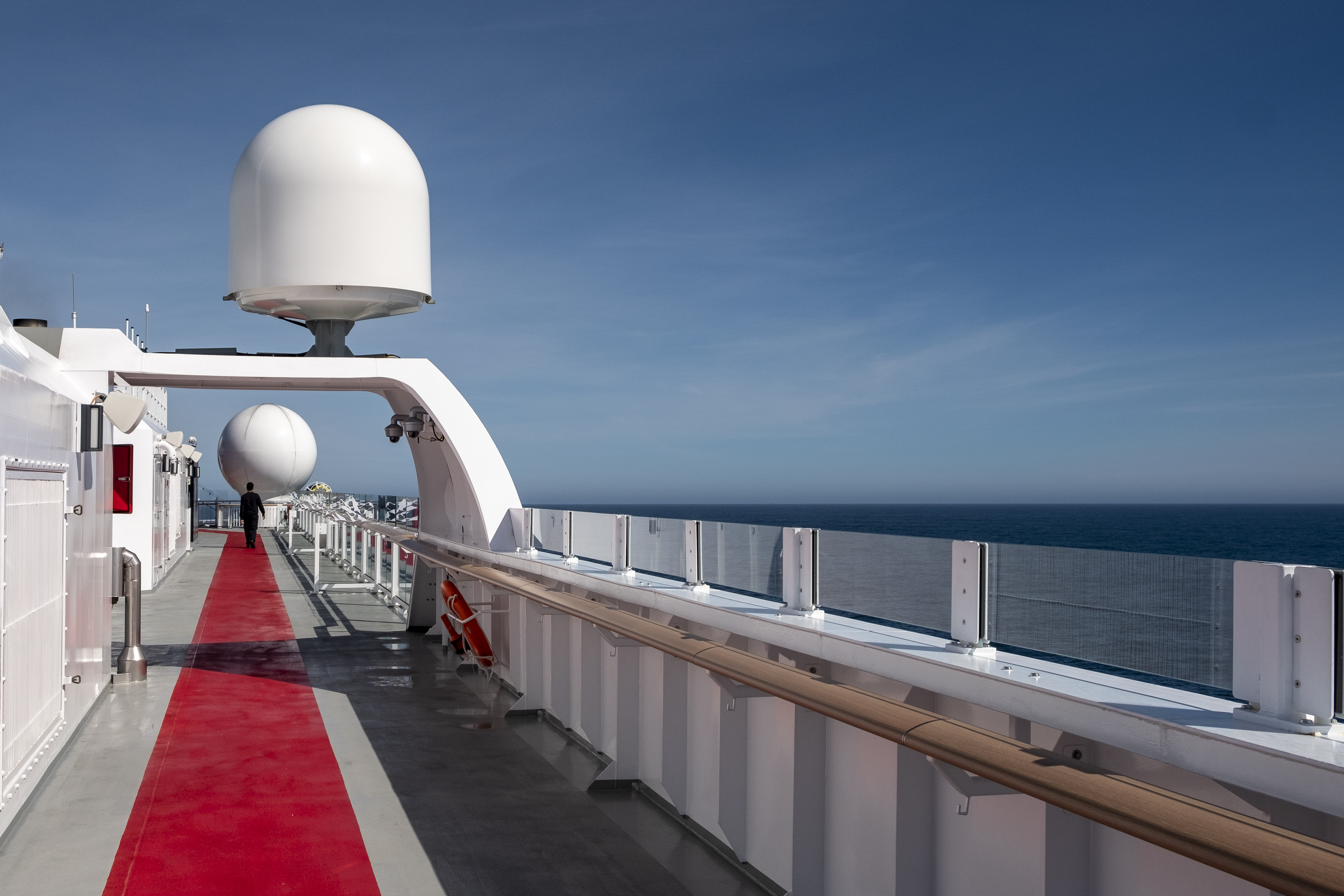
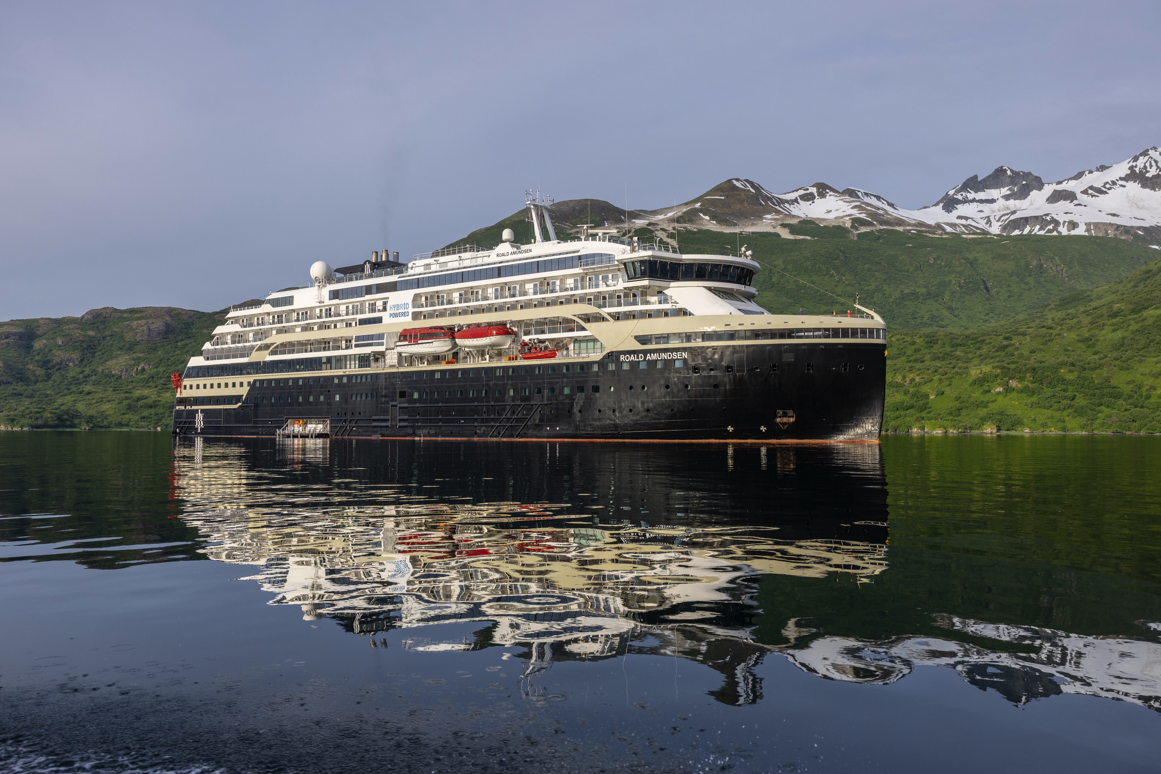
About the Ship
Deck Plans
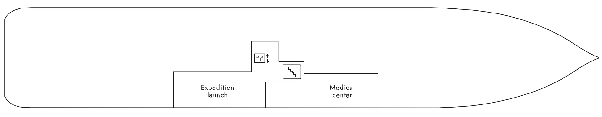
- Expedition Launch
- Medical Center
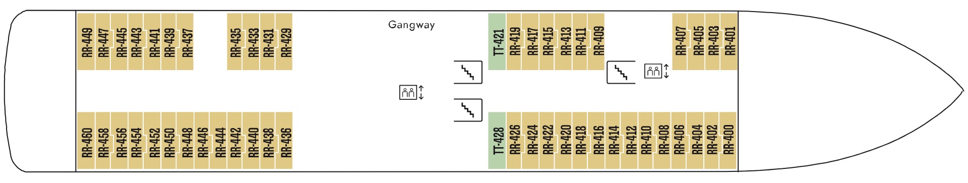
- Gangway
- Polar Outside Cabins
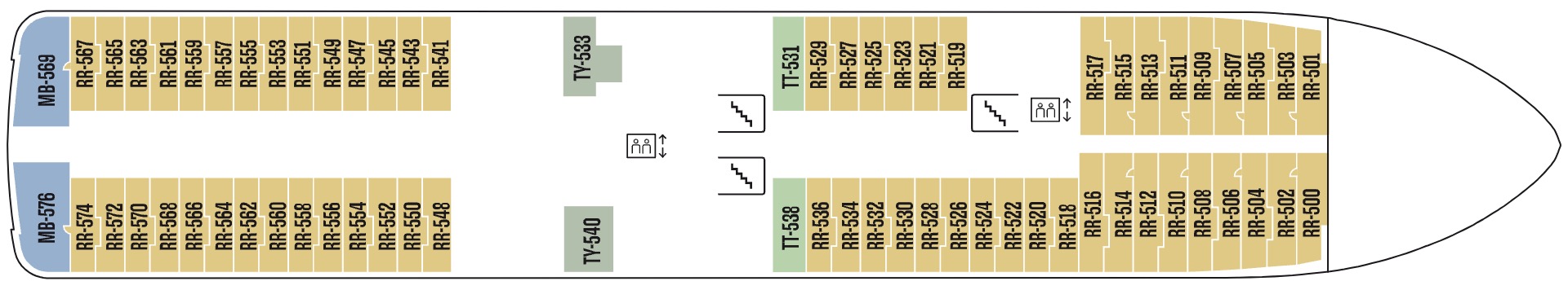
- Expedition Suites
- Arctic Superior Cabins
- Polar Outside Cabins
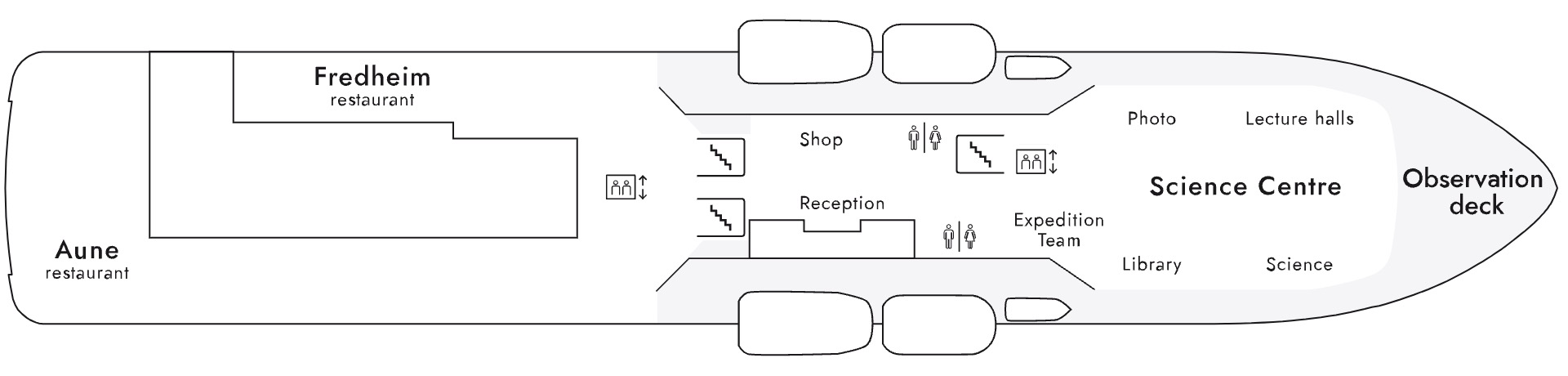
- Aune Restaurant
- Fredheim Restaurant
- Shop
- Reception
- Expedition Team
- Library
- Science Center
- Lecture Halls
- Observation Deck
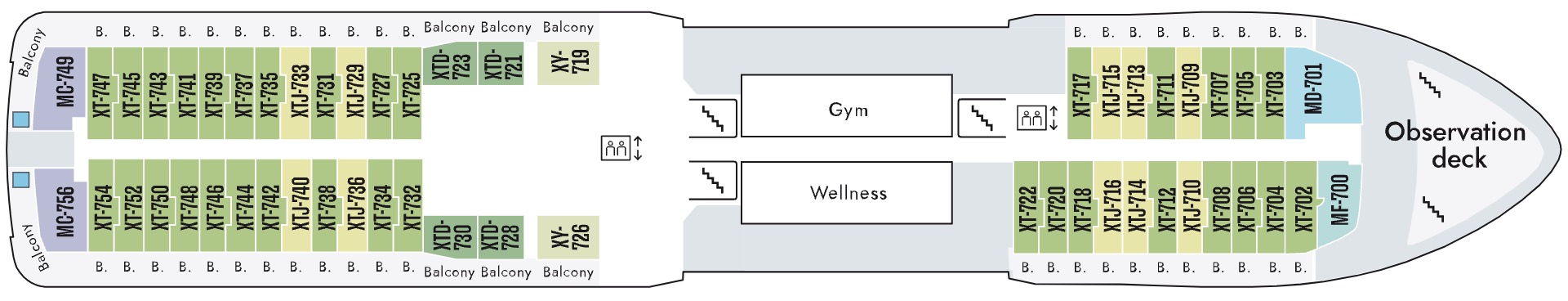
- Fitness Center
- Wellness Center
- Observation Deck
- Expedition Suites
- Arctic Superior Cabins
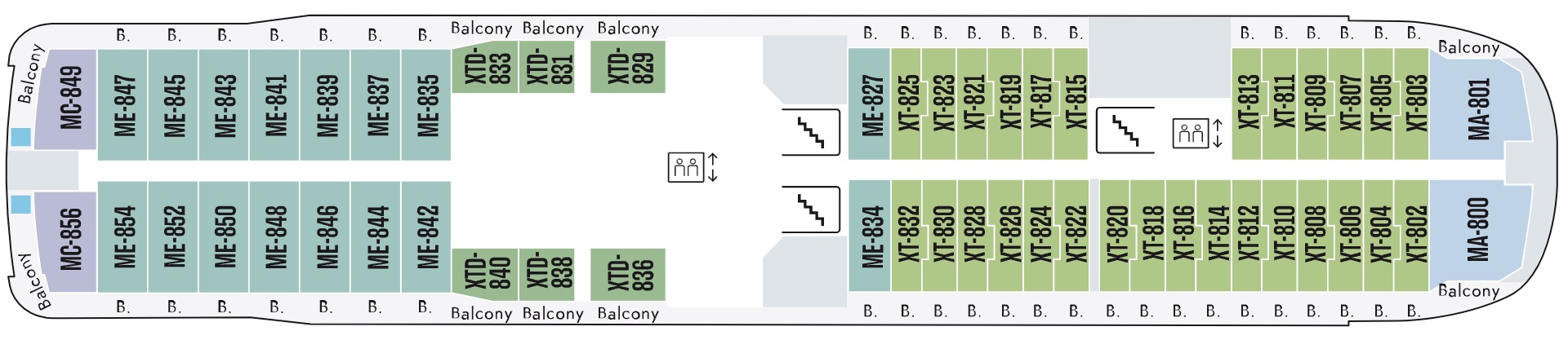
- Expedition Suites
- Arctic Superior Cabins
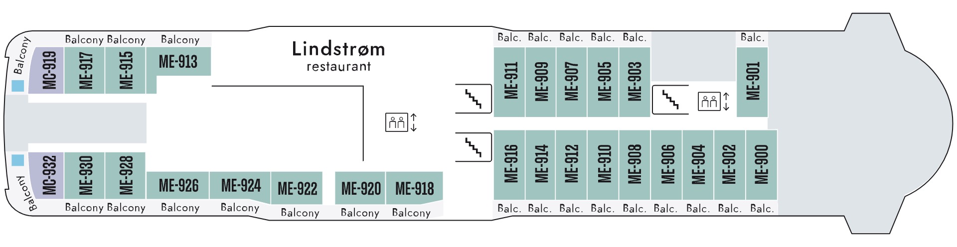
- Lindstrom Restaurant
- Expedition Suites
- Arctic Superior Cabins
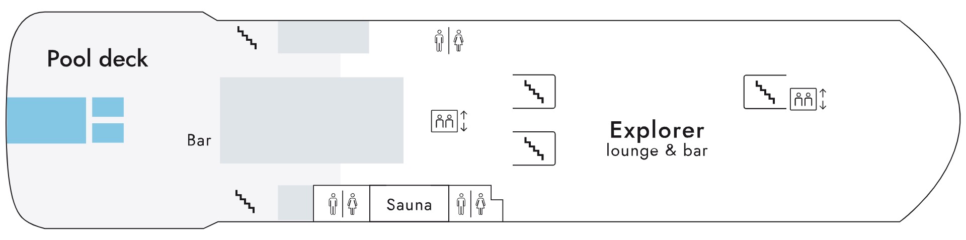
- Pool Deck
- Pool Bar
- Sauna
- Explorer Lounge & Bar
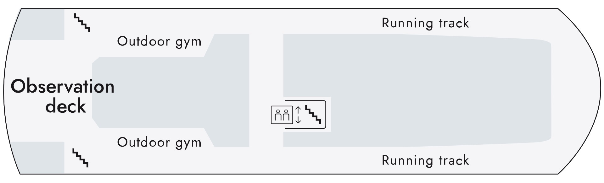
- Observation Deck
- Outdoor Gym
- Running Track
- Expedition Launch
- Medical Center
- Gangway
- Polar Outside Cabins
- Expedition Suites
- Arctic Superior Cabins
- Polar Outside Cabins
- Aune Restaurant
- Fredheim Restaurant
- Shop
- Reception
- Expedition Team
- Library
- Science Center
- Lecture Halls
- Observation Deck
- Fitness Center
- Wellness Center
- Observation Deck
- Expedition Suites
- Arctic Superior Cabins
- Expedition Suites
- Arctic Superior Cabins
- Lindstrom Restaurant
- Expedition Suites
- Arctic Superior Cabins
- Pool Deck
- Pool Bar
- Sauna
- Explorer Lounge & Bar
- Observation Deck
- Outdoor Gym
- Running Track