Itinerary
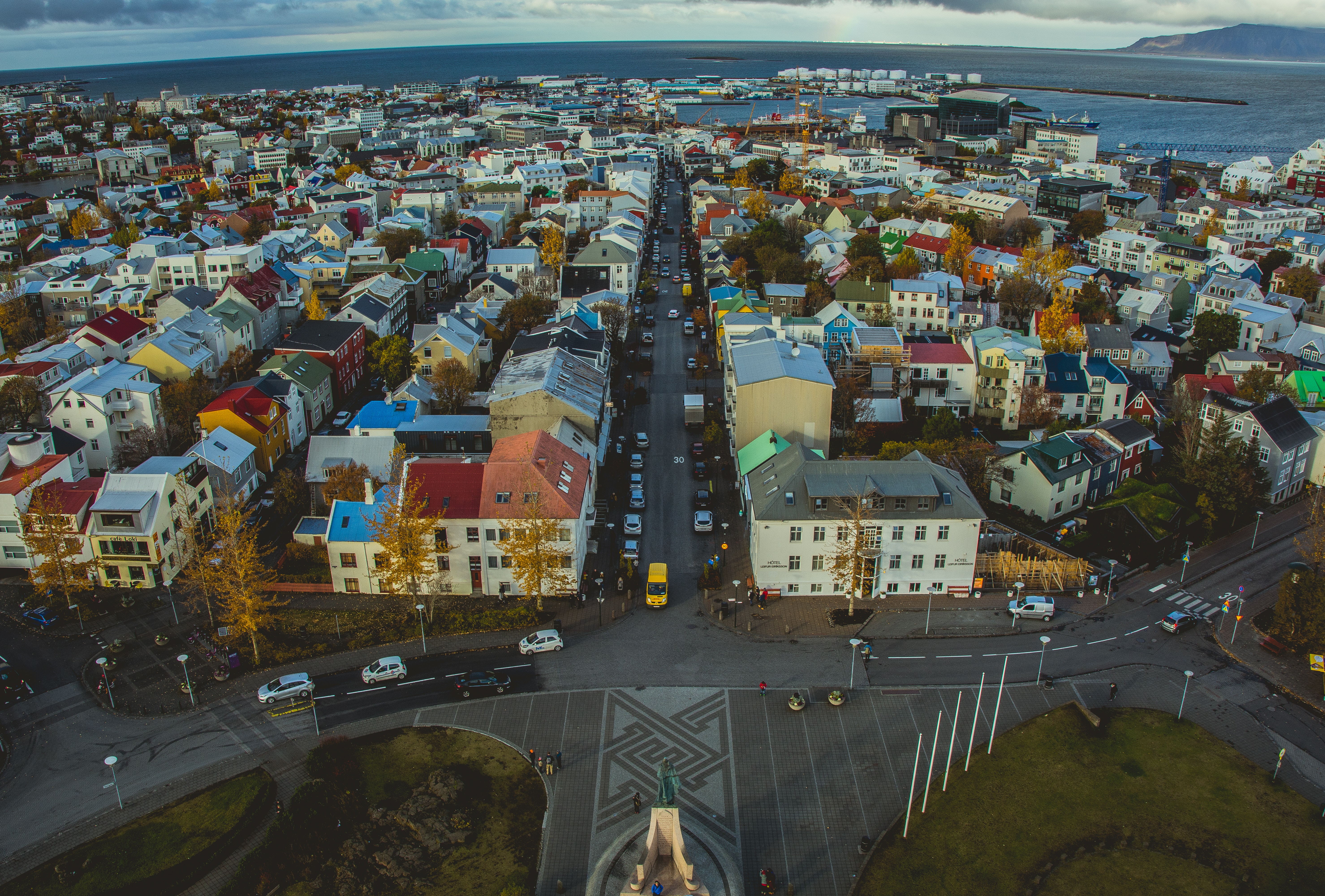
Reykjavík, Iceland
Sprawling Reykjavík, the nation’s nerve center and government seat, is home to half the island’s population. On a bay overlooked by proud Mt. Esja (pronounced eh-shyuh), with its ever-changing hues, Reykjavík presents a colorful sight, its concrete houses painted in light colors and topped by vibrant red, blue, and green roofs. In contrast to the almost treeless countryside, Reykjavík has many tall, native birches, rowans, and willows, as well as imported aspen, pines, and spruces.Reykjavík’s name comes from the Icelandic words for smoke, reykur, and bay, vík. In AD 874, Norseman Ingólfur Arnarson saw Iceland rising out of the misty sea and came ashore at a bay eerily shrouded with plumes of steam from nearby hot springs. Today most of the houses in Reykjavík are heated by near-boiling water from the hot springs. Natural heating avoids air pollution; there’s no smoke around. You may notice, however, that the hot water brings a slight sulfur smell to the bathroom.Prices are easily on a par with other major European cities. A practical option is to purchase a Reykjavík City Card at the Tourist Information Center or at the Reykjavík Youth Hostel. This card permits unlimited bus usage and admission to any of the city’s seven pools, the Family Park and Zoo, and city museums. The cards are valid for one (ISK 3,300), two (ISK 4,400), or three days (ISK 4,900), and they pay for themselves after three or four uses a day. Even lacking the City Card, paying admission (ISK 500, or ISK 250 for seniors and people with disabilities) to one of the city art museums (Hafnarhús, Kjarvalsstaðir, or Ásmundarsafn) gets you free same-day admission to the other two.
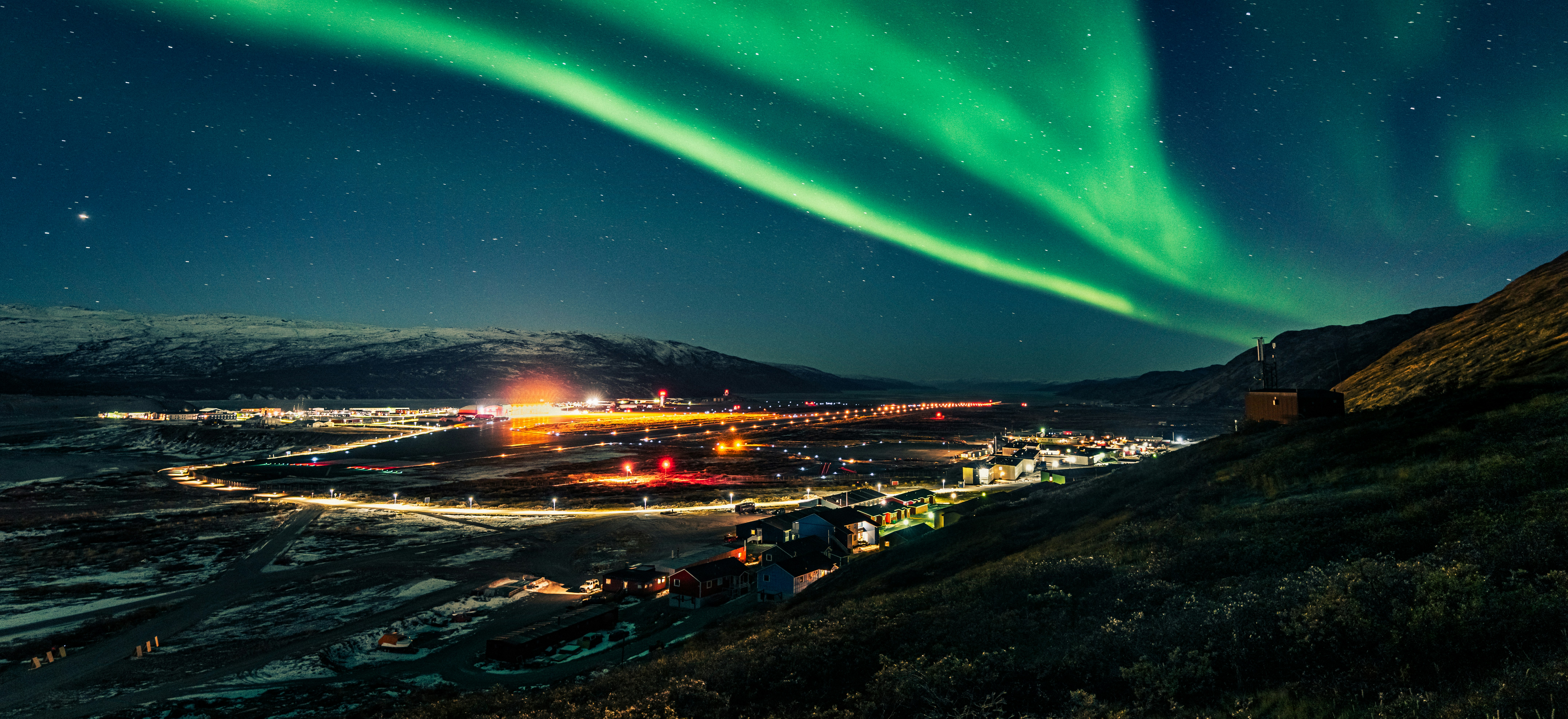
Kangerlussuaq Havn, Greenland
The name Kangerlussuaq means “Big Fjord” in the local Kalaallisut language. The settlement of about 500 people is located in western Greenland on flat land at the head of a fjord with the same name. Kangerlussuaq is the site of Greenland’s largest commercial airport and most of the economy here is dependent on the air transportation hub and tourism. The rugged lands around the settlement support terrestrial Arctic fauna including muskoxen, caribou, and Gyrfalcons.
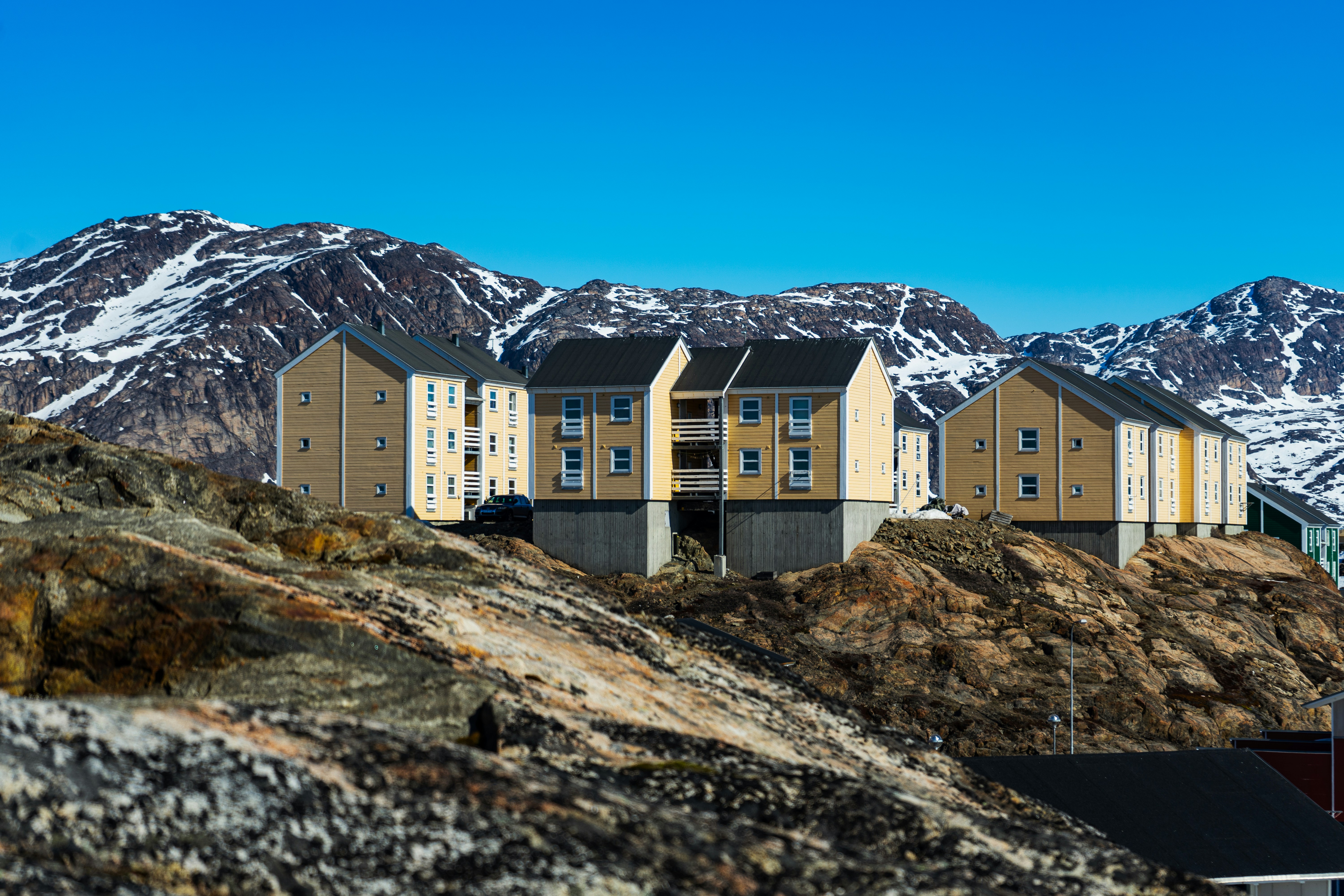
Sisimiut (Holsteinsborg), Greenland
Located just north of the Arctic Circle, Sisimiut is the northernmost town in Greenland where the port remains free of ice in the winter. Yet it is also the southernmost town where there is enough snow and ice to drive a dogsled in winter and spring. In Sisimiut, travelling by sled has been the primary means of winter transportation for centuries. In fact, the area has been inhabited for approximately 4,500 years. Modern Sisimiut is the largest business center in the north of Greenland, and is one of the fastest growing Greenlandic cities. Commercial fishing is the lead economy in the town‘s thriving industrial base.
Ilulissat (Jakobshavn), Greenland
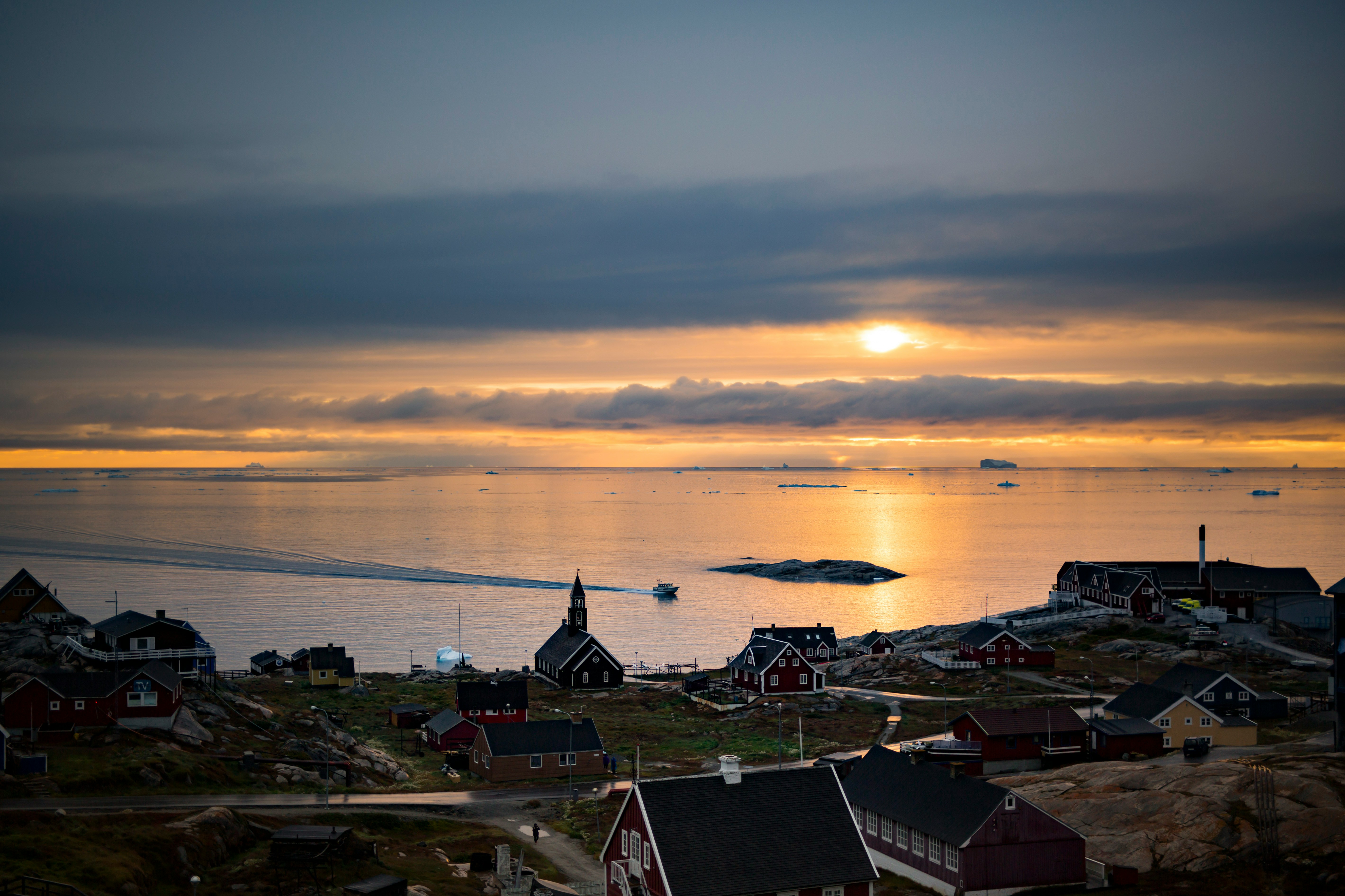
Known as the birthplace of icebergs, the Ilulissat Icefjord produces nearly 20 million tons of ice each day. In fact, the word Ilulissat means “icebergs” in the Kalaallisut language. The town of Ilulissat is known for its long periods of calm and settled weather, but the climate tends to be cold due to its proximity to the fjord. Approximately 4,500 people live in Ilulissat, the third-largest town in Greenland after Nuuk and Sisimiut. Some people here estimate that there are nearly as many sled dogs as human beings living in the town that also boasts a local history museum located in the former home of Greenlandic folk hero and famed polar explorer Knud Rasmussen.
Cruising Davis Strait
Pangnirtung, Nunavut, Canada
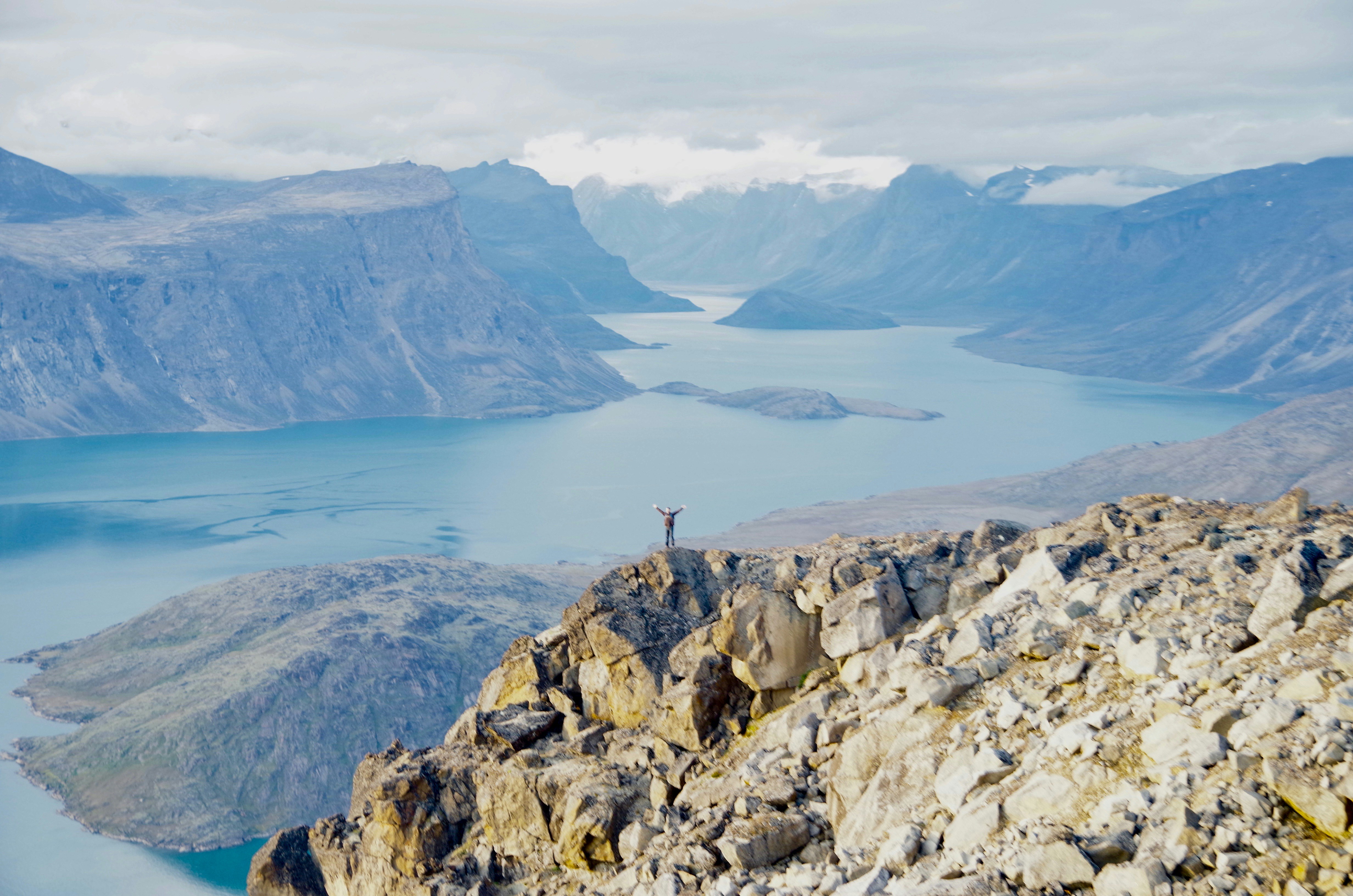
Cumberland Peninsula, Baffin Island, Nunavut, Canada
Reykjavík, Iceland
Sprawling Reykjavík, the nation’s nerve center and government seat, is home to half the island’s population. On a bay overlooked by proud Mt. Esja (pronounced eh-shyuh), with its ever-changing hues, Reykjavík presents a colorful sight, its concrete houses painted in light colors and topped by vibrant red, blue, and green roofs. In contrast to the almost treeless countryside, Reykjavík has many tall, native birches, rowans, and willows, as well as imported aspen, pines, and spruces.Reykjavík’s name comes from the Icelandic words for smoke, reykur, and bay, vík. In AD 874, Norseman Ingólfur Arnarson saw Iceland rising out of the misty sea and came ashore at a bay eerily shrouded with plumes of steam from nearby hot springs. Today most of the houses in Reykjavík are heated by near-boiling water from the hot springs. Natural heating avoids air pollution; there’s no smoke around. You may notice, however, that the hot water brings a slight sulfur smell to the bathroom.Prices are easily on a par with other major European cities. A practical option is to purchase a Reykjavík City Card at the Tourist Information Center or at the Reykjavík Youth Hostel. This card permits unlimited bus usage and admission to any of the city’s seven pools, the Family Park and Zoo, and city museums. The cards are valid for one (ISK 3,300), two (ISK 4,400), or three days (ISK 4,900), and they pay for themselves after three or four uses a day. Even lacking the City Card, paying admission (ISK 500, or ISK 250 for seniors and people with disabilities) to one of the city art museums (Hafnarhús, Kjarvalsstaðir, or Ásmundarsafn) gets you free same-day admission to the other two.
Kangerlussuaq Havn, Greenland
The name Kangerlussuaq means “Big Fjord” in the local Kalaallisut language. The settlement of about 500 people is located in western Greenland on flat land at the head of a fjord with the same name. Kangerlussuaq is the site of Greenland’s largest commercial airport and most of the economy here is dependent on the air transportation hub and tourism. The rugged lands around the settlement support terrestrial Arctic fauna including muskoxen, caribou, and Gyrfalcons.
Sisimiut (Holsteinsborg), Greenland
Located just north of the Arctic Circle, Sisimiut is the northernmost town in Greenland where the port remains free of ice in the winter. Yet it is also the southernmost town where there is enough snow and ice to drive a dogsled in winter and spring. In Sisimiut, travelling by sled has been the primary means of winter transportation for centuries. In fact, the area has been inhabited for approximately 4,500 years. Modern Sisimiut is the largest business center in the north of Greenland, and is one of the fastest growing Greenlandic cities. Commercial fishing is the lead economy in the town‘s thriving industrial base.
Ilulissat (Jakobshavn), Greenland
Known as the birthplace of icebergs, the Ilulissat Icefjord produces nearly 20 million tons of ice each day. In fact, the word Ilulissat means “icebergs” in the Kalaallisut language. The town of Ilulissat is known for its long periods of calm and settled weather, but the climate tends to be cold due to its proximity to the fjord. Approximately 4,500 people live in Ilulissat, the third-largest town in Greenland after Nuuk and Sisimiut. Some people here estimate that there are nearly as many sled dogs as human beings living in the town that also boasts a local history museum located in the former home of Greenlandic folk hero and famed polar explorer Knud Rasmussen.
Cruising Davis Strait
Pangnirtung, Nunavut, Canada
Cumberland Peninsula, Baffin Island, Nunavut, Canada
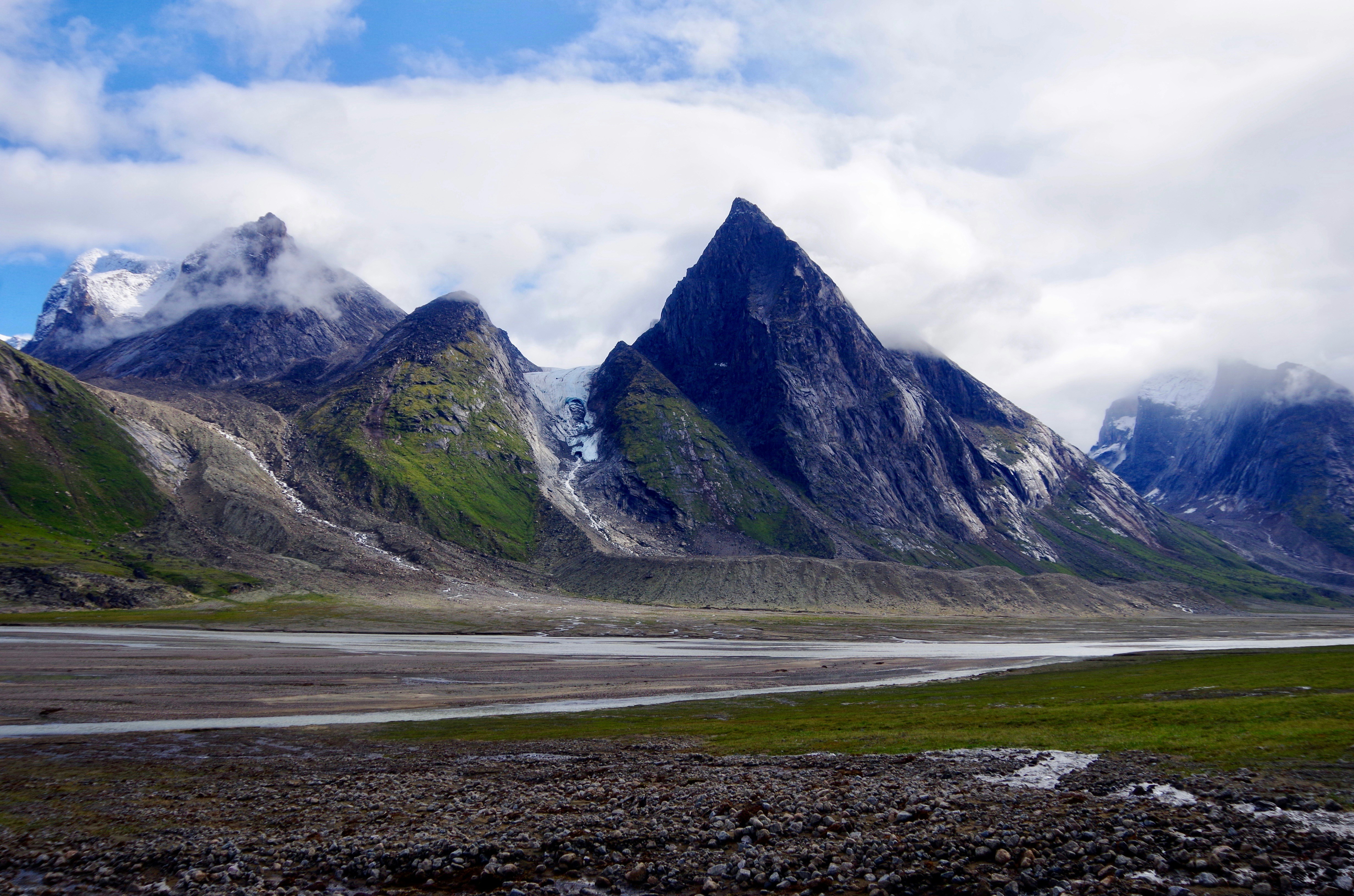
Torngat Mountains National Park, Newfoundland and Labrador, Canada
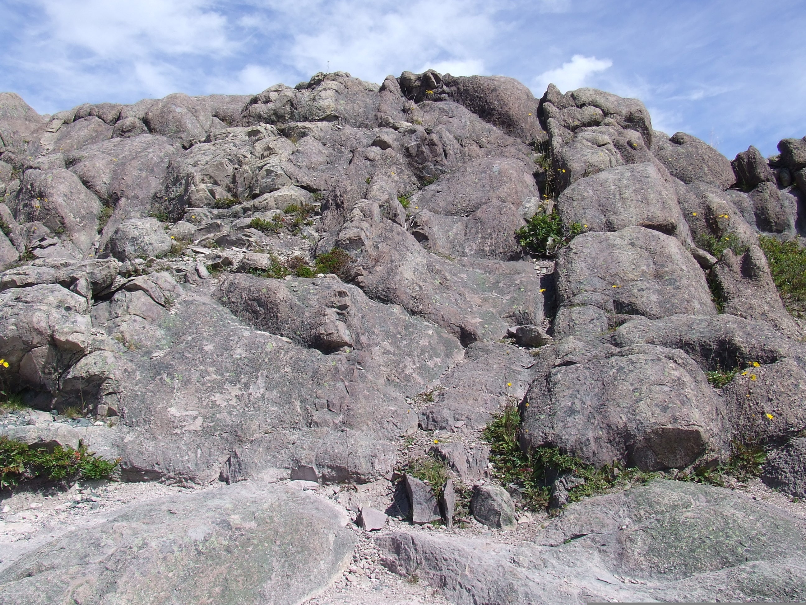
The Torngat Mountains National Park is situated on the eastern side of Labrador’s northernmost point and features mountains sometimes described as the “Eastern Rocky Mountains”. The park covers an area of 9,700 km2 (over 6,000 mi2) and is dotted with remnants of several cirque glaciers. Saglek Fjord has an outstanding array of geological features and the steep cliffs provide some of the best exposures to the earth’s geologic history. The name of the national park goes back to Torngarsoak, who was believed to control the life of sea animals and took the form of a huge polar bear. Polar bears hunt seals on the ice here in the winter months, and herds of Torngat Mountain and George River caribou migrate to and from their calving grounds in the warmer months. Inuit use the area to hunt, fish and travel throughout the year and many still have a strong spiritual connection to this “Place of Spirits”.
Torngat Mountains National Park, Newfoundland and Labrador, Canada
The Torngat Mountains National Park is situated on the eastern side of Labrador’s northernmost point and features mountains sometimes described as the “Eastern Rocky Mountains”. The park covers an area of 9,700 km2 (over 6,000 mi2) and is dotted with remnants of several cirque glaciers. Saglek Fjord has an outstanding array of geological features and the steep cliffs provide some of the best exposures to the earth’s geologic history. The name of the national park goes back to Torngarsoak, who was believed to control the life of sea animals and took the form of a huge polar bear. Polar bears hunt seals on the ice here in the winter months, and herds of Torngat Mountain and George River caribou migrate to and from their calving grounds in the warmer months. Inuit use the area to hunt, fish and travel throughout the year and many still have a strong spiritual connection to this “Place of Spirits”.
Nain, Newfoundland and Labrador, Canada
At Sea
L'Anse aux Meadows, Newfoundland and Labrador, Canada
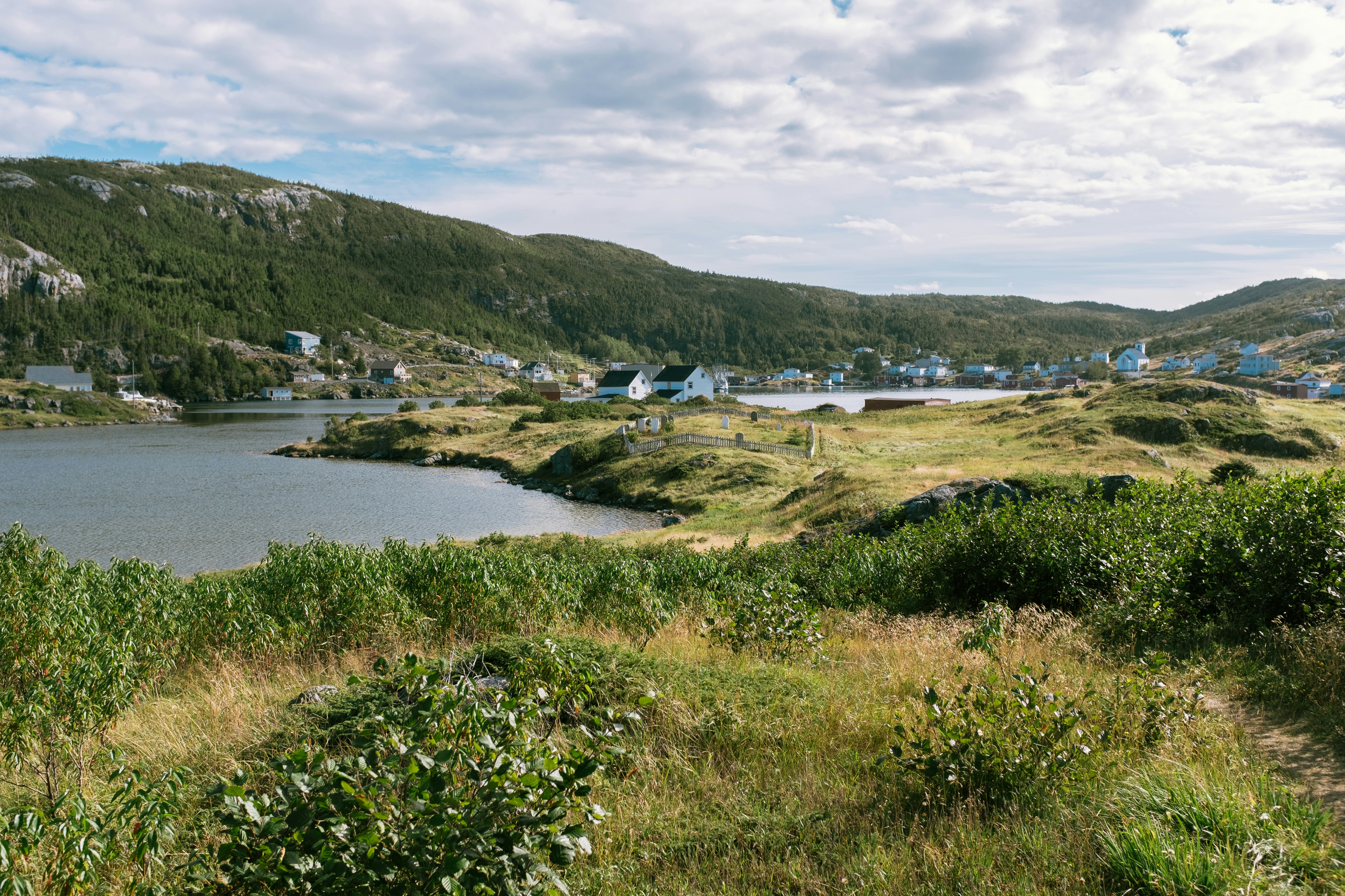
Around the year 1000, Vikings from Greenland and Iceland founded the first European settlement in North America, near the northern tip of Newfoundland. They arrived in the New World 500 years before Columbus but stayed only a few years and were forgotten for centuries. Since the settlement’s rediscovery in the last century, the archaeological site has brought tourism to the area. Viking themes abound but so do views, whales, icebergs, fun dining experiences, and outdoor activities. L’Anse Aux Meadows on the northern tip of the island of Newfoundland is a remote community of just 40 people, with St Anthony, 40 minutes away, having a population of only 3,500. The region is locally famous for springtime polar bears, nesting eider ducks, the northern extreme of the Appalachians at nearby Belle Isle, numerous spring and summer icebergs, and a rich ocean fishery. L’Anse Aux Meadows National Historic Site is the UNESCO World Heritage Site that tells the story of Leif Erickson and the first Europeans in the new world. This site is often the keystone attraction for cruises themed around the Vikings. Discovered in 1960, it is the site of a Norse village, the only known one in North America outside of Greenland. The site remains the only widely-accepted instance of pre-Columbian trans-oceanic contact, and is notable for possible connections with the attempted colony of Vinland established by Leif Ericson around 1003, or more broadly with Norse exploration of the Americas. The root of the name “L’Anse aux Meadows” is believed to have originated with French fishermen in the area during the nineteenth and twentieth centuries, who named the site L’Anse aux Meduses, meaning ‘Jellyfish Bay’.
At Sea
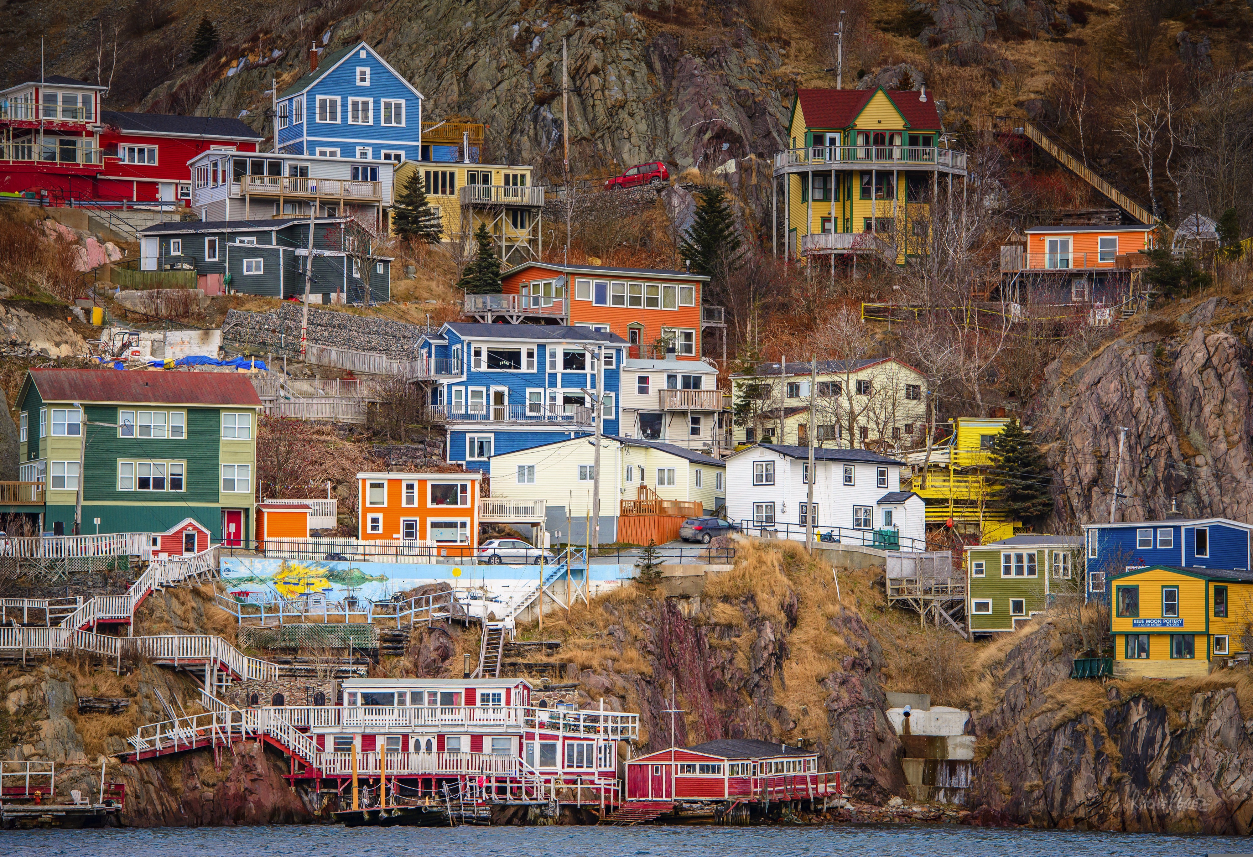
Saint-John's, Newfoundland and Labrador, Canada
Old meets new in the province’s capital (metro-area population a little more than 200,000), with modern office buildings surrounded by heritage shops and colorful row houses. St. John’s mixes English and Irish influences, Victorian architecture and modern convenience, and traditional music and rock and roll into a heady brew. The arts scene is lively, but overall the city moves at a relaxed pace.For centuries, Newfoundland was the largest supplier of salt cod in the world, and St. John’s Harbour was the center of the trade. As early as 1627, the merchants of Water Street—then known as the Lower Path—were doing a thriving business buying fish, selling goods, and supplying alcohol to soldiers and sailors.
Torngat Mountains National Park, Newfoundland and Labrador, Canada
The Torngat Mountains National Park is situated on the eastern side of Labrador’s northernmost point and features mountains sometimes described as the “Eastern Rocky Mountains”. The park covers an area of 9,700 km2 (over 6,000 mi2) and is dotted with remnants of several cirque glaciers. Saglek Fjord has an outstanding array of geological features and the steep cliffs provide some of the best exposures to the earth’s geologic history. The name of the national park goes back to Torngarsoak, who was believed to control the life of sea animals and took the form of a huge polar bear. Polar bears hunt seals on the ice here in the winter months, and herds of Torngat Mountain and George River caribou migrate to and from their calving grounds in the warmer months. Inuit use the area to hunt, fish and travel throughout the year and many still have a strong spiritual connection to this “Place of Spirits”.
Torngat Mountains National Park, Newfoundland and Labrador, Canada
The Torngat Mountains National Park is situated on the eastern side of Labrador’s northernmost point and features mountains sometimes described as the “Eastern Rocky Mountains”. The park covers an area of 9,700 km2 (over 6,000 mi2) and is dotted with remnants of several cirque glaciers. Saglek Fjord has an outstanding array of geological features and the steep cliffs provide some of the best exposures to the earth’s geologic history. The name of the national park goes back to Torngarsoak, who was believed to control the life of sea animals and took the form of a huge polar bear. Polar bears hunt seals on the ice here in the winter months, and herds of Torngat Mountain and George River caribou migrate to and from their calving grounds in the warmer months. Inuit use the area to hunt, fish and travel throughout the year and many still have a strong spiritual connection to this “Place of Spirits”.
Nain, Newfoundland and Labrador, Canada
At Sea
L'Anse aux Meadows, Newfoundland and Labrador, Canada
Around the year 1000, Vikings from Greenland and Iceland founded the first European settlement in North America, near the northern tip of Newfoundland. They arrived in the New World 500 years before Columbus but stayed only a few years and were forgotten for centuries. Since the settlement’s rediscovery in the last century, the archaeological site has brought tourism to the area. Viking themes abound but so do views, whales, icebergs, fun dining experiences, and outdoor activities. L’Anse Aux Meadows on the northern tip of the island of Newfoundland is a remote community of just 40 people, with St Anthony, 40 minutes away, having a population of only 3,500. The region is locally famous for springtime polar bears, nesting eider ducks, the northern extreme of the Appalachians at nearby Belle Isle, numerous spring and summer icebergs, and a rich ocean fishery. L’Anse Aux Meadows National Historic Site is the UNESCO World Heritage Site that tells the story of Leif Erickson and the first Europeans in the new world. This site is often the keystone attraction for cruises themed around the Vikings. Discovered in 1960, it is the site of a Norse village, the only known one in North America outside of Greenland. The site remains the only widely-accepted instance of pre-Columbian trans-oceanic contact, and is notable for possible connections with the attempted colony of Vinland established by Leif Ericson around 1003, or more broadly with Norse exploration of the Americas. The root of the name “L’Anse aux Meadows” is believed to have originated with French fishermen in the area during the nineteenth and twentieth centuries, who named the site L’Anse aux Meduses, meaning ‘Jellyfish Bay’.
At Sea
Saint-John's, Newfoundland and Labrador, Canada
Old meets new in the province’s capital (metro-area population a little more than 200,000), with modern office buildings surrounded by heritage shops and colorful row houses. St. John’s mixes English and Irish influences, Victorian architecture and modern convenience, and traditional music and rock and roll into a heady brew. The arts scene is lively, but overall the city moves at a relaxed pace.For centuries, Newfoundland was the largest supplier of salt cod in the world, and St. John’s Harbour was the center of the trade. As early as 1627, the merchants of Water Street—then known as the Lower Path—were doing a thriving business buying fish, selling goods, and supplying alcohol to soldiers and sailors.
Cabin Options
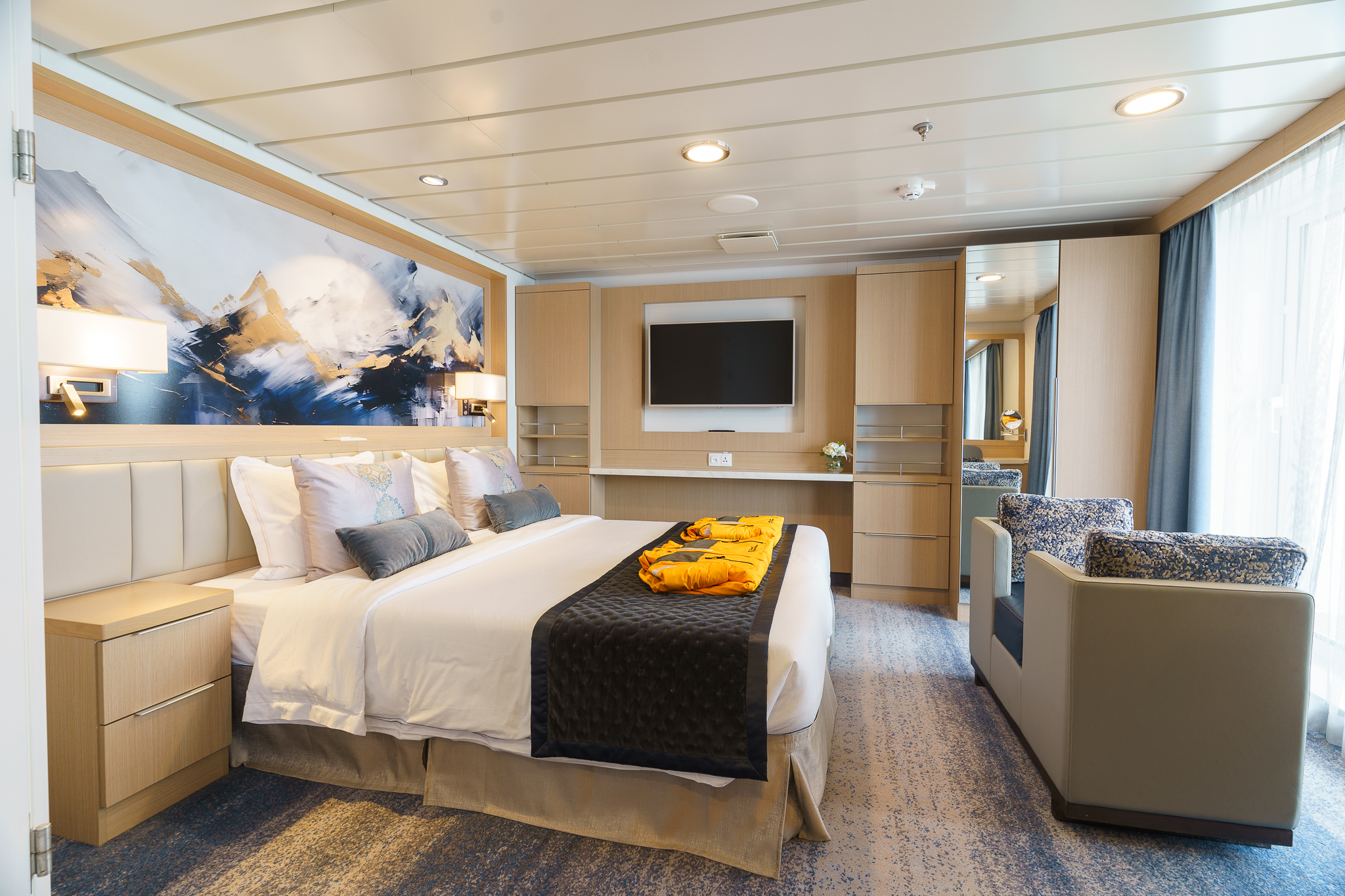
Owners Suite
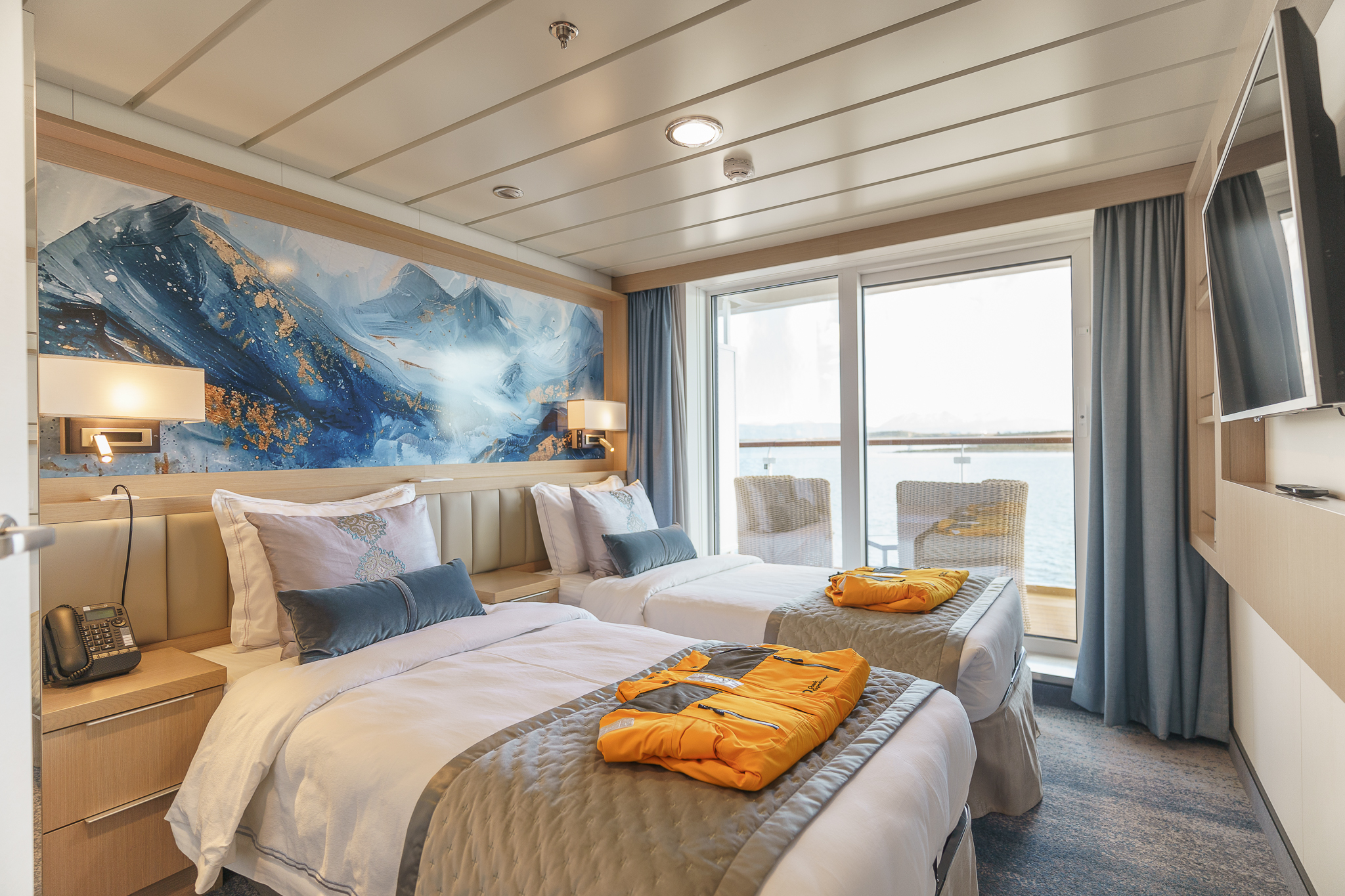
Junior Suite
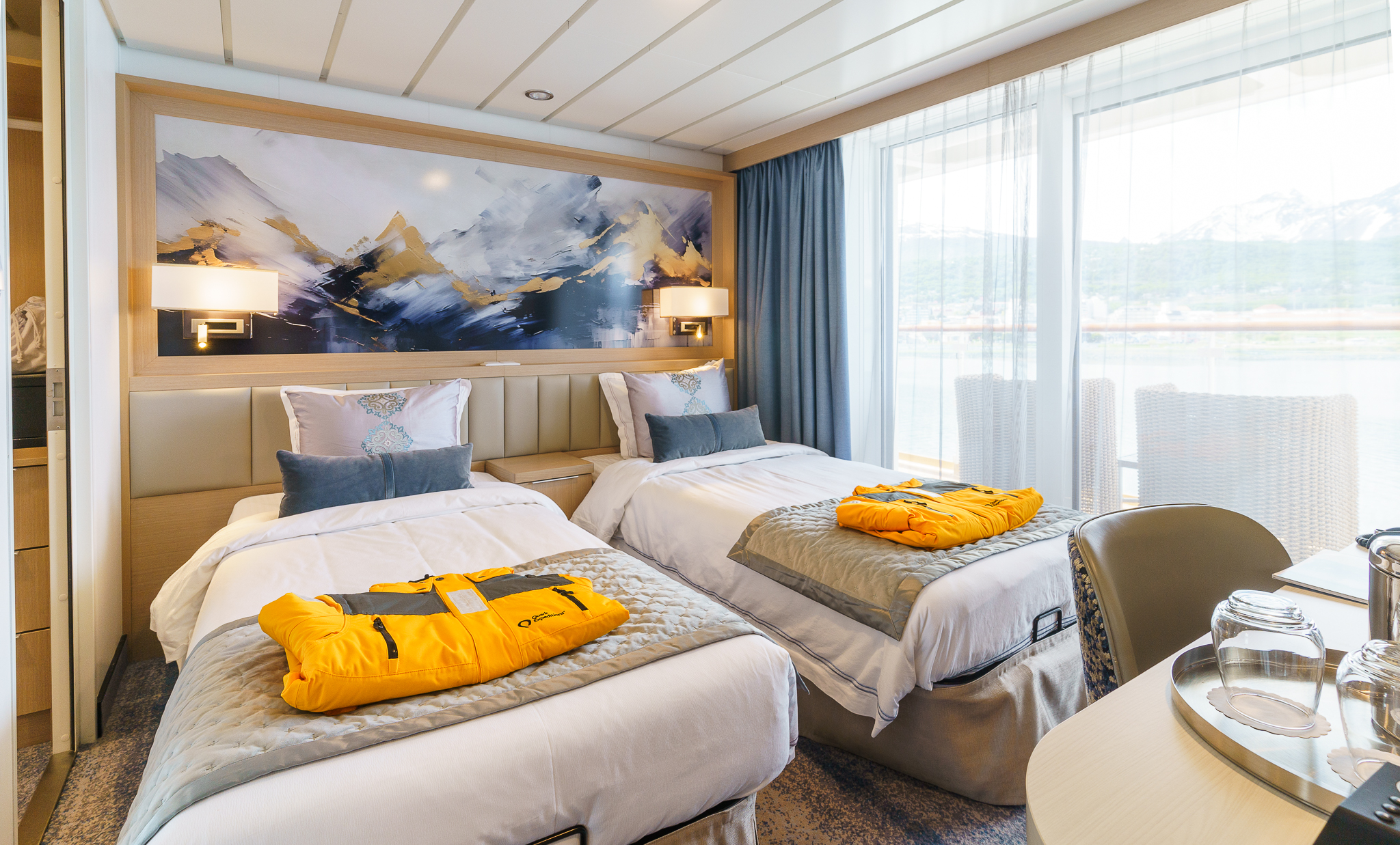
Penthouse Suite
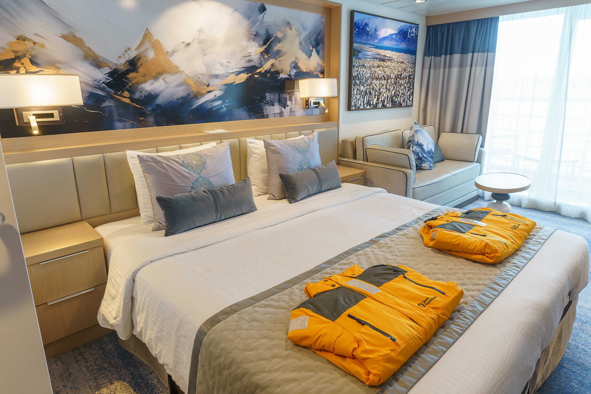
Veranda Suite
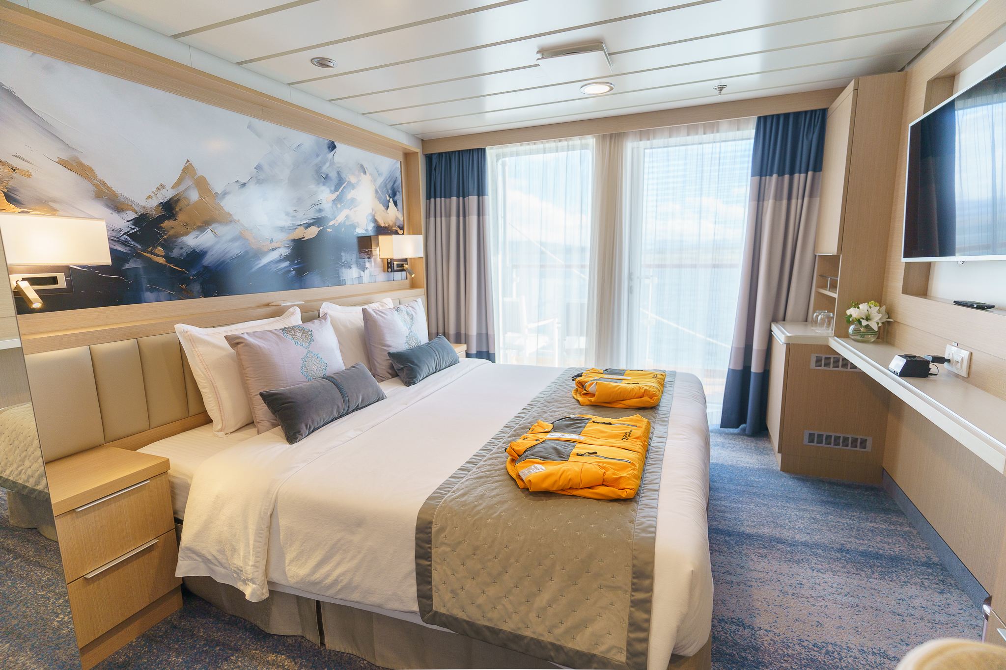
Veranda Stateroom
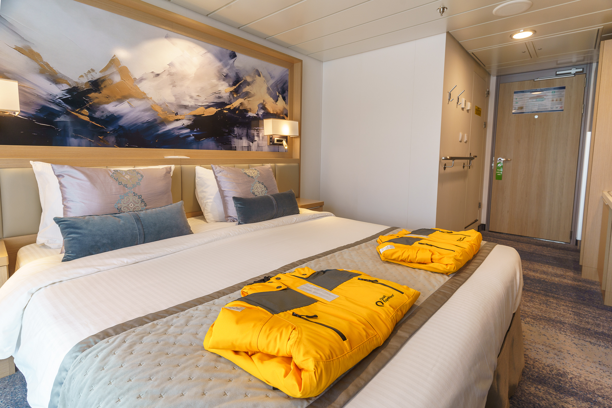
Deluxe Veranda Forward
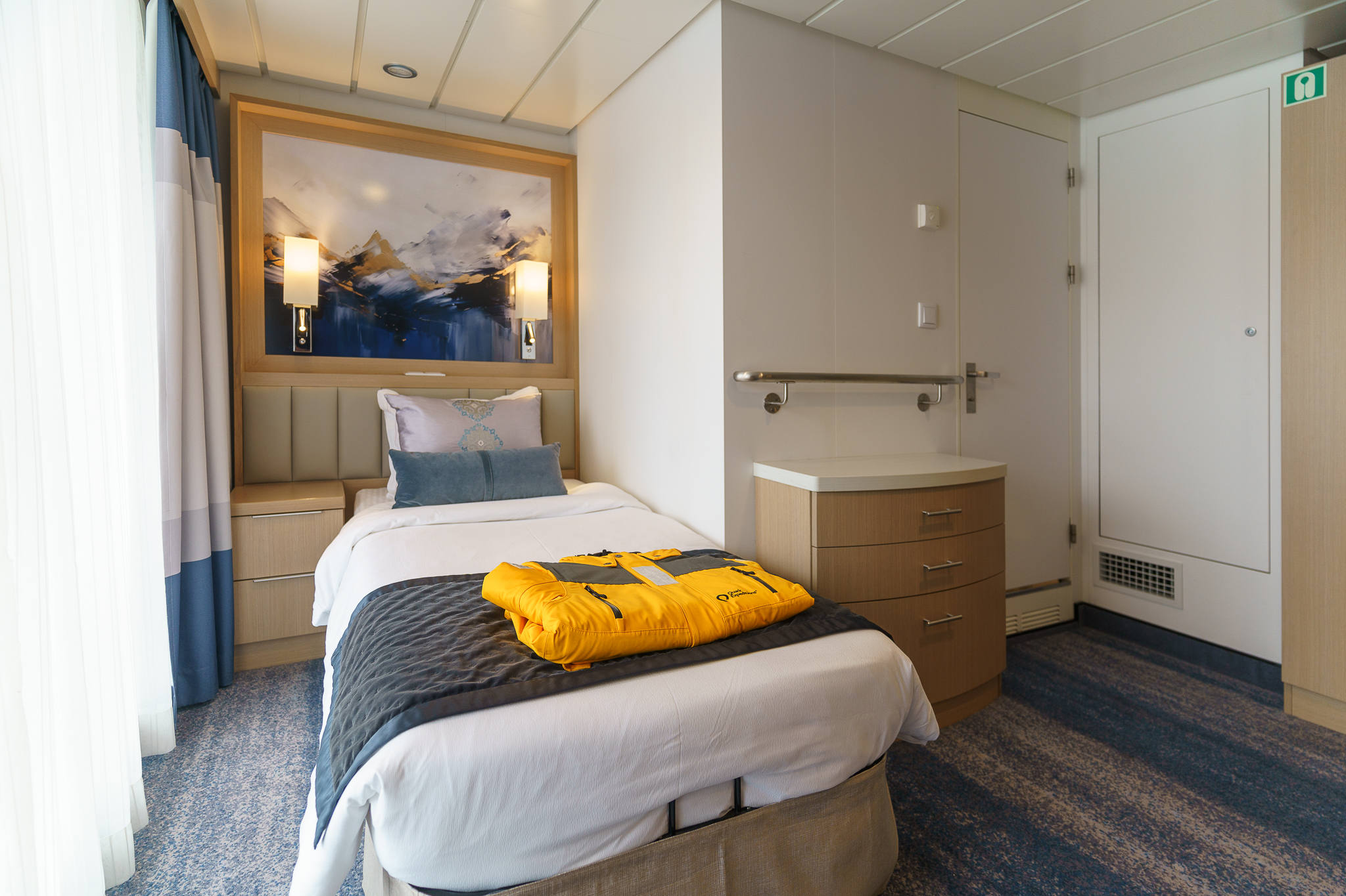
Studio Veranda Single
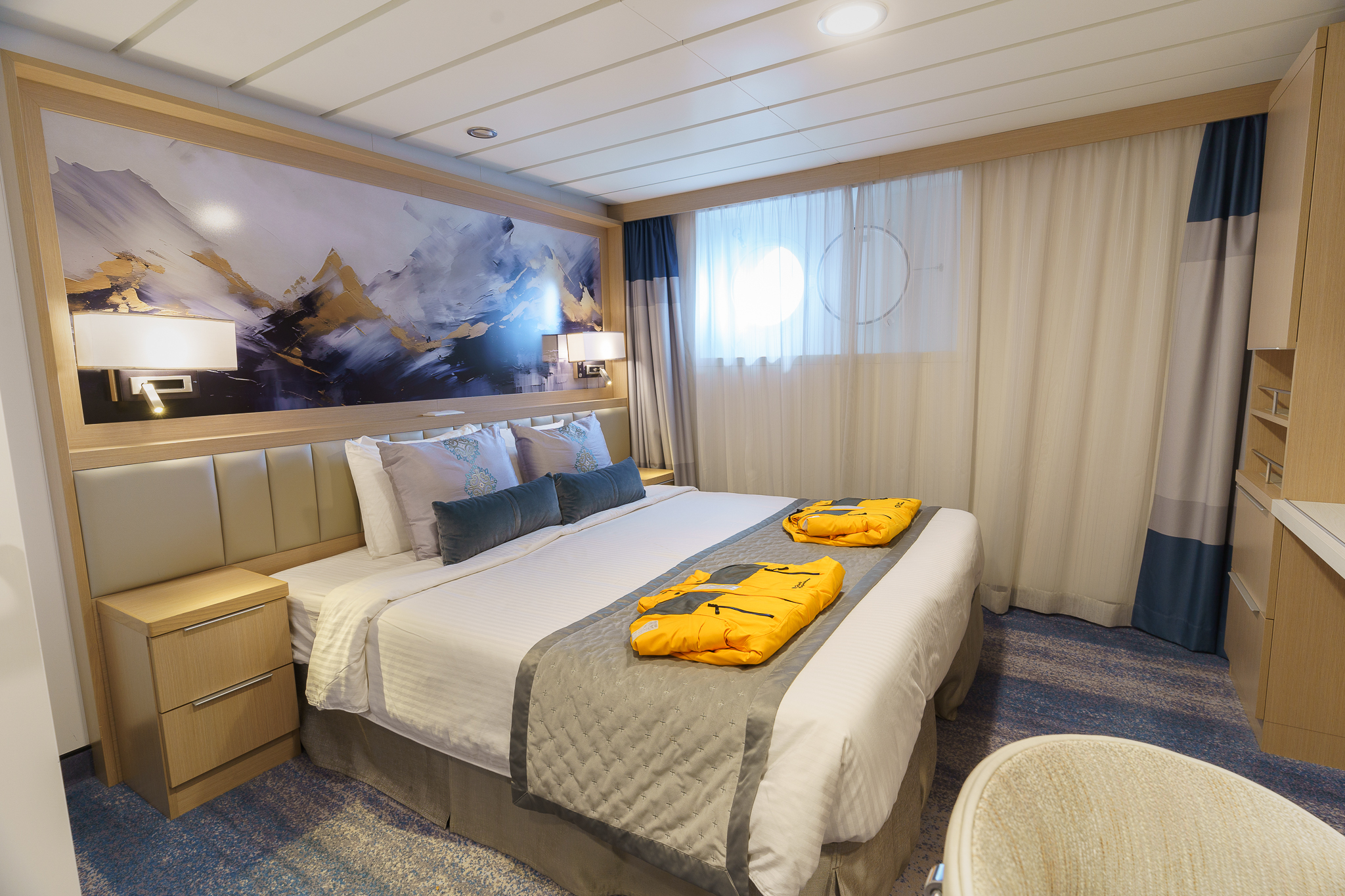
Studio Single
Ship Facilities
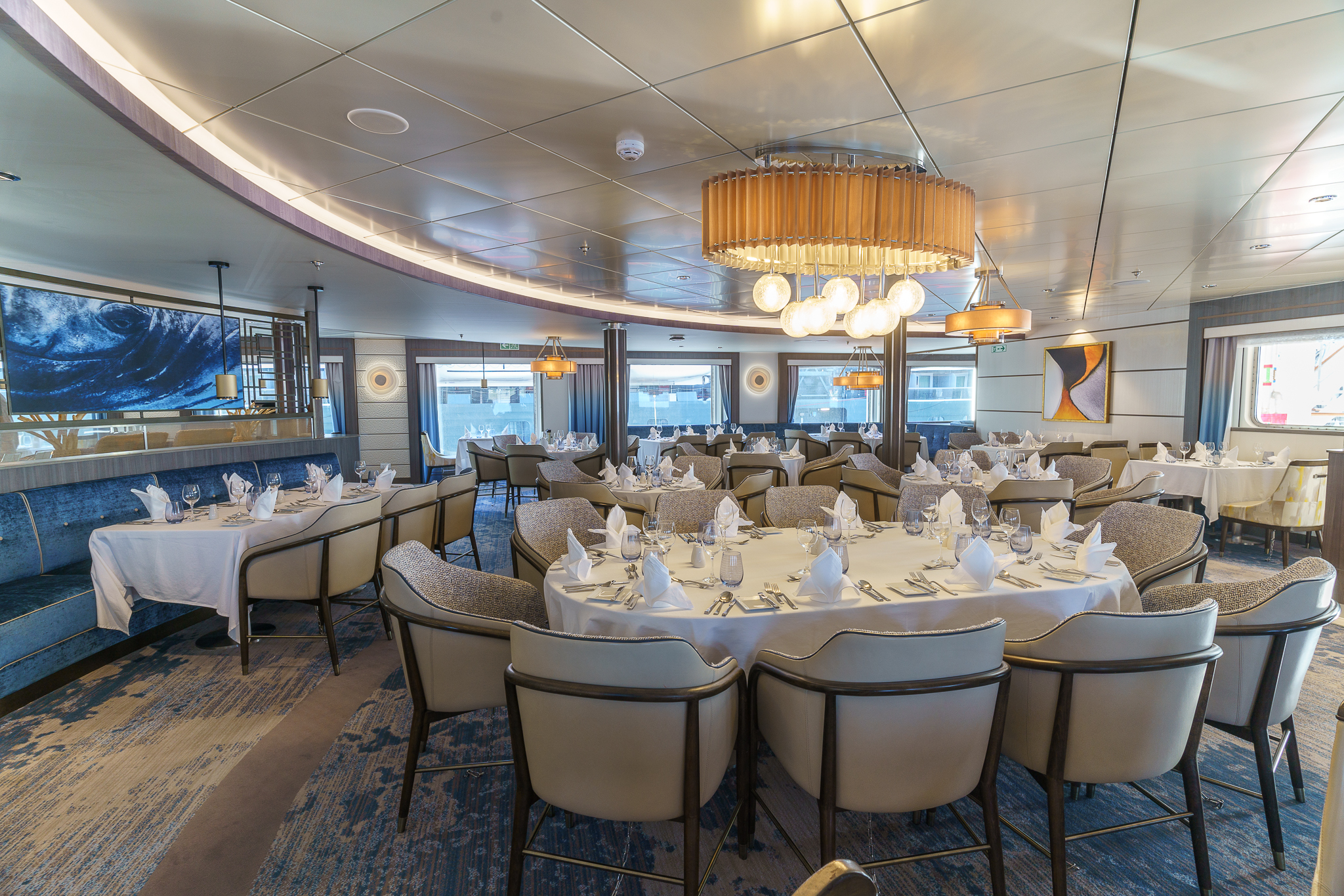
Main Dining Room
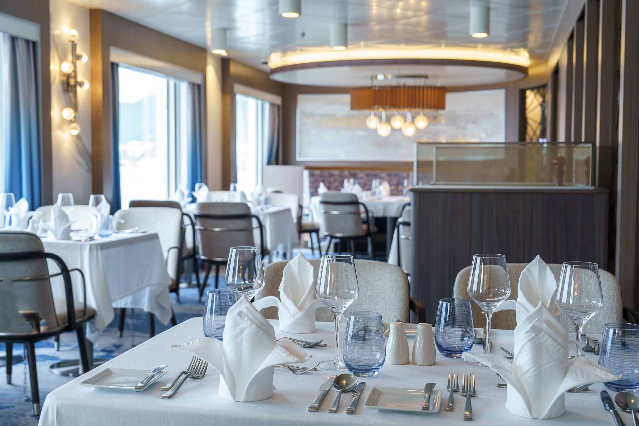
Private Dining Room
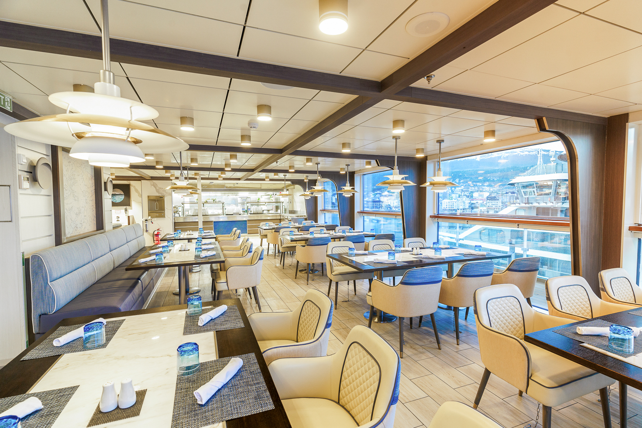
Observation Bistro
With its marine blue and off-white colors—is your go-to spot for lighter fare and graband-go snacks. This relaxed eatery seats up to 44 guests, who can take in full views of their polar surroundings and wildlife while enjoying a light bite.
Off-Ship Adventures
With four separate sea-level embarkation points and a fleet of 15 Zodiacs, Ocean Explorer offers a comprehensive breadth of off-ship activities including Zodiac cruising and paddling, allowing you to intimately connect with the polar wilderness.
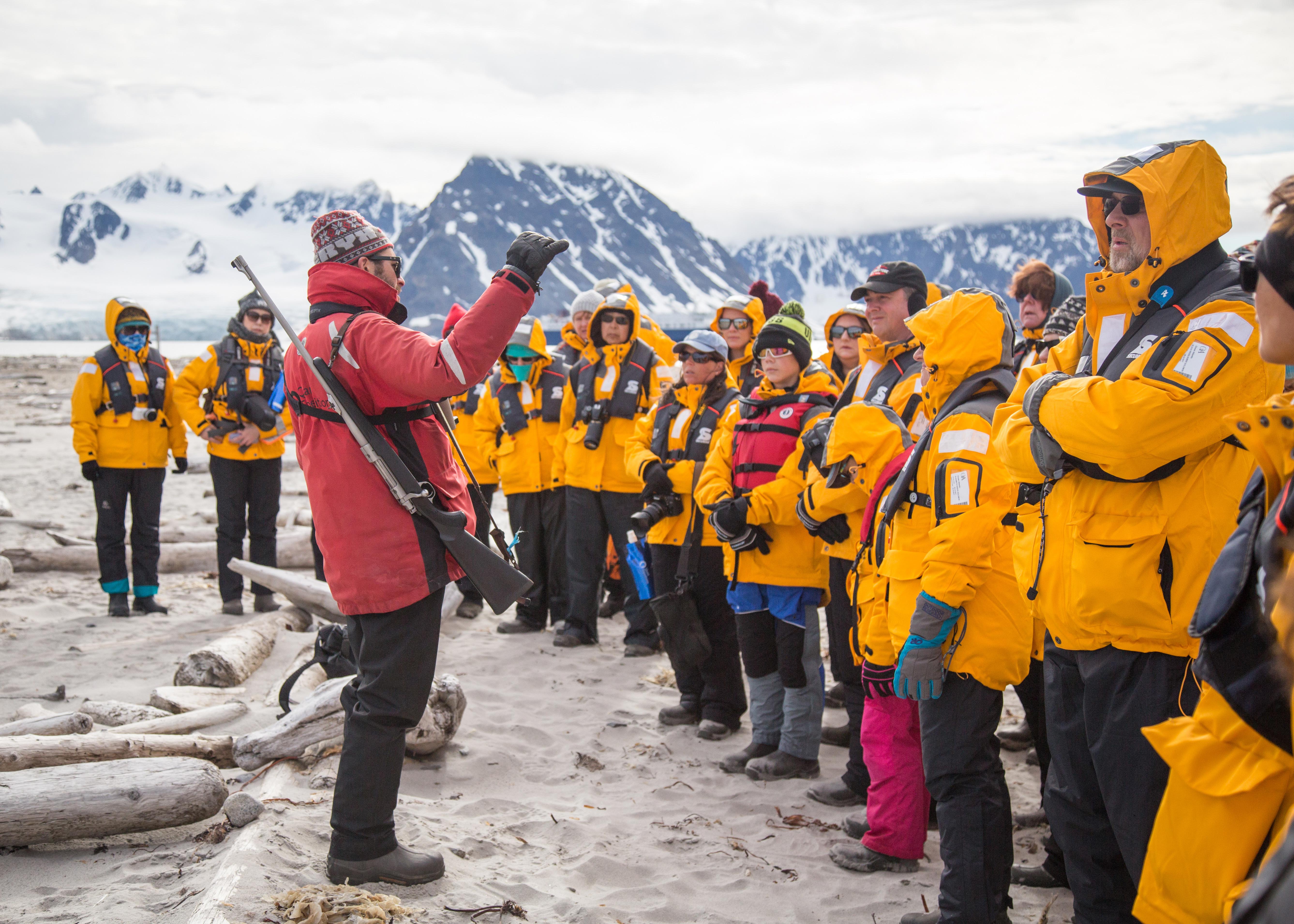
Expedition Team
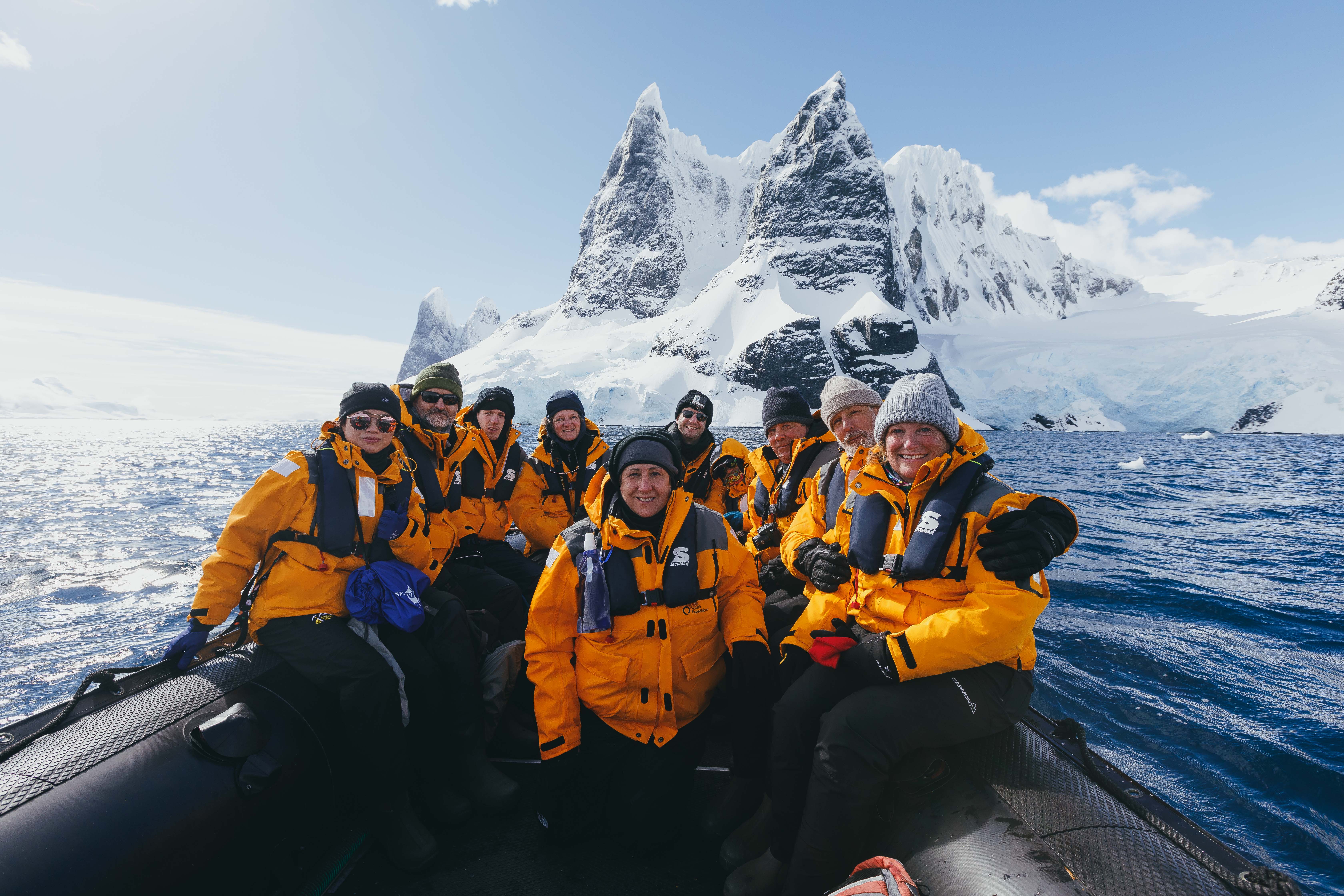
Zodiac Cruising
Zodiacs are used for transferring you ashore, transporting your luggage when necessary and for taking you ocean-level cruising among icebergs, whales and seabirds. During the expedition, you will visit remote and isolated sites that are accessible only by Zodiac.
These large, heavy-duty inflatable vessels are extremely safe and were specially designed for expedition work. Zodiacs are the workhorses of Polar expeditions. Separate air compartments retain a large reserve of buoyancy even if these sturdy boats are damaged. Their flat bottom design permits the craft to land directly onto the cobble and ice-strewn beaches that you will encounter on your Polar expedition.
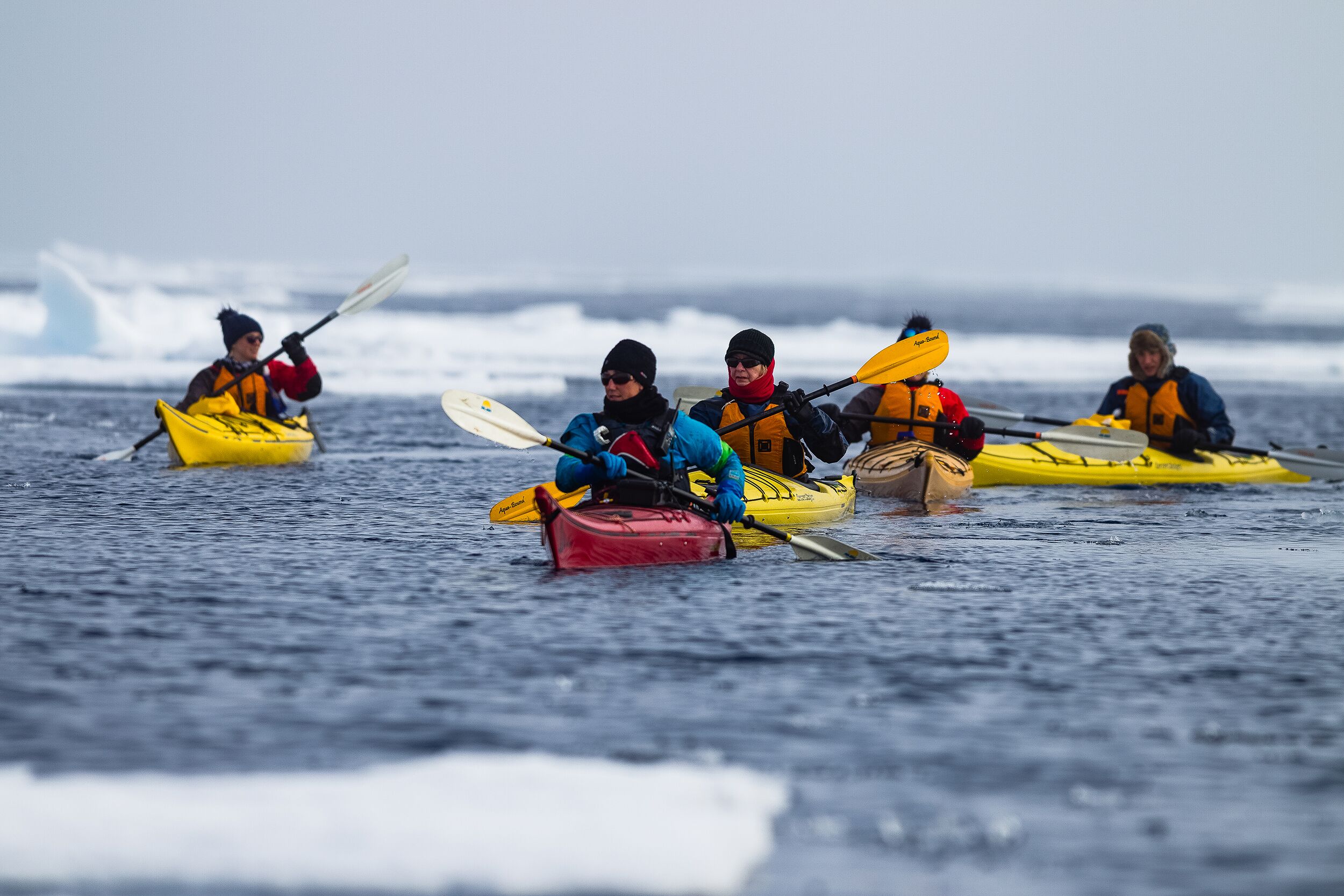
Sea Kayaking
The kayak adventure option is open to all levels of experience. However, it is highly recommended that you have some sea kayaking related experience prior to kayaking in the polar regions with Quark Expeditions. Our sea kayaks are the ideal means by which to slow down and connect with the pristine natural environments and surroundings.
Positioning yourself in the seat of a kayak is one of the most intimate ways travelers can connect with the polar regions—at water level, up close, where you can touch and feel every polar sensation imaginable. The Sea Kayak Program enables a small group of like-minded individuals to forge bonds as they explore fjords, glacial faces or mazes of sea ice.
Conditions and logistics permitting, your kayak guide(s) will endeavor to have you paddling as often as possible throughout the voyage. Typically, sea kayakers are shuttled by Zodiac from the ship to an ideal starting point, where the kayak excursion begins. Guests return to the ship by Zodiac at the end of their paddling experience. Some kayak excursions are designed so guests can go ashore and explore.
Stand-up Paddleboarding
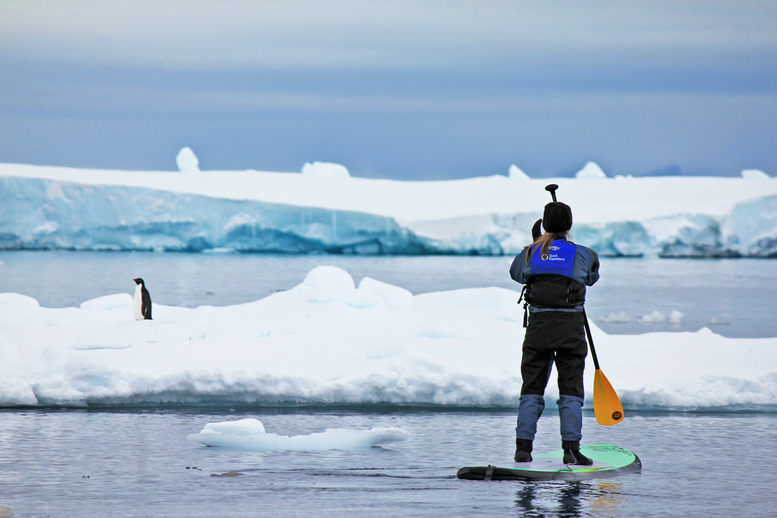
Stand-up Paddleboarding, popularly known as SUPing, originated in Hawaii. Quark Expeditions is the first company to bring this watersport all the way to Antarctica.
SUPing combines the immersive experience of kayaking but in a standing position. Participants, if they prefer, can kneel, sit or even lie down and stare up at the azure Antarctic sky. Because of their wide base and tail fins, SUP boards are quite stable, enabling participants – after a bit of practice – to stop staring at their feet and admire the surrounding scenery. Imagine seeing Gentoo penguins gliding below you, or making eye contact with a Weddell seal lying on a piece of ice as you paddle by.
Guests receive on-ship and on-water instruction from a qualified SUP guide. In addition, a safety driver (in a Zodiac) stays within range to offer assistance.
Polar Plunge
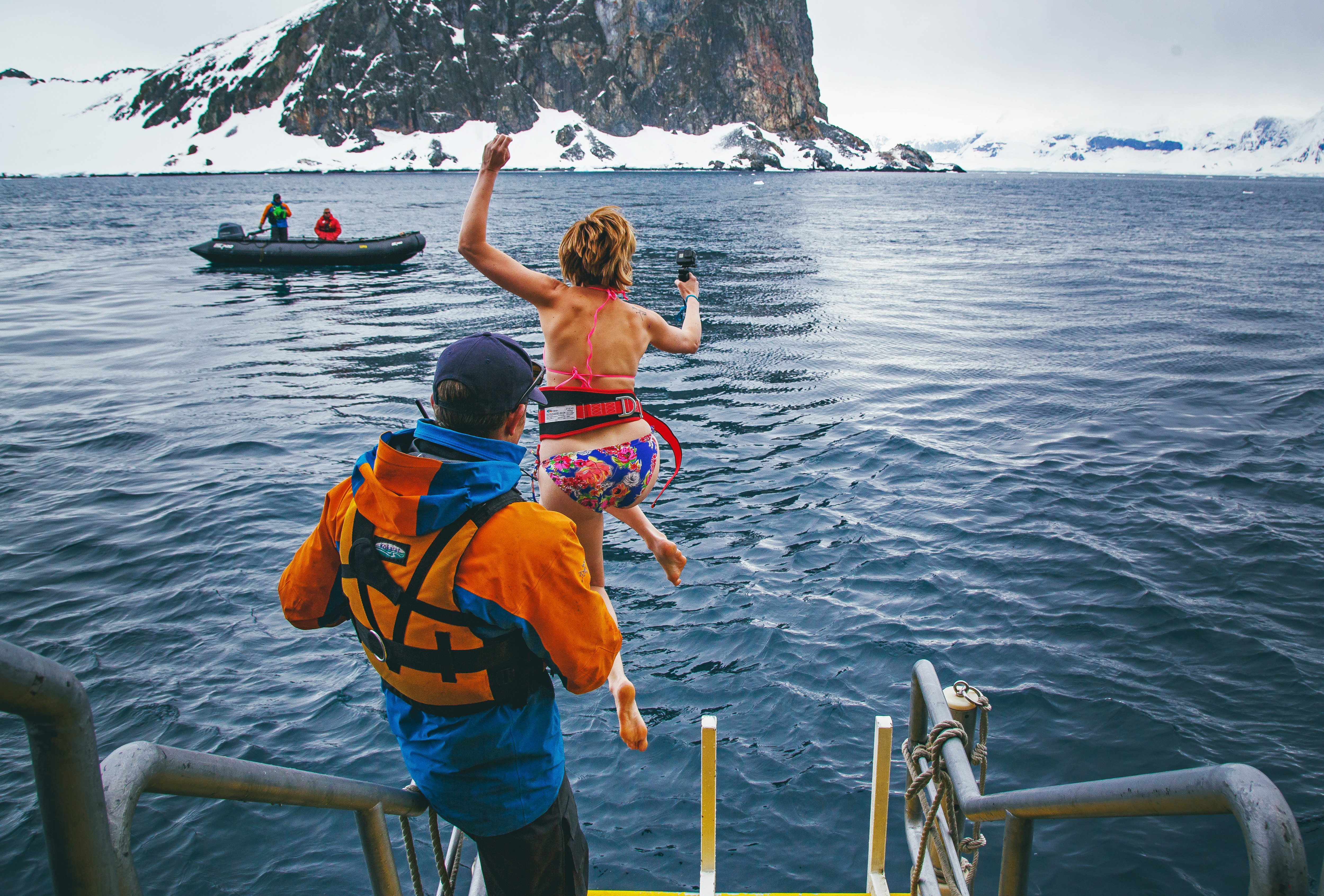
The Polar Plunge is scheduled once during each voyage. Throughout the journey, the Expedition Leader and Captain constantly monitor conditions in order to choose the optimal time and location. The Polar Plunge sometimes takes place onshore or, in many cases, from the gangway or Zodiac. All participants wear a tethered harness and plunge into the polar waters from the side of Zodiac or safety of the gangplank cheered on, of course, by fellow passengers and Expedition Team.
Safety is paramount—the onboard physician always attends the Polar Plunge. Guides in survival gear circle the area in Zodiacs as guests take their turn jumping or cannon-balling into the polar waters.
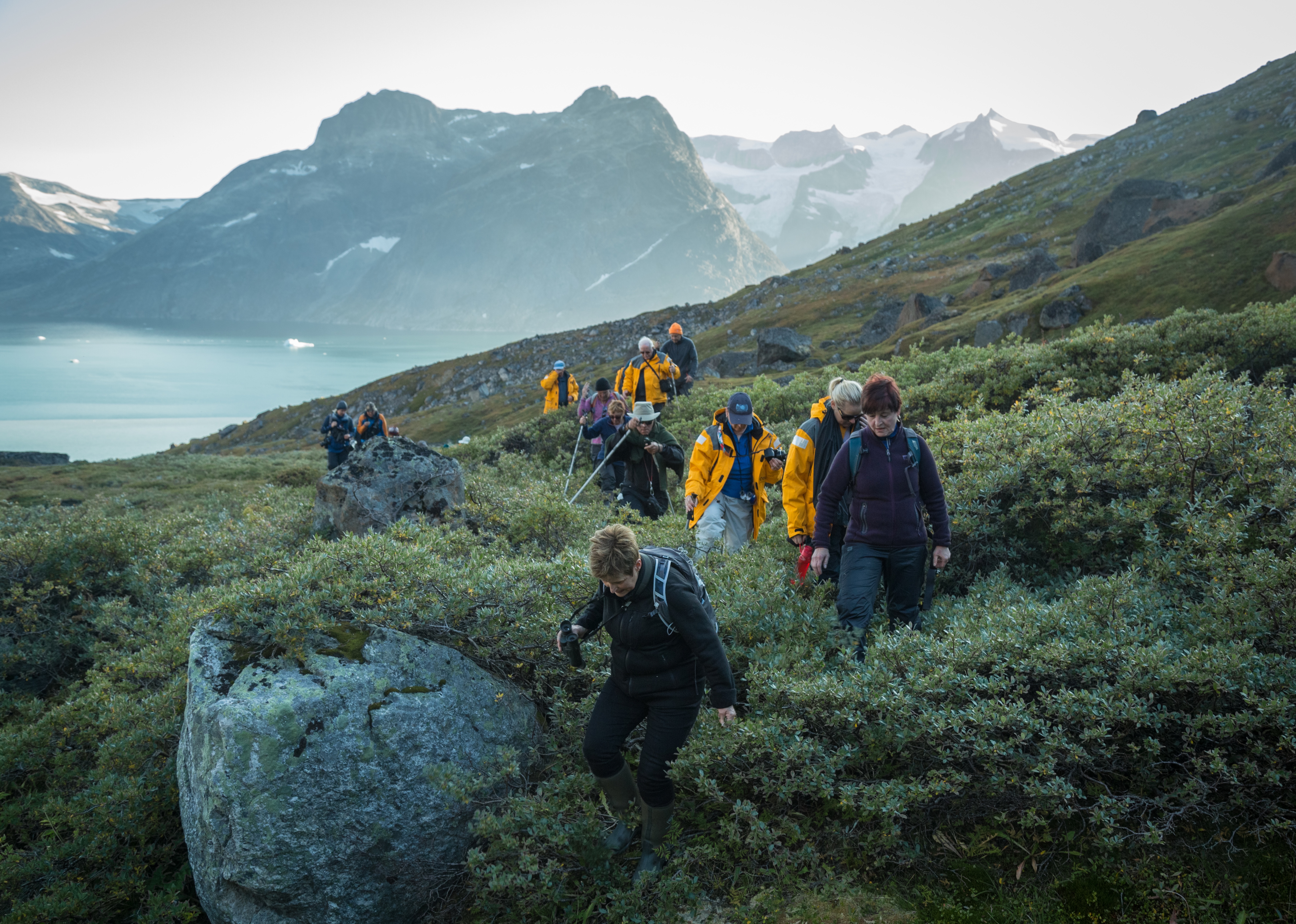
Hiking
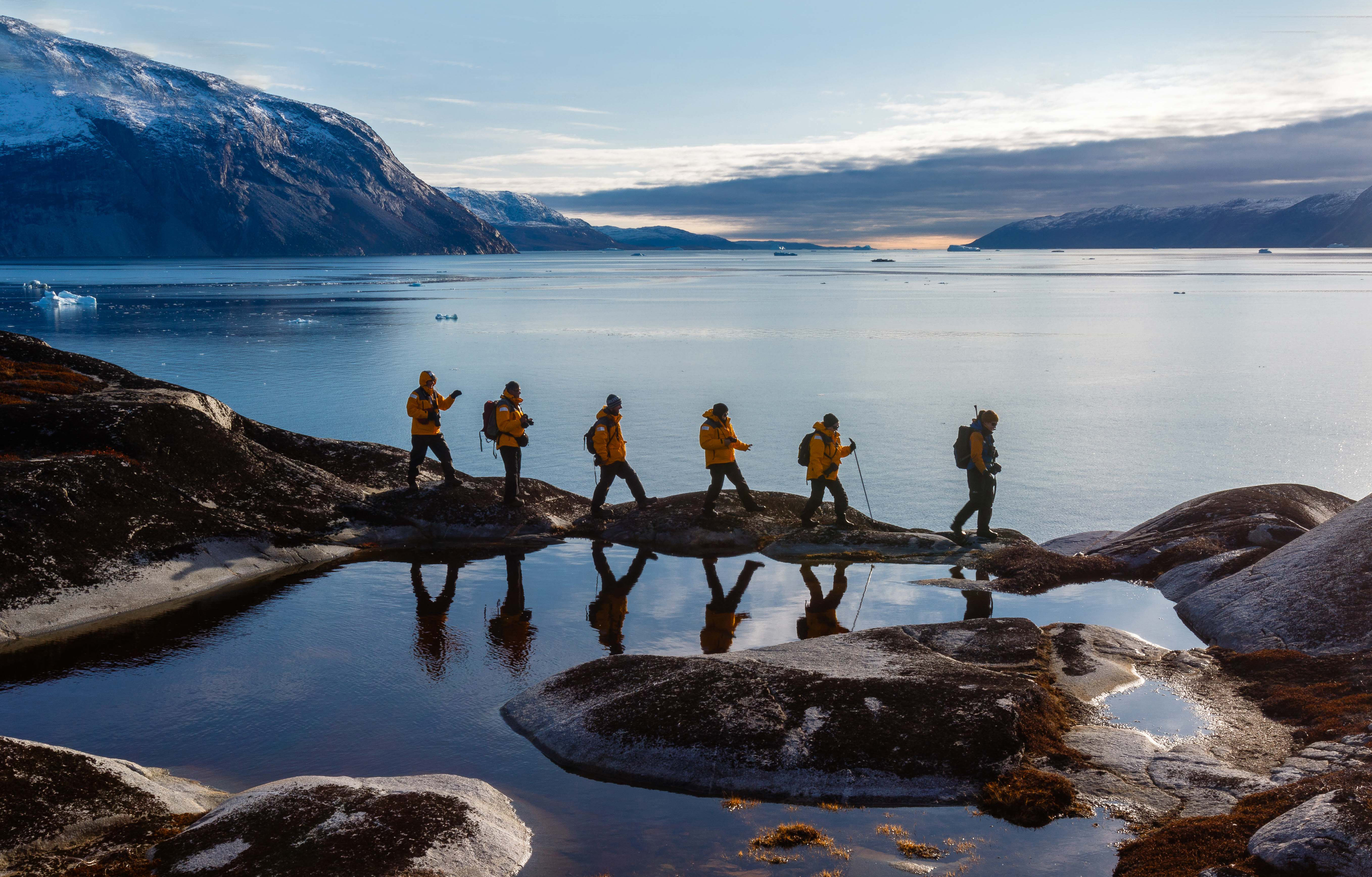
Hiking in the polar regions differs from your typical trail experience. Here, in a tree-less terrain, you are the tallest figure on the landscape as you walk over spongy tundra, crusty snow or sandy beaches in remotes parts of the Arctic and Antarctica. Stepping ashore anywhere in the polar regions means you’re not a distant observer.
Our organized hikes range from short jaunts to the top of lookouts or visits to see wildlife or longer walks of several kilometers over ice and rock and snow. Hiking excursions may last from two to three hours with plenty of time for photographs of wildlife, learning moments from your experienced guides, or just time to stand back and admire the incredible polar surroundings.
No experience is necessary but participants should be able to get in and out of a Zodiac and walk on uneven terrain. Hiking options are tailored to all interests and abilities, from those who want to contemplate the landscape in silence to photographers who want that perfect image to energetic travelers who want to summit a peak in the hopes of seeing wildlife in their natural habitat.
Paddling Excursion
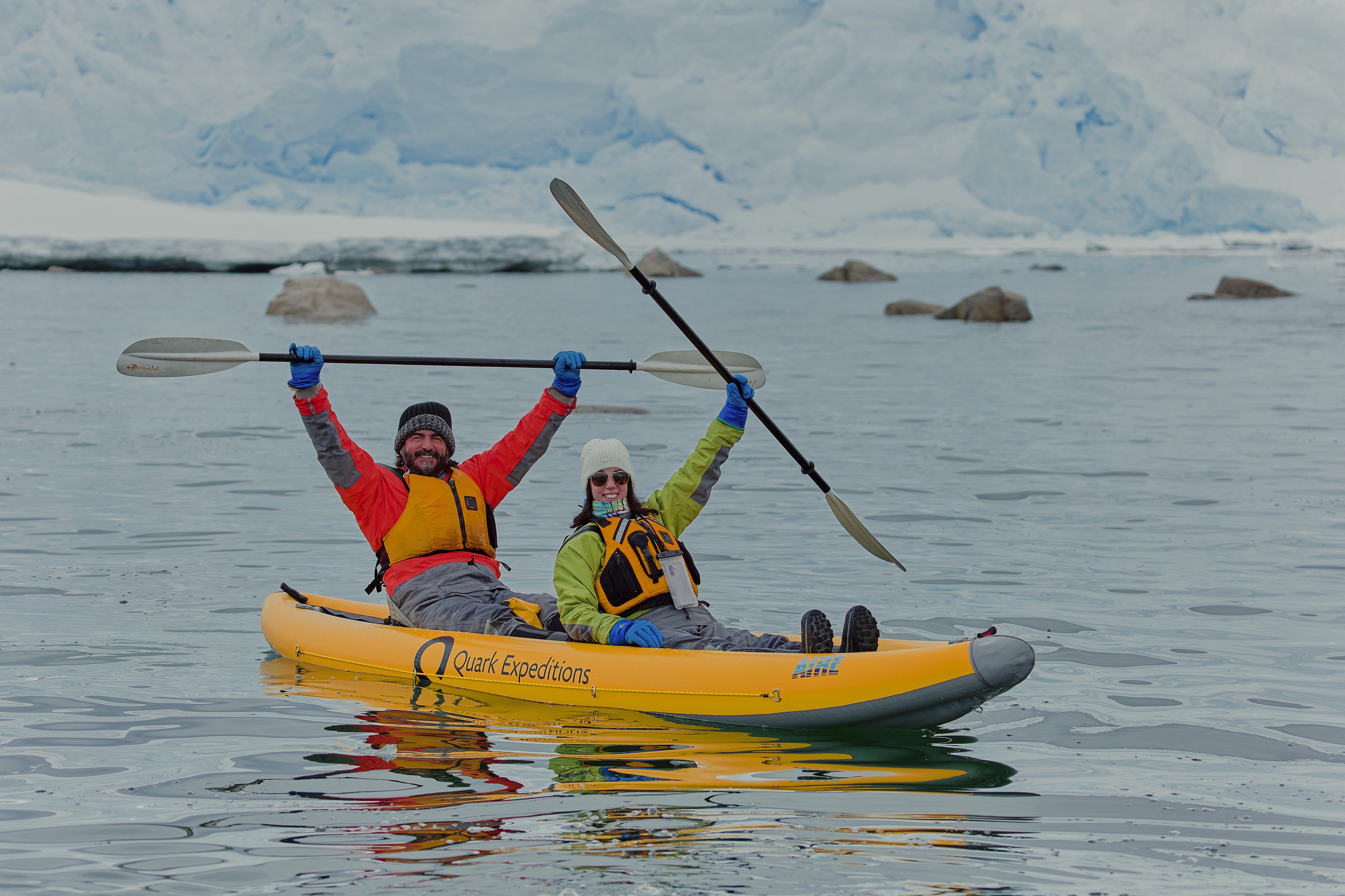
Explore the ocean from a more intimate vantage point on a sit-on-top kayak. No experience is required to manoeuvre these very stable kayaks, allowing you to enjoy an unforgettable experience on the water, taking in breathtaking landscapes and wildlife. Whether it’s your first time in a kayak or you want greater flexibility to try other Adventure options, this shorter excursion is for you.
Paddling in the Polar Regions is highly weather-dependent and a one-time experience. Your kayak guides will attempt to take you out on the water for 1-1.5 hours of paddling. Offered on most voyages, spaces are limited. All equipment, guides and instructions are provided by Quark.
Pricing subject to change based on season. Please proceed to checkout or contact a Polar Travel Adviser for more details.
Camping
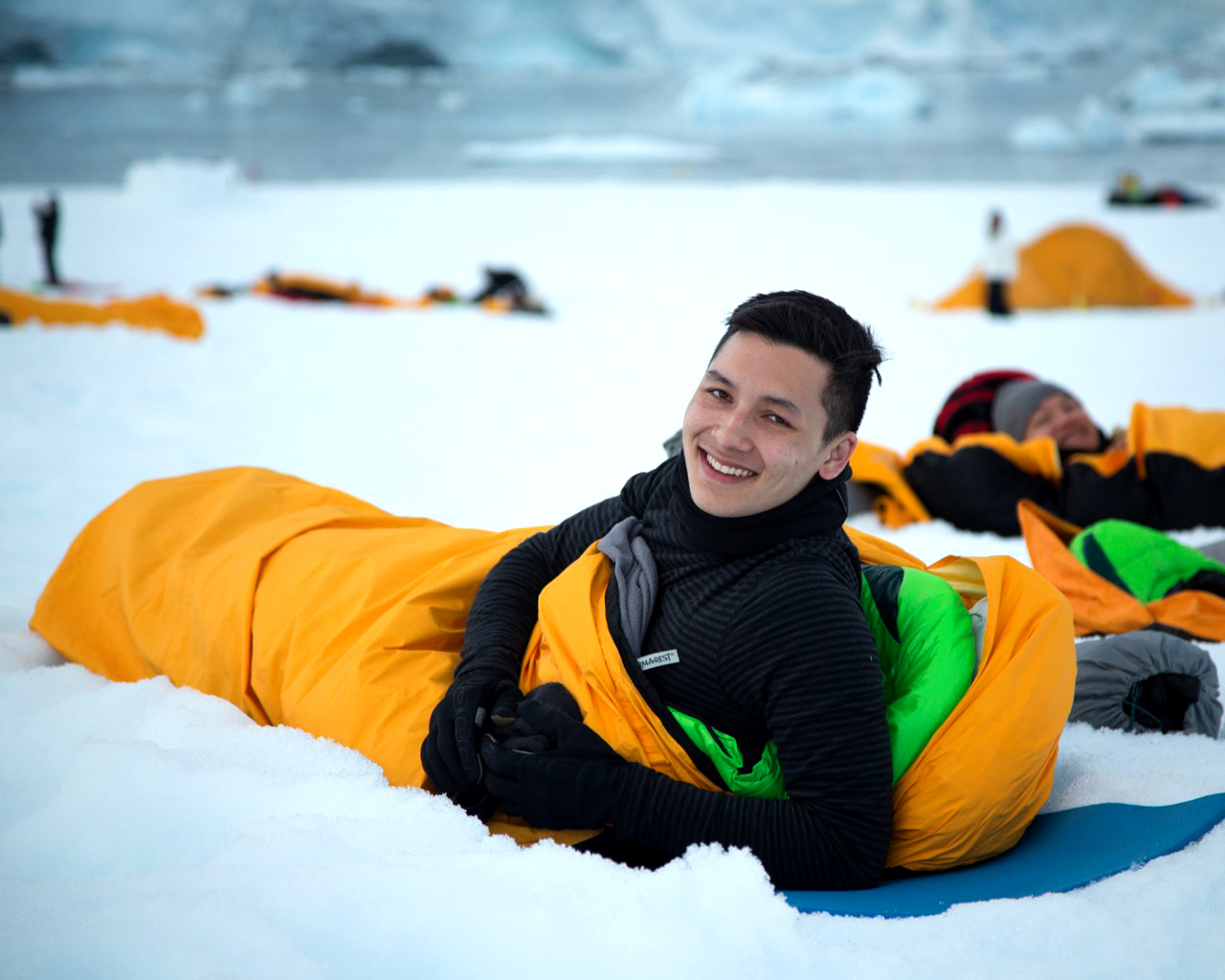
Imagine for a moment, staring at the stars in the indigo glow of an Antarctic night as you bed down for the night outside in the elements. The buzz of your daily life becomes a distant memory as you listen to the bray of penguin, the ethereal calls of the Weddell sea – even the exhalation of a humpback whale. And then you fall asleep.
Antarctic Camping with Quark Expeditions is an unforgettable experience. After dinner onboard, you’ll be escorted ashore by Zodiac to camp out on the snow for the night in your ready-to-roll bivy sack (tents can be used upon request). Once you decide on your spot, you set up camp and enjoy the peace as the Antarctic night unfolds.
Camping in Antarctica is limited to 50 participants, all of whom will be briefed beforehand on the principals of basic camping. Prior to you settling down for the night, Quark Expeditions staff will prepare the site, including setting up a perimeter in safe, flat to gently-sloping and beautiful site. You’re free to choose where (within the perimeters) you want to settle down for the night.
You’ll be equipped with the following:
- Mummy-style sleeping bag
- Bivy sack
- Insulated sleeping pad
- Sleeping bag liner
- 3 or 4 season tent provided upon request (pending availability)
- Quark Expeditions Parka
- Waterbottle (Small collapsible reusable water bottles provided onboard upon embarkation)
- Muck Boots (insulated waterproof boots provided onboard upon embarkation)
Other recommended gear:
- Base and mid-layer clothing
- Warm hat
- Warm gloves
- Hand-warmers
- Camera and accessories
- Backpack
- Eye mask if you wish complete darkness
- Need a pillow? Roll up your parka!
- Essential medication and or supplements
Explorer Lecture Lounge
Enjoy daily chats with and presentations by our world-class onboard polar experts—expedition guides, specialists, photography guides and other special guests who will introduce you to the fascinating history, biology, ornithology, glaciology and geology of the region, and much, much more.
Photography
The Latitude Bar
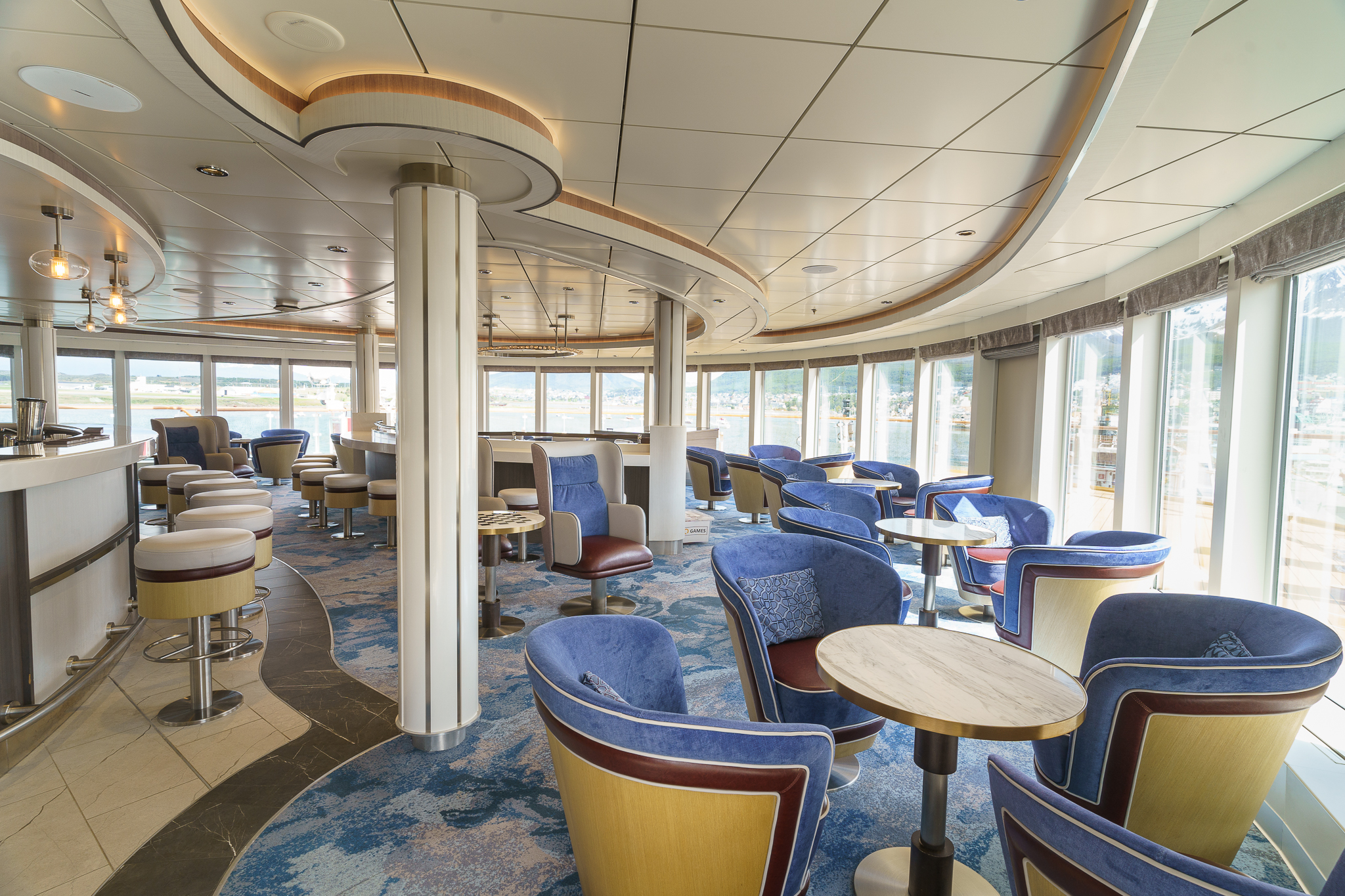
Observation Lounge
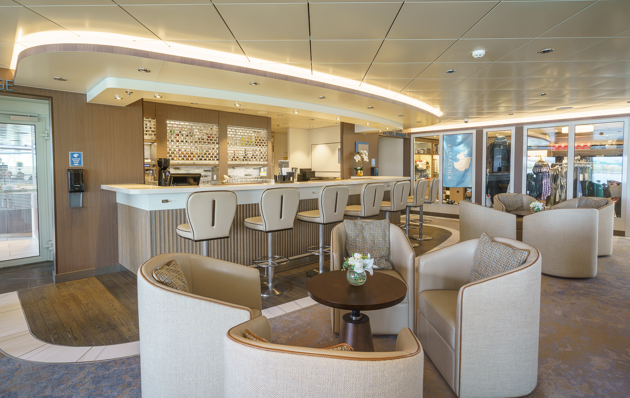
This stylish lounge at the top of the ship guarantees incredible views. Guests also frequent this spacious lookout on Deck 8 to enjoy cocktails and conversation with fellow travelers. Seats 63.
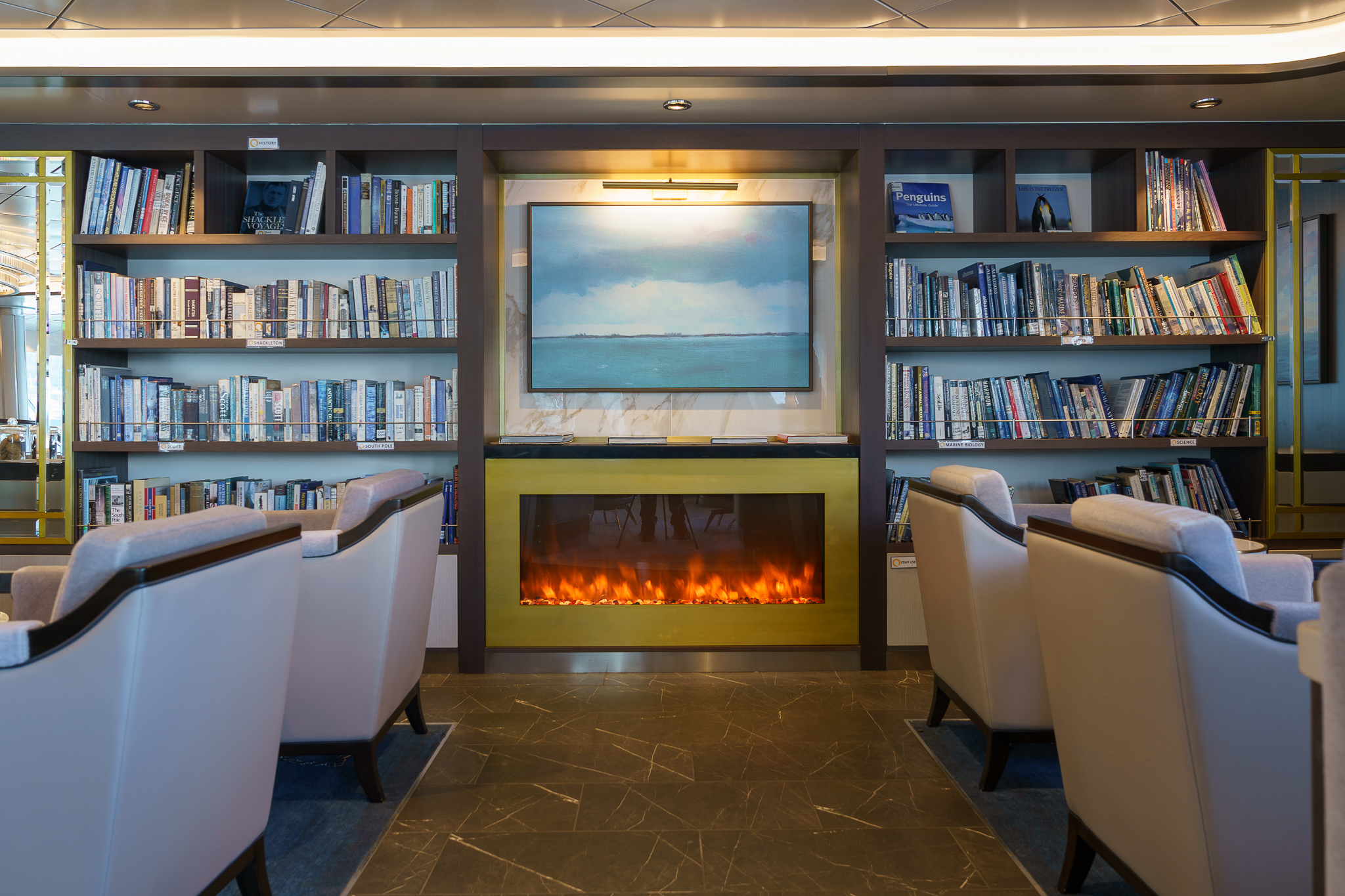
Discovery Library
Located on Deck 6 at the top of the gorgeous atrium staircase, this beautiful Library with floor-to-ceiling glass, accommodates up to 47 people
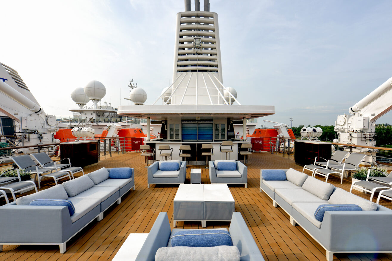
Sun Deck and Bar
More information coming soon.
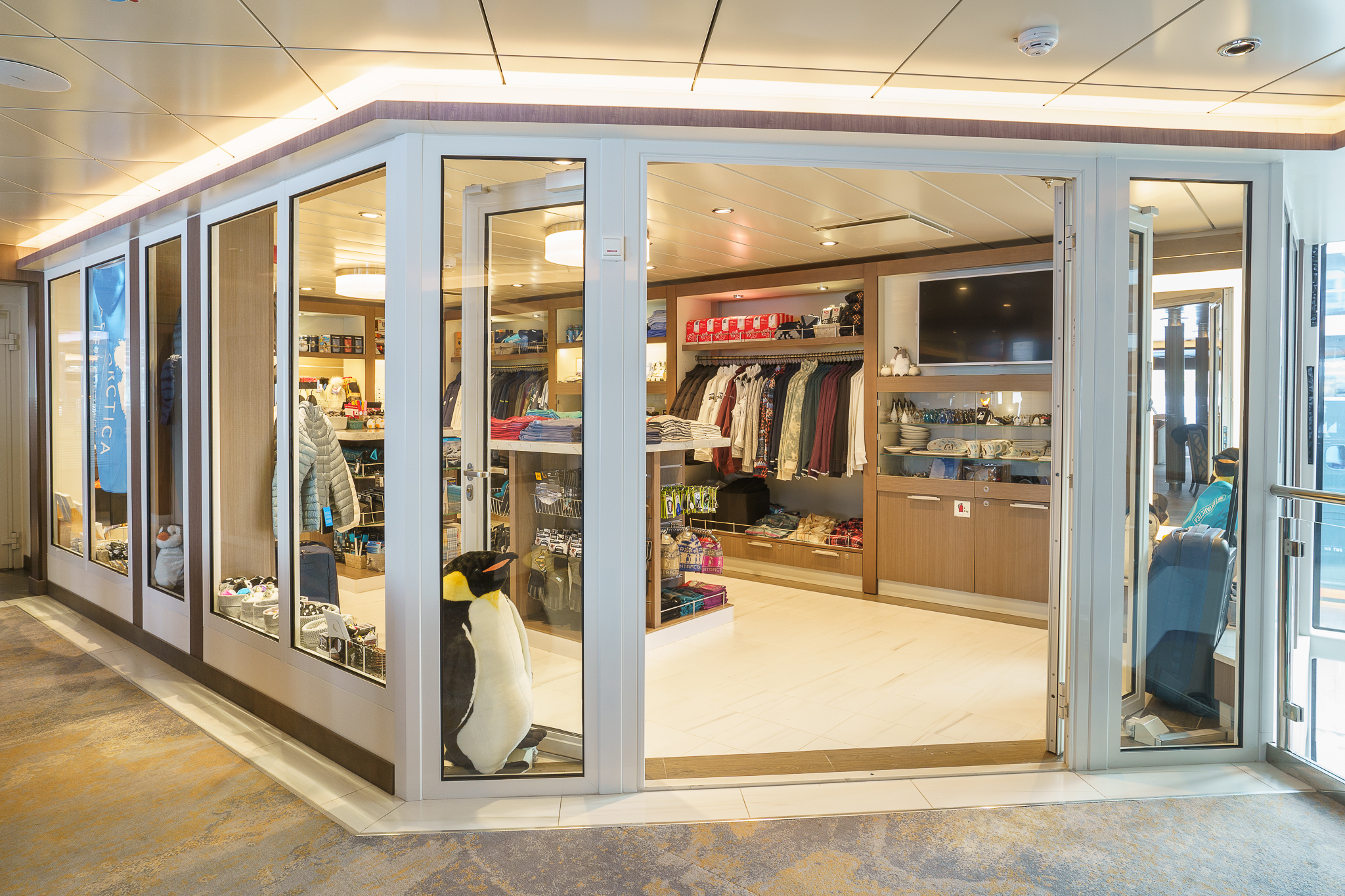
Polar Boutique
The Polar Boutique can be located on Deck 5.
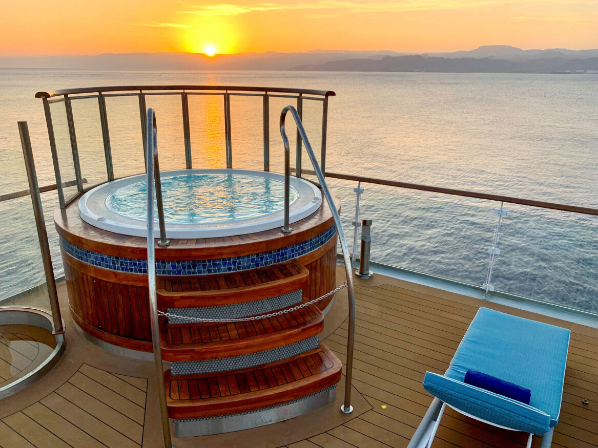
Jacuzzis
Two outdoor Jacuzzis on deck 7, at the ship’s stern, mean you can relax alfresco while soaking up the breath-taking polar views.
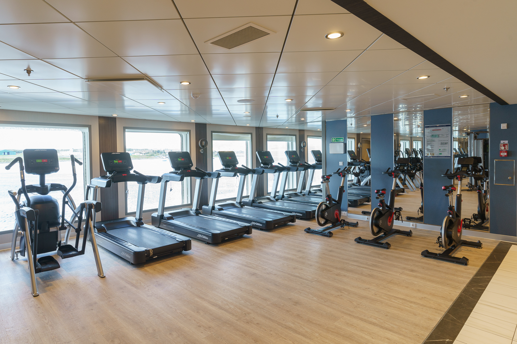
Fitness Centre
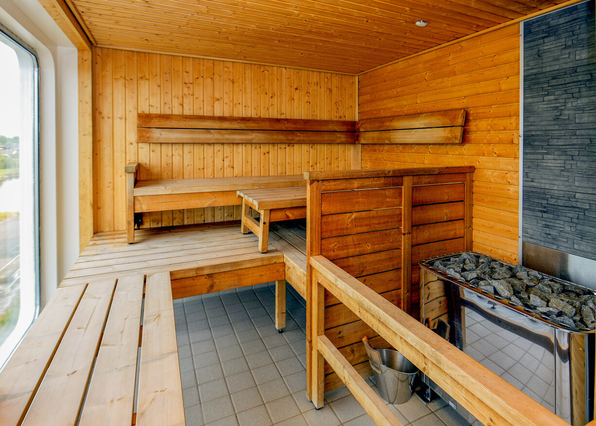
Dry Sauna
Main Dining Room
Private Dining Room
Observation Bistro
With its marine blue and off-white colors—is your go-to spot for lighter fare and graband-go snacks. This relaxed eatery seats up to 44 guests, who can take in full views of their polar surroundings and wildlife while enjoying a light bite.
Off-Ship Adventures
With four separate sea-level embarkation points and a fleet of 15 Zodiacs, Ocean Explorer offers a comprehensive breadth of off-ship activities including Zodiac cruising and paddling, allowing you to intimately connect with the polar wilderness.
Expedition Team
Zodiac Cruising
Zodiacs are used for transferring you ashore, transporting your luggage when necessary and for taking you ocean-level cruising among icebergs, whales and seabirds. During the expedition, you will visit remote and isolated sites that are accessible only by Zodiac.
These large, heavy-duty inflatable vessels are extremely safe and were specially designed for expedition work. Zodiacs are the workhorses of Polar expeditions. Separate air compartments retain a large reserve of buoyancy even if these sturdy boats are damaged. Their flat bottom design permits the craft to land directly onto the cobble and ice-strewn beaches that you will encounter on your Polar expedition.
Sea Kayaking
The kayak adventure option is open to all levels of experience. However, it is highly recommended that you have some sea kayaking related experience prior to kayaking in the polar regions with Quark Expeditions. Our sea kayaks are the ideal means by which to slow down and connect with the pristine natural environments and surroundings.
Positioning yourself in the seat of a kayak is one of the most intimate ways travelers can connect with the polar regions—at water level, up close, where you can touch and feel every polar sensation imaginable. The Sea Kayak Program enables a small group of like-minded individuals to forge bonds as they explore fjords, glacial faces or mazes of sea ice.
Conditions and logistics permitting, your kayak guide(s) will endeavor to have you paddling as often as possible throughout the voyage. Typically, sea kayakers are shuttled by Zodiac from the ship to an ideal starting point, where the kayak excursion begins. Guests return to the ship by Zodiac at the end of their paddling experience. Some kayak excursions are designed so guests can go ashore and explore.
Stand-up Paddleboarding
Stand-up Paddleboarding, popularly known as SUPing, originated in Hawaii. Quark Expeditions is the first company to bring this watersport all the way to Antarctica.
SUPing combines the immersive experience of kayaking but in a standing position. Participants, if they prefer, can kneel, sit or even lie down and stare up at the azure Antarctic sky. Because of their wide base and tail fins, SUP boards are quite stable, enabling participants – after a bit of practice – to stop staring at their feet and admire the surrounding scenery. Imagine seeing Gentoo penguins gliding below you, or making eye contact with a Weddell seal lying on a piece of ice as you paddle by.
Guests receive on-ship and on-water instruction from a qualified SUP guide. In addition, a safety driver (in a Zodiac) stays within range to offer assistance.
Polar Plunge
The Polar Plunge is scheduled once during each voyage. Throughout the journey, the Expedition Leader and Captain constantly monitor conditions in order to choose the optimal time and location. The Polar Plunge sometimes takes place onshore or, in many cases, from the gangway or Zodiac. All participants wear a tethered harness and plunge into the polar waters from the side of Zodiac or safety of the gangplank cheered on, of course, by fellow passengers and Expedition Team.
Safety is paramount—the onboard physician always attends the Polar Plunge. Guides in survival gear circle the area in Zodiacs as guests take their turn jumping or cannon-balling into the polar waters.
Hiking
Hiking in the polar regions differs from your typical trail experience. Here, in a tree-less terrain, you are the tallest figure on the landscape as you walk over spongy tundra, crusty snow or sandy beaches in remotes parts of the Arctic and Antarctica. Stepping ashore anywhere in the polar regions means you’re not a distant observer.
Our organized hikes range from short jaunts to the top of lookouts or visits to see wildlife or longer walks of several kilometers over ice and rock and snow. Hiking excursions may last from two to three hours with plenty of time for photographs of wildlife, learning moments from your experienced guides, or just time to stand back and admire the incredible polar surroundings.
No experience is necessary but participants should be able to get in and out of a Zodiac and walk on uneven terrain. Hiking options are tailored to all interests and abilities, from those who want to contemplate the landscape in silence to photographers who want that perfect image to energetic travelers who want to summit a peak in the hopes of seeing wildlife in their natural habitat.
Paddling Excursion
Explore the ocean from a more intimate vantage point on a sit-on-top kayak. No experience is required to manoeuvre these very stable kayaks, allowing you to enjoy an unforgettable experience on the water, taking in breathtaking landscapes and wildlife. Whether it’s your first time in a kayak or you want greater flexibility to try other Adventure options, this shorter excursion is for you.
Paddling in the Polar Regions is highly weather-dependent and a one-time experience. Your kayak guides will attempt to take you out on the water for 1-1.5 hours of paddling. Offered on most voyages, spaces are limited. All equipment, guides and instructions are provided by Quark.
Pricing subject to change based on season. Please proceed to checkout or contact a Polar Travel Adviser for more details.
Camping
Imagine for a moment, staring at the stars in the indigo glow of an Antarctic night as you bed down for the night outside in the elements. The buzz of your daily life becomes a distant memory as you listen to the bray of penguin, the ethereal calls of the Weddell sea – even the exhalation of a humpback whale. And then you fall asleep.
Antarctic Camping with Quark Expeditions is an unforgettable experience. After dinner onboard, you’ll be escorted ashore by Zodiac to camp out on the snow for the night in your ready-to-roll bivy sack (tents can be used upon request). Once you decide on your spot, you set up camp and enjoy the peace as the Antarctic night unfolds.
Camping in Antarctica is limited to 50 participants, all of whom will be briefed beforehand on the principals of basic camping. Prior to you settling down for the night, Quark Expeditions staff will prepare the site, including setting up a perimeter in safe, flat to gently-sloping and beautiful site. You’re free to choose where (within the perimeters) you want to settle down for the night.
You’ll be equipped with the following:
- Mummy-style sleeping bag
- Bivy sack
- Insulated sleeping pad
- Sleeping bag liner
- 3 or 4 season tent provided upon request (pending availability)
- Quark Expeditions Parka
- Waterbottle (Small collapsible reusable water bottles provided onboard upon embarkation)
- Muck Boots (insulated waterproof boots provided onboard upon embarkation)
Other recommended gear:
- Base and mid-layer clothing
- Warm hat
- Warm gloves
- Hand-warmers
- Camera and accessories
- Backpack
- Eye mask if you wish complete darkness
- Need a pillow? Roll up your parka!
- Essential medication and or supplements
Explorer Lecture Lounge
Enjoy daily chats with and presentations by our world-class onboard polar experts—expedition guides, specialists, photography guides and other special guests who will introduce you to the fascinating history, biology, ornithology, glaciology and geology of the region, and much, much more.
Photography
The Latitude Bar
Observation Lounge
This stylish lounge at the top of the ship guarantees incredible views. Guests also frequent this spacious lookout on Deck 8 to enjoy cocktails and conversation with fellow travelers. Seats 63.
Discovery Library
Located on Deck 6 at the top of the gorgeous atrium staircase, this beautiful Library with floor-to-ceiling glass, accommodates up to 47 people
Sun Deck and Bar
More information coming soon.
Polar Boutique
The Polar Boutique can be located on Deck 5.
Jacuzzis
Two outdoor Jacuzzis on deck 7, at the ship’s stern, mean you can relax alfresco while soaking up the breath-taking polar views.
Fitness Centre
Dry Sauna
About the Ship
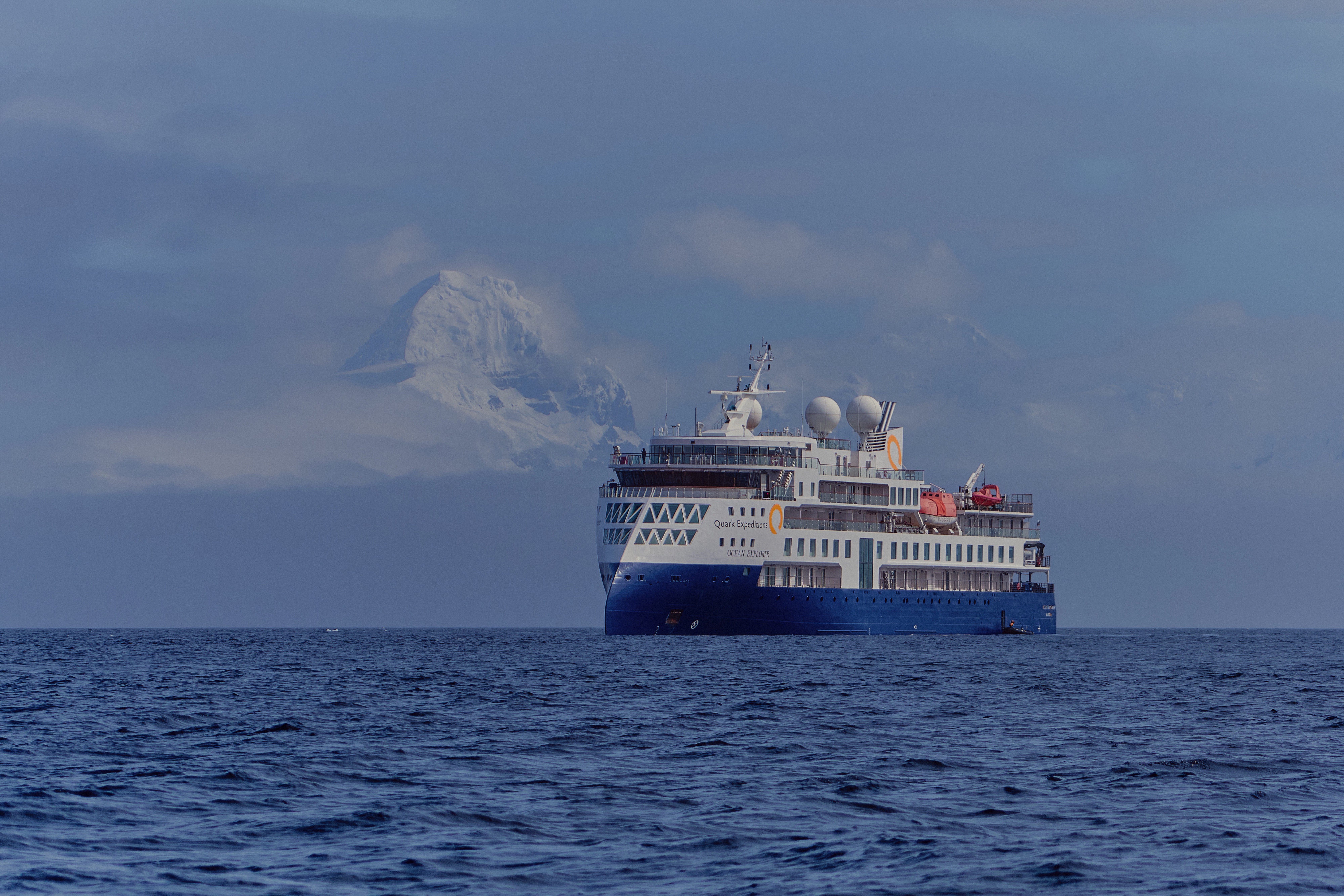
Deck Plans

- Ready Room
- Medical Facilities
- Zodiac Embarkation Points
- Studio Single
- Elevator

- Deluxe Veranda Forward
- Veranda Suite
- Veranda Stateroom
- Expedition Desk
- Elevator

- Main Dining Room
- Private Dining Room
- Reception
- Polar Boutique
- Latitude Bar & Lounge
- Explorer Lecture Lounge
- Elevator

- The Discovery Library
- Junior Suite
- Veranda Suite
- Veranda Stateroom
- Elevator

- Penthouse Suite
- Owners Suite
- Veranda Stateroom
- Studio Veranda Single
- Polar Deck and Bar
- Jacuzzis
- Gym
- Tundra Spa & Sauna
- Bridge
- Bridge Deck
- Elevator

- Observation Deck
- Observation Bistro
- Observation Lounge & Bar
- Elevator

- Top Deck
- Ready Room
- Medical Facilities
- Zodiac Embarkation Points
- Studio Single
- Elevator
- Deluxe Veranda Forward
- Veranda Suite
- Veranda Stateroom
- Expedition Desk
- Elevator
- Main Dining Room
- Private Dining Room
- Reception
- Polar Boutique
- Latitude Bar & Lounge
- Explorer Lecture Lounge
- Elevator
- The Discovery Library
- Junior Suite
- Veranda Suite
- Veranda Stateroom
- Elevator
- Penthouse Suite
- Owners Suite
- Veranda Stateroom
- Studio Veranda Single
- Polar Deck and Bar
- Jacuzzis
- Gym
- Tundra Spa & Sauna
- Bridge
- Bridge Deck
- Elevator
- Observation Deck
- Observation Bistro
- Observation Lounge & Bar
- Elevator
- Top Deck